

Read this first
The Karakoram Highway (KKH, N-35) is the classic way to reach Hunza, and it is also the most discussed road in Pakistan. Before you plan a drive, note what the UK government says about it. Ask the district administration or local police about current conditions before you go. For foreign visitors: the UK FCDO page for Pakistan (updated 27 October 2026) advises against all travel on the Karakoram Highway between Mansehra and Chilas, and against all travel to Balochistan, Peshawar, Swat, Upper and Lower Dir and other listed parts of Khyber Pakhtunkhwa, the N-45 up to the edge of Chitral city (including the Kalash valleys) and within 10 miles of the Line of Control. It advises against all but essential travel to Malakand, Mardan, Nowshera, Shangla, Swabi, Azad Jammu and Kashmir, Sindh north of and including Nawabshah, and Dera Ghazi Khan. It does not advise against Gilgit-Baltistan generally. It also notes emergency measures and Governor's Rule in Khyber Pakhtunkhwa since 11 October 2026. Read the live page before you book.
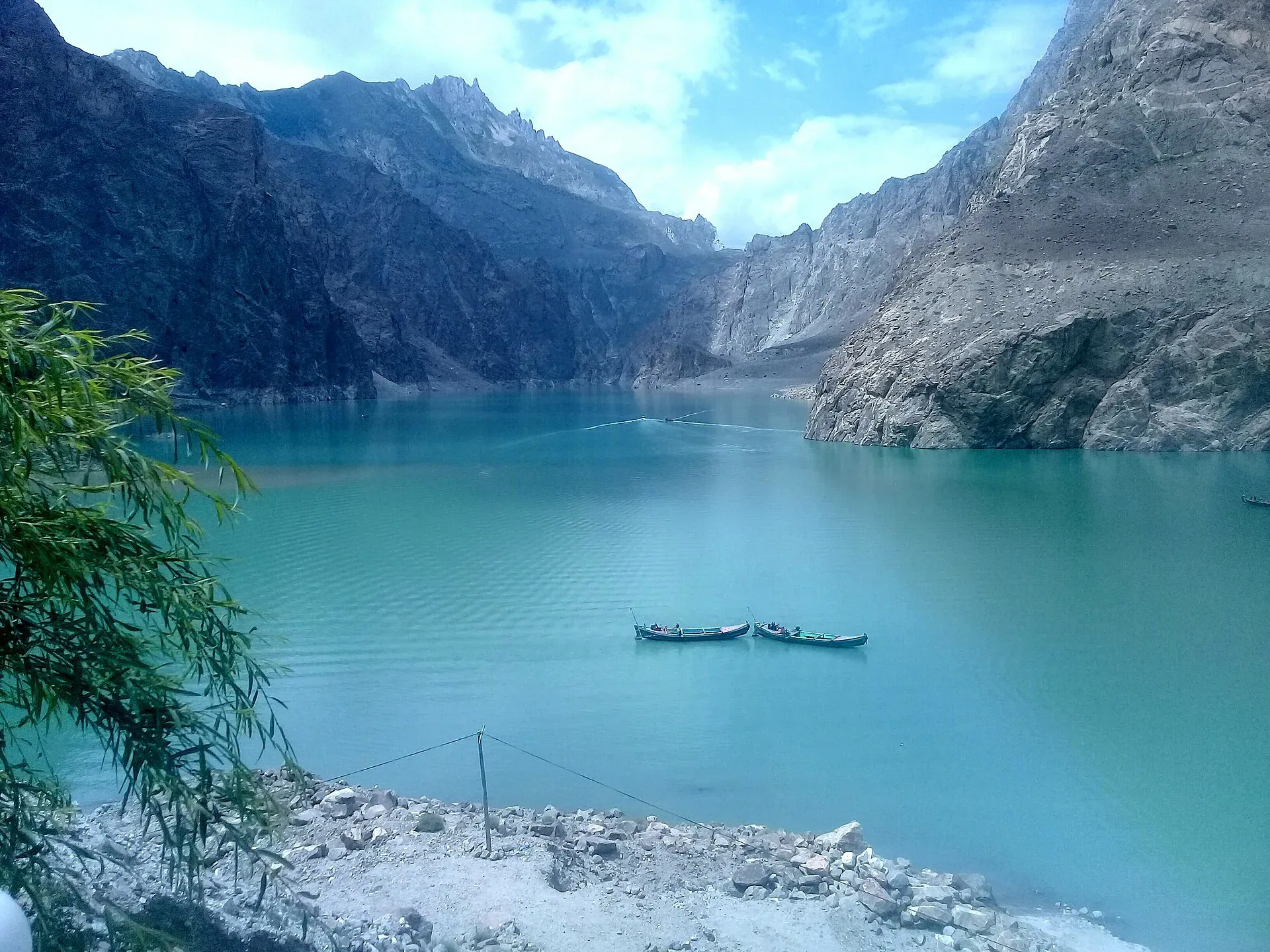
Photo: Peracha1, with thanks · CC BY-SA 4.0 · via Wikimedia Commons · temporary stand-in photo
In practice that means the road stretch between Mansehra and Chilas, through Battagram, Besham, Dasu and Sazin, is the part that official advice covers. From Chilas to Gilgit and on to Hunza, Gilgit-Baltistan is not advised against in general. This guide describes the whole road so you know what to expect, but you should decide for yourself, with your government's advice and a licensed operator, whether to travel the lower section by road or to fly past it.
The road in numbers
The highway runs from Hasan Abdal, on the plains near Islamabad, to the Khunjerab Pass at 4,693 m on the China border. Measured stops along the route (Hasan Abdal as the zero point) are roughly:
| Place | Distance from Hasan Abdal |
|---|---|
| Abbottabad | about 74 km |
| Mansehra | about 99 km |
| Besham | about 221 km |
| Chilas | about 445 km |
| Raikot Bridge (Fairy Meadows turn-off) | about 505 km |
| Gilgit | about 581 km |
| Karimabad (Hunza) | about 680 km |
| Sost | about 768 km |
These distances come from routing data, not from road signs, and they ignore stops. Journey times are always longer than the numbers suggest. Wikipedia says the highway was built by Pakistan and China, with work from 1962 to 1979, and that it opened to the public in 1986.
Stage by stage
Islamabad to Besham. The first leg leaves the plains and climbs through the Hazara hills, with towns such as Haripur, Abbottabad and Mansehra on the way. The road is paved and busy. It crosses the Indus near Thakot. Most travellers treat Besham as the first overnight stop because it has hotels and fuel.
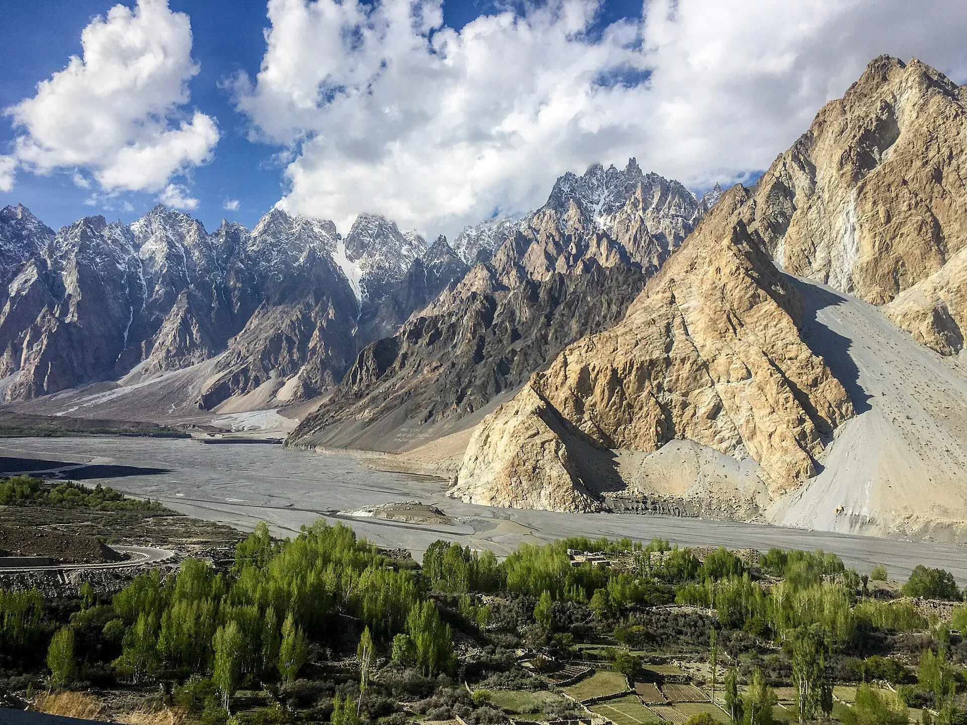
Photo: Mehrunisa Reimoo, with thanks · CC BY-SA 4.0 · via Wikimedia Commons · temporary stand-in photo
Besham to Chilas. This is the slowest and least stable part. The road is narrow, cut into steep slopes, and passes through Dasu and Upper Kohistan. Landslides and rockfall are most frequent here, especially in July and August, and in May and June 2026 Dawn reported closures in Upper Kohistan and Diamer. This is also the stretch the UK advises against. Allow a full day and expect police and army checkposts where you may be asked for your passport and visa.
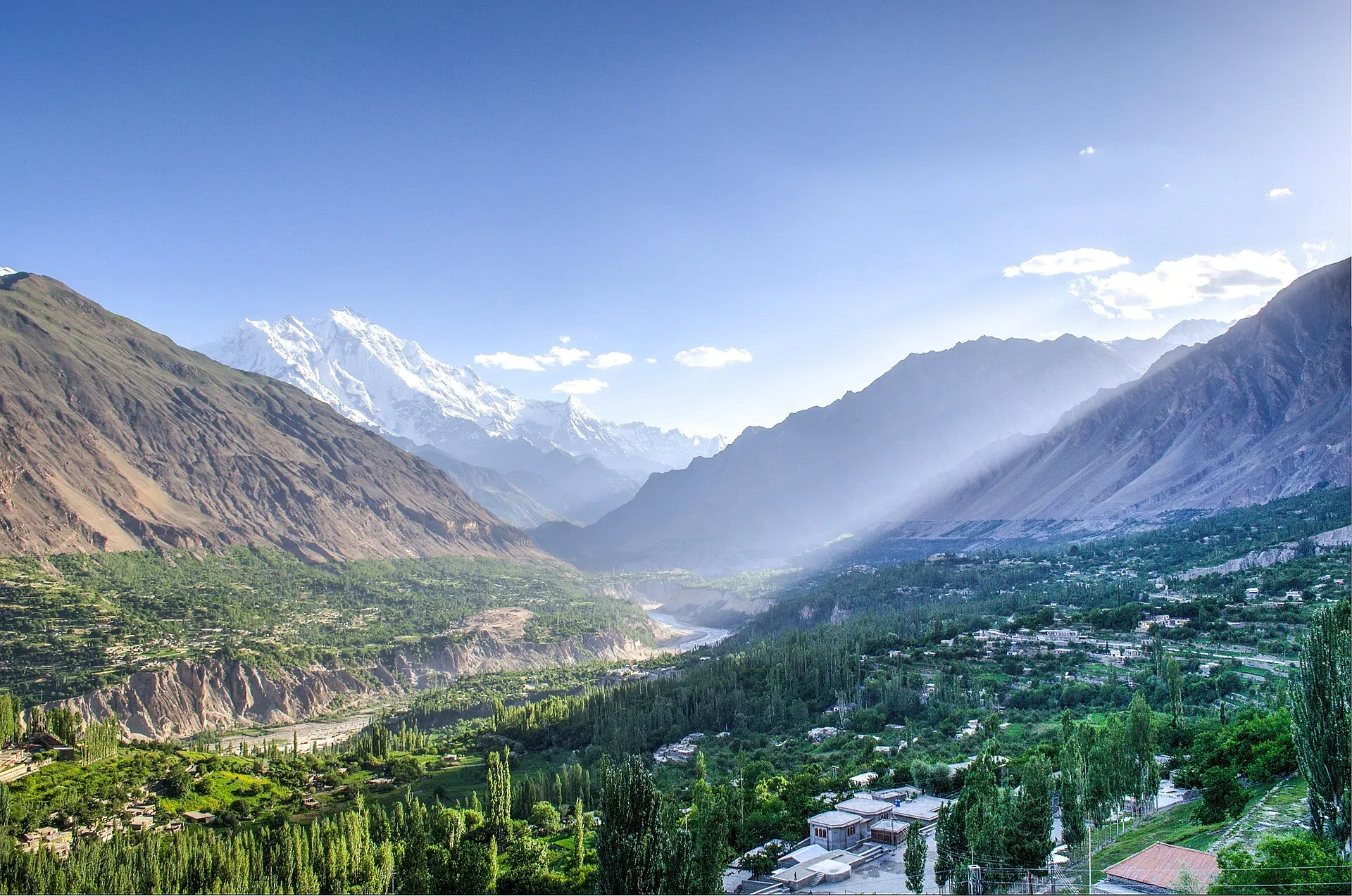
Chilas to Gilgit. Beyond Chilas the valley opens up and the road is paved with long, exposed stretches. You pass the turn-off to Raikot Bridge, where the jeep track to Fairy Meadows begins, and then the junction for Gilgit. Rakaposhi (7,788 m) appears above the road as you approach Gilgit.
Gilgit to Karimabad. The road follows the Hunza River. It is better surfaced than the lower half. A series of bridges and five tunnels, opened on 15 September 2015, carries the road above Attabad Lake, which formed after the 2010 landslide. The longest tunnel is 3,360 m. Karimabad, the main tourist town of Hunza, is about 100 km from Gilgit, and the drive takes two to three hours with stops.
How long does it take?
Plan on two long days from Islamabad to Gilgit (a night at Besham or Chilas) and a third half day to Hunza. A single day from Islamabad to Gilgit is possible only on very good days and is tiring. Road works, checkposts, slow trucks, prayer breaks and landslide queues all add time. Do not drive the mountain sections after dark.
Flying instead
Many visitors fly from Islamabad to Gilgit and start the road at Gilgit. Flights depend on cloud and wind, and cancellations are frequent, so book a flexible ticket and keep a day or two spare. Reports from earlier years show that road and air can both be disrupted in the same bad spell, so do not assume the road is a safe backup. Check the airline's own notices for the day.
What to carry
- Cash. ATMs are scarce north of Gilgit and can be empty or offline. Withdraw before you leave.
- Documents. Passport, visa copies and any permits. Checkposts are common in Hazara, Kohistan and Diamer.
- Water and snacks. Gaps between towns can be long.
- Warm clothes. Karimabad is cool at night even in summer.
- Medicine. Motion-sickness tablets and stomach remedies.
- Offline maps. Mobile signal fails in the gorges.
Fuel and services
Fuel stations and hotels are found in Abbottabad, Mansehra, Besham, Chilas, Gilgit, Karimabad, Aliabad and Sost. Gaps are long in Kohistan and between Gilgit and the Hunza villages. Fill up in towns and carry a spare can if your vehicle needs it. Tolls apply on some National Highway Authority roads; current rates will be added soon, so ask at the toll plaza.
What to see on the way
- Chilas and Shatial rock carvings, a few of the thousands carved along the upper Indus.
- The Raikot Bridge turn-off for Fairy Meadows and Nanga Parbat.
- Gilgit, the Danyore suspension bridge and the Kargah Buddha.
- The Rakaposhi viewpoint beside the highway.
- Karimabad, with Baltit and Altit forts and the Eagle's Nest viewpoint.
- Attabad Lake, Hussaini suspension bridge and the Passu Cones, further up in Gojal.
When to go
The highway can be closed by snow, rain or landslides at any time. May to October is the practical season for Hunza. July and August bring the most landslides in Kohistan and Diamer. Before you set out each morning, check road status and ask your hotel about the day's reports.
A short checklist
- Read the UK advice and your own government's advice for the Mansehra to Chilas section.
- Decide whether to drive, fly or split the trip.
- Leave two spare days at each end.
- Use a driver who knows the road.
- Travel in daylight only.
- Carry cash, documents, water and warm clothes.
- Tell your hotel or operator your plan each evening.


