

Photo: Furqanlw, with thanks · CC BY-SA 4.0 · via Wikimedia Commons · temporary stand-in photo

Silk Road (KKH)
The Karakoram Highway as an ancient Silk Road: rock carvings, Buddha figures and the forts of Hunza, up to the Khunjerab Pass. A five-day plan from Gilgit with measured distances and current advice.
Customise this route Change the dates, stops and how you travel in the Road Trip Planner.
The story
For centuries traders, monks and armies crossed the high Karakoram on foot, and the Indus gorge and Hunza valley carried them. The modern Karakoram Highway (KKH) follows one of the many paths of the ancient Silk Road. It was built jointly by Pakistan and China. Work began in 1962 and finished in 1979, and the road opened to the public in 1986. It runs about 1,300 km from Hasan Abdal to the Khunjerab Pass at 4,693 m, then on to Kashgar as China National Highway 314. About 810 Pakistanis and about 200 Chinese workers died building it, mostly in landslides and falls, and more than 140 Chinese workers are buried in the Chinese cemetery in Gilgit.
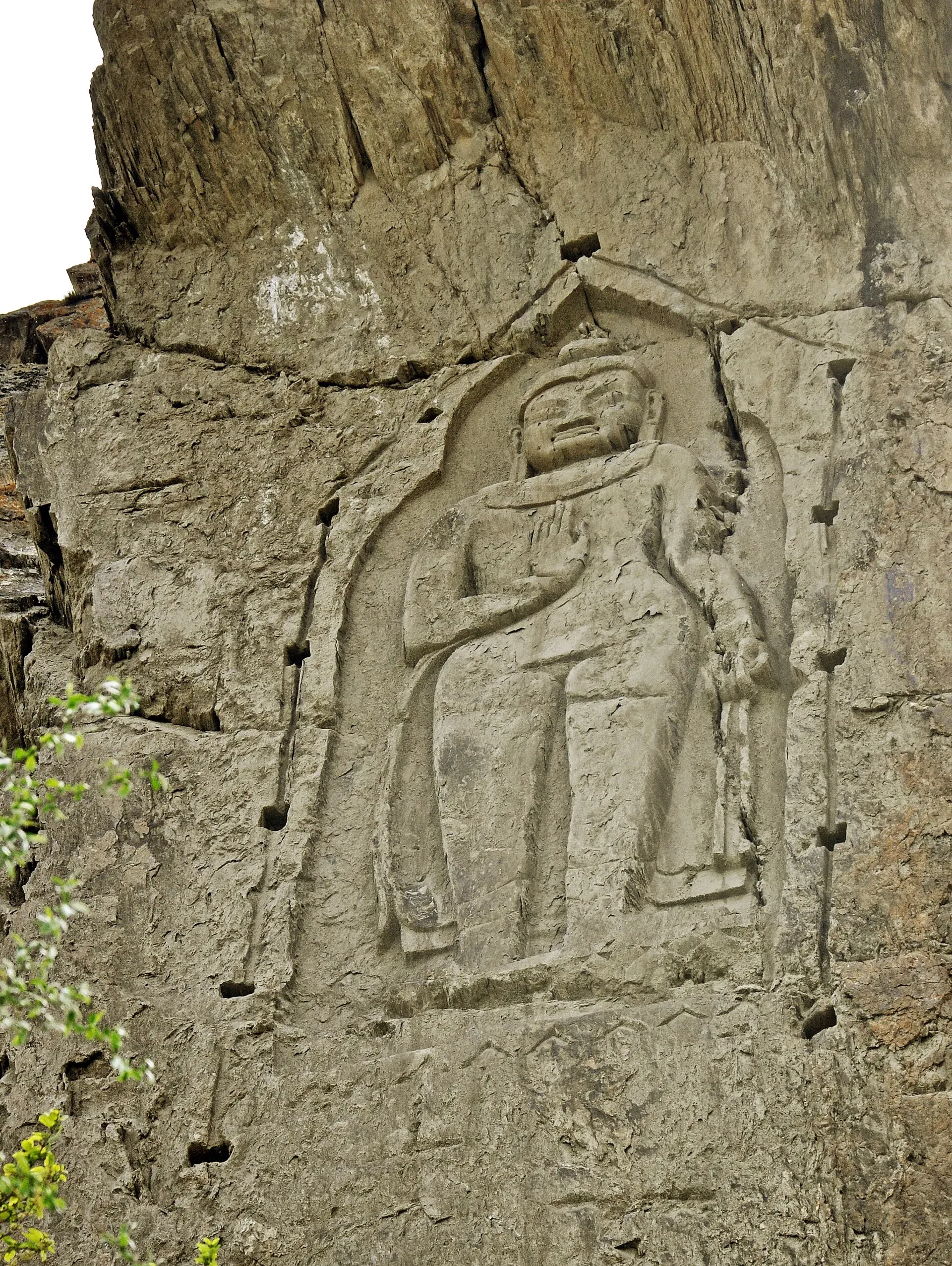
The Silk Road left its own marks beside the road. More than 50,000 carvings and petroglyphs are concentrated at ten major sites between Hunza and Shatial, the earliest dating from about 5000 to 1000 BC. Near Chilas thousands of carvings run from prehistoric hunting scenes to Buddhist stupas and inscriptions left by travellers. At Shatial more than 1,000 inscriptions include many by Sogdian merchants of the 3rd to 7th centuries. Beside the road near Ganish in Hunza, the Sacred Rock (Haldeikish) is a 180 m outcrop of engraved boulders with ibex carvings and inscriptions in several ancient scripts. A standing Buddha about 15 m tall is carved into a cliff at Kargah near Gilgit, probably in the 7th century.
Timeline
- About 5000 to 1000 BC: Earliest rock carvings along the upper Indus.
- 3rd to 7th centuries CE: Sogdian merchants leave inscriptions at Shatial.
- About 7th century CE: Kargah Buddha carved.
- 1962: Work starts on the KKH.
- 1979: KKH completed.
- 1982: Road across the Khunjerab Pass completed.
- 1986: KKH opens to the public.
- 1 June 2006: Daily Gilgit to Kashgar bus service begins.
Gilgit and the Kargah Buddha
Gilgit, the capital of Gilgit-Baltistan, was an important Buddhist centre on the Silk Road. Wikipedia says the Chinese pilgrims Faxian and Xuanzang reportedly passed through, and that its Patola Shahi rulers were Vajrayana Buddhists. The city is about 10 km from the Karakoram Highway and has a cold desert climate, with 120 to 240 mm of rain a year. A PIA flight from Islamabad is the usual way in. The Kargah Buddha is a standing figure in relief on a cliff in the Kargah nala (a stream gully) near the city, dated to around 700 CE. The Chinese cemetery for the highway workers is at Danyor, near Gilgit.
Hunza: Baltit, Altit and the Sacred Rock
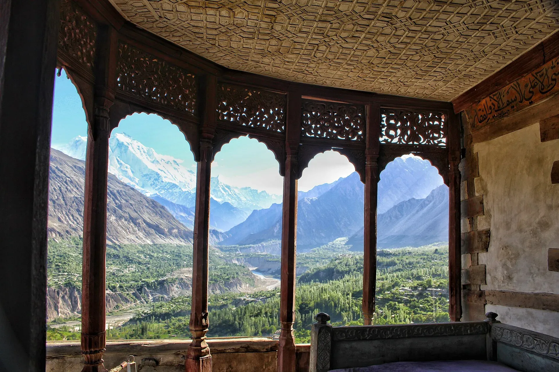
Photo: Fassifarooq, with thanks · CC BY-SA 4.0 · via Wikimedia Commons · temporary stand-in photo

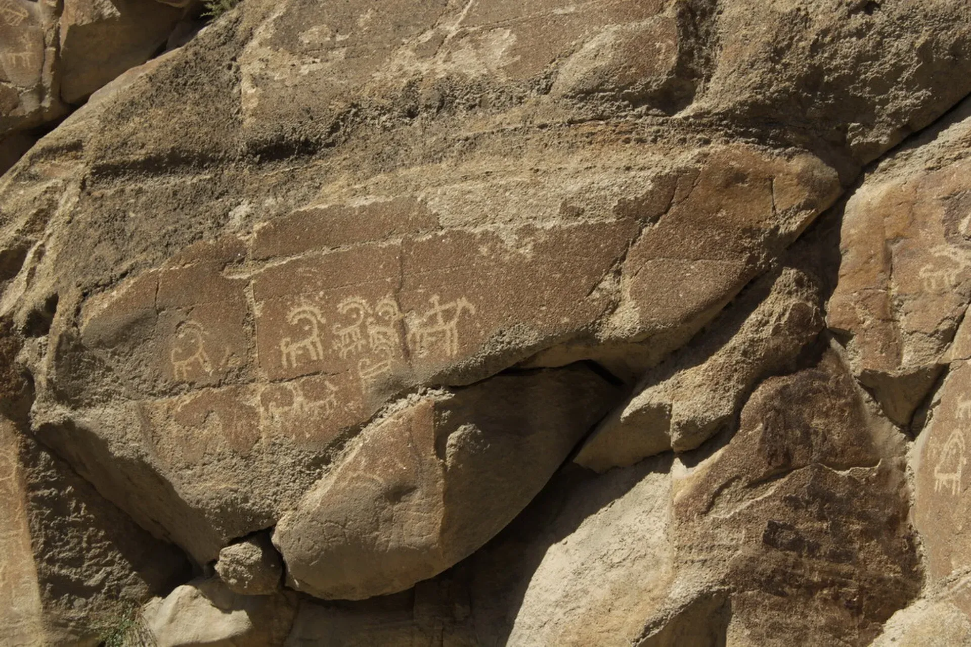
Photo: Baniashirjeel, with thanks · CC BY-SA 3.0 · via Wikimedia Commons · temporary stand-in photo

Baltit Fort stands above Karimabad. Its core dates to the 8th century CE and the Mirs of Hunza left it in 1945. A restoration supported by the Aga Khan Trust for Culture was completed in 1996, and the Baltit Heritage Trust now runs it as a museum. Altit Fort, nearby, is described as the oldest monument in Gilgit-Baltistan. It has been open to tourists since 2007 and won the UNESCO Asia-Pacific heritage award for conservation in 2011. The Sacred Rock at Ganish, beside the highway, has ibex carvings and inscriptions. Wikivoyage describes Ganish as the oldest village in Hunza, with mosques about 800 years old and ancient watchtowers. Most Hunza residents are Ismaili Muslims, and Burushaski, Wakhi and Shina are spoken.
Rock carvings along the Indus
The carvings at Chilas and Shatial lie on or at the end of the stretch the FCDO advises against; see the safety section. More than 50,000 carvings are concentrated at ten major sites between Hunza and Shatial. Near Chilas they run from prehistoric hunting scenes to Buddhist stupas, and at Shatial the Sogdian inscriptions of the 3rd to 7th centuries are among more than 1,000 on the rocks.
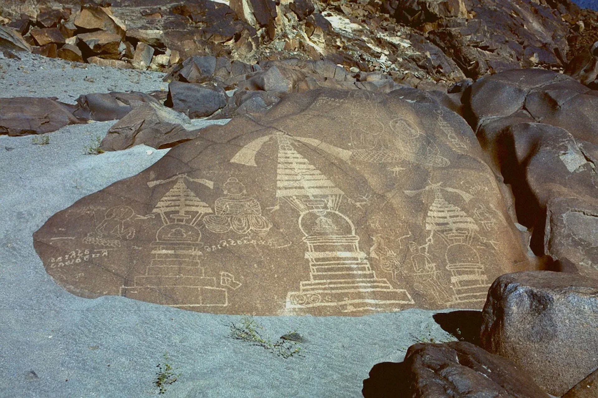
Photo: B.Degel, with thanks · Public domain (CC0) · via Wikimedia Commons · temporary stand-in photo

Attabad Lake and the tunnels
On 4 January 2010 a landslide dammed the Hunza River and created Attabad Lake about 15 km upstream of Karimabad. The lake reached about 22 km in length by June 2010 and flooded over 20 km of the highway, including a 310 m bridge. A new alignment with five tunnels, the longest 3,360 m, and the 1,480 m Shishkat Great Bridge opened on 15 September 2015 at a cost of $275 million (Wikipedia). Wikivoyage says some of the tunnels are unlit.
Food in Hunza
Wikivoyage names several Hunza dishes: giyalin (thin crepes), burus berikutz (cheese bread), baterin xy dawdo (dried apricot soup) and diram fiti (a sweet bread). Sharbat and harisa are served at festivals such as Navroz. Apricots, mulberries, grapes, plums and cherries are the local fruit.
Sost and the Khunjerab Pass
Sost has the Pakistani customs and immigration post, and the road climbs 90 km (by OSRM; Wikipedia says about 75 km from the Sost customs post) to the pass at 4,693 m, with the Chinese port of entry 3.5 km beyond. Wikivoyage says Pakistan drives on the left and China on the right, so drivers switch sides at the border, and cyclists cannot cross.
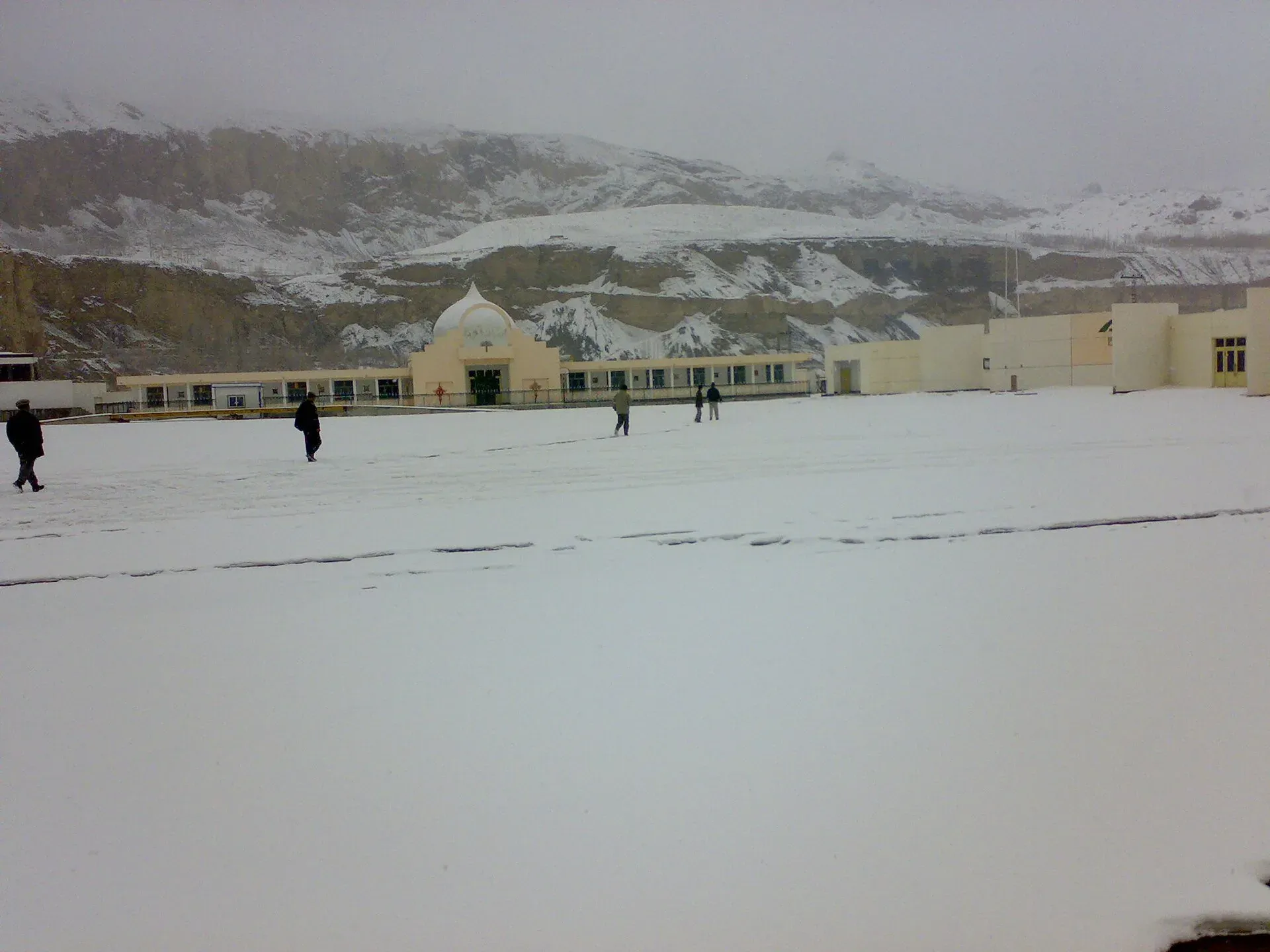
Photo: Shakeelgilgity, with thanks · CC BY-SA 3.0 · via Wikimedia Commons · temporary stand-in photo

Journey stages and road conditions
These are OSRM estimates for a car without stops. Gilgit to Karimabad is about 102 km, around 1 hour 20 minutes (Wikivoyage says 2 to 3 hours). Karimabad to Sost is about 90 km, around 1 hour 20 minutes. Sost to the pass is about 84 km by this routing, around 1 hour. Islamabad to Gilgit is about 488 km by routing, but Wikivoyage says the Islamabad to Hunza journey can take as long as 24 hours, so plan for delays.
Wikivoyage describes the road as good from Hasan Abdal but worse in Kohistan, with the section from Besham to Chilas narrow, bumpy and steep, and mostly smooth from Chilas to the border. Landslides in the monsoon (July to September) can block it for hours or longer, and Besham to Chilas can reach 45 degrees Celsius in summer. Spring and early autumn are the best seasons.
Etiquette
Rock carvings are fragile. Do not touch, trace or chalk them. Stay off the boulders. Ask before photographing people, particularly women. Dress modestly in the valleys. At the pass, follow the instructions of the border and park staff, do not photograph military posts and carry your passport. High altitude affects everyone at 4,693 m: go up slowly, drink water and come down if you feel unwell.
Crossing into China
Crossing at Khunjerab needs a valid Chinese visa and the pass to be open to travellers. Pakistan and China agreed to year-round trade and travel through the pass, which was formally inaugurated in April 2025 (Dawn, 23 April 2025). There is no known official notice of 2026 dates for tourist crossings; a Dawn report of 25 March 2026 quotes a tour operator saying the pass is open to tourists, with Chinese visa rules a hurdle for visitors coming the other way. The bus between Gilgit and Kashgar ran from 1 June 2006 until 2010. A new service by NATCO and a Kashgar operator began in November 2024 and entered a trial phase in March 2025, with departures from Gilgit on Mondays, Tuesdays and Fridays at 6 am (Pakistan Today, 7 March 2025). There is no known later report, so we have not confirmed that it runs now. The pass has had seasonal closures: heavy vehicles were generally shut from 30 November to 1 May, and all vehicles from 30 December to 1 April, but these dates are not fixed and snow clearance can take days or weeks. Check with Gilgit-Baltistan Tourism and the Sost immigration office. A park entry fee applies at Khunjerab National Park; current fees will be added soon.
When to go
May to October for Hunza and the pass, with the best weather from June to September. Snow can close the road at any time outside summer.
Events and visitor information
There is no confirmed annual festivals for this theme. Hunza villages hold local celebrations; ask at the Karimabad tourism office.
Highlights
- Rock carvings along the Indus and in Hunza
- Kargah Buddha and the Sacred Rock of Hunza
- Baltit and Altit forts at Karimabad
- Khunjerab Pass at 4,693 m
Stops
- GilgitStart; PIA flights from Islamabad
- Kargah BuddhaFrom Gilgit
- Karimabad (Baltit Fort)From Gilgit
- Altit Fort5 km from Karimabad
- Sacred Rock of Hunza, Ganish5 km from Karimabad
- Sost88 km from Karimabad; customs and immigration
- Khunjerab Pass90 km from Sost; 4,693 m
km: distance from the start along the route.
Numbers follow the stops in order. The map shows the stops, not the road itself.
Day by day
Day 1 · Gilgit and Kargah Buddha
Fly in and see the Kargah Buddha, 10 km from Gilgit (about 20 minutes by OSRM). Rest and take in Gilgit's bazaar.
Day 2 · Gilgit to Karimabad: Baltit and Altit
Drive 100 km up the KKH to Karimabad (about 1 hour 20 minutes by OSRM). Visit Baltit Fort in the afternoon and Altit Fort (5 km) at sunset.
Day 3 · Ganish and Sost
See the Sacred Rock of Hunza at Ganish, 5 km from Karimabad, then drive 88 km to Sost for the night. Altitude rises; drink plenty of water.
Day 4 · Khunjerab Pass and return to Sost
Drive 90 km up to the Khunjerab Pass (4,693 m) and return. Start early; the weather often changes by afternoon. Check pass status first.
Day 5 · Sost to Gilgit
Drive 184 km back to Gilgit (2.4 hours by OSRM) and fly out. Allow a spare day for weather.
Road conditions
- Gilgit to Karimabad and Sost: paved KKH with rockfall and landslide risk, especially after rain.
- Sost to the pass: high-altitude mountain road; snow can close it.
- Pass: open seasonally; dates are not fixed.
- Times: OSRM drive times are optimistic and exclude stops, traffic and checkpoints.
Fuel and services
Fuel is available in Gilgit and Karimabad. Sost has basic services and customs facilities; there is little beyond it. Carry cash and water.
Where to stay, eat and fuel up
Places to stay
- Shangrila Chilas HotelCall Shangrila Chilas HotelMap of Shangrila Chilas Hotel in Google Maps
- Eagle's Nest Hotel HunzaCall Eagle's Nest Hotel HunzaMap of Eagle's Nest Hotel Hunza in Google Maps
- Indus Lodges GilgitCall Indus Lodges GilgitMap of Indus Lodges Gilgit in Google Maps
- Gilgit Serena HotelCall Gilgit Serena HotelMap of Gilgit Serena Hotel in Google Maps
- Park Hotel GilgitCall Park Hotel GilgitMap of Park Hotel Gilgit in Google Maps
- Hotel SarbanCall Hotel SarbanMap of Hotel Sarban in Google Maps
Places to eat
- KFC | AbbottabadCall KFC | AbbottabadMap of KFC | Abbottabad in Google Maps
- Yum Bakery and CafeCall Yum Bakery and CafeMap of Yum Bakery and Cafe in Google Maps
- Food PlanetCall Food PlanetMap of Food Planet in Google Maps
- Flame On Jadoon PlazaCall Flame On Jadoon PlazaMap of Flame On Jadoon Plaza in Google Maps
- BaithakCall BaithakMap of Baithak in Google Maps
- Food HutCall Food HutMap of Food Hut in Google Maps
Essential services fuel stations, ATMs, banks, pharmacies and hospitals and clinics
Fuel
- ShellCall ShellMap of Shell in Google Maps
- Attock Petrol PumpMap of Attock Petrol Pump in Google Maps
- PSO ROYAL STAR FILLING STATIONCall PSO ROYAL STAR FILLING STATIONMap of PSO ROYAL STAR FILLING STATION in Google Maps
- Ibex PSO Petrol StationMap of Ibex PSO Petrol Station in Google Maps
- PSO SostCall PSO SostMap of PSO Sost in Google Maps
- Sakhi Darbar PSO Petrol PumpMap of Sakhi Darbar PSO Petrol Pump in Google Maps
ATMs
- World's Highest ATM NBPMap of World's Highest ATM NBP in Google Maps
- National Bank of Pakistan (NBP) Mirpur/Mandian BranchCall National Bank of Pakistan (NBP) Mirpur/Mandian BranchMap of National Bank of Pakistan (NBP) Mirpur/Mandian Branch in Google Maps
- HBLMap of HBL in Google Maps
- Allied Bank LimitedCall Allied Bank LimitedMap of Allied Bank Limited in Google Maps
- United Bank LimitedMap of United Bank Limited in Google Maps
- The Bank of PunjabCall The Bank of PunjabMap of The Bank of Punjab in Google Maps
Banks and money exchange
- National Bank of Pakistan (NBP)Call National Bank of Pakistan (NBP)Map of National Bank of Pakistan (NBP) in Google Maps
- Telenor Microfinance BankMap of Telenor Microfinance Bank in Google Maps
- Allied Bank LtdCall Allied Bank LtdMap of Allied Bank Ltd in Google Maps
Pharmacies
- Alam Family HospitalCall Alam Family HospitalMap of Alam Family Hospital in Google Maps
- Bilal PlazaCall Bilal PlazaMap of Bilal Plaza in Google Maps
- Qureshi Brothers Chemists and DruggistCall Qureshi Brothers Chemists and DruggistMap of Qureshi Brothers Chemists and Druggist in Google Maps
Hospitals and clinics
- Shamshad Aslam HospitalCall Shamshad Aslam HospitalMap of Shamshad Aslam Hospital in Google Maps
- Fatima HospitalCall Fatima HospitalMap of Fatima Hospital in Google Maps
- Umer Hospital Wah CanttCall Umer Hospital Wah CanttMap of Umer Hospital Wah Cantt in Google Maps
- Aga Khan Hospital, GilgitCall Aga Khan Hospital, GilgitMap of Aga Khan Hospital, Gilgit in Google Maps
- Shifa Physiotherapy ClinicCall Shifa Physiotherapy ClinicMap of Shifa Physiotherapy Clinic in Google Maps
- City HospitalCall City HospitalMap of City Hospital in Google Maps
Listings come from Google Maps data and are unverified: phone numbers, opening months and prices may have changed. Report a problem · Own one of these? Claim it
Safety
- Government advice (UK FCDO, updated 27 October 2026, checked 16 November 2026): the FCDO advises against all travel on the Karakoram Highway between Mansehra and Chilas, via Battagram, Besham City, Dasu and Sazin, up to the junction with the N15. For foreign visitors: the UK FCDO page does not cover Gilgit-Baltistan generally, so it gives no advice for Gilgit, Hunza, Sost or Khunjerab.
- Shatial and Chilas: Shatial lies on the advised-against section. Chilas sits at the end of it. We have not planned either stop.
- Getting there: fly to Gilgit rather than drive the KKH from Islamabad.
- Altitude and weather: Khunjerab is at 4,693 m. Landslides and snow can close the road with little warning.
- Insurance: travel insurance can be invalid if you travel against FCDO advice.
Tips
- Fly to Gilgit; the KKH between Mansehra and Chilas is advised against by the UK FCDO.
- Add a rest day before the pass to adjust to altitude.
- Carry your passport for checkpoints and the Khunjerab area.
- Check with Gilgit-Baltistan Tourism for road and pass status.
Photos we still need: Hunza food (giyalin, burus berikutz) and Gilgit city. Send us yours
Sources and last checked
Last checked Confidence medium19 sources6 still to check
- Last checked
- Method
- Desk research from published sources
- Confidence
- medium
- Checked by
- trek.pk research team
Researched from published sources; not yet checked on the ground by our team. Spot something out of date? Report a mistake.
Sources
- Pakistan travel advice: Warnings and insurance (updated 27 October 2026) · UK Foreign, Commonwealth & Development Office (FCDO) · checked
- OSRM driving route service: distances and times measured 16 November 2026 (drive times are optimistic and exclude stops) · OSRM / OpenStreetMap contributors · checked
- Karakoram Highway (Wikipedia) · Wikipedia · checked
- Khunjerab Pass (Wikipedia) · Wikipedia · checked
- Chilas (Wikipedia) · Wikipedia · checked
- Shatial (Wikipedia) · Wikipedia · checked
- Haldeikish (Wikipedia) · Wikipedia · checked
- Kargah Buddha (Wikipedia) · Wikipedia · checked
- Baltit Fort (Wikipedia) · Wikipedia · checked
- Altit Fort (Wikipedia) · Wikipedia · checked
- Gandhara (Wikipedia) · Wikipedia · checked
- Khunjerab Pass opens for year-round trade and travel (23 April 2025) · Dawn · checked
- GB tour operators look towards China to offset war impact (25 March 2026) · Dawn · checked
- China-Pak two-way bus service resumes (7 March 2025) · Pakistan Today · checked
- Trade and travel through Khunjerab reopen after 68-day sit-in (29 September 2025) · Dawn · checked
- Karakoram Highway (road conditions, stages, border) · Wikivoyage · checked
- Hunza (food, sights, distances) · Wikivoyage · checked
- Hunza Valley · Wikipedia · checked
- Gilgit · Wikipedia · checked
Still to be checked on the ground (6)
- Khunjerab Pass tourist access and exact dates in 2026 (year-round trade agreed April 2025; no official 2026 tourist notice found)
- Flights to Gilgit and their reliability (weather cancellations reported in January 2026 in a search summary only)
- Road status of the KKH between Gilgit and Sost (Sost-Gulmit washed out August 2025; no current report found)
- Whether Chilas and Shatial carvings are visitable at present (no current report found)
- Distance from Sost to the pass: about 75 km (Wikipedia) against 90 km by OSRM
- Whether the Gilgit-Kashgar bus is still running (trial service from March 2025; no later report found)
Nearby and related

Gilgit
Gateway to Gilgit-Baltistan on the Karakoram Highway: a busy mountain town with the Kargah Buddha and the base for Hunza, Naltar and Skardu.

Kargah Buddha
A standing Buddha about 15 m tall, carved into a cliff in Kargah Nala west of Gilgit, probably from the 7th century.

Hunza Valley
A long Karakoram valley on the Karakoram Highway, with Karimabad, Baltit and Altit forts, Ganish village and Attabad Lake, below Rakaposhi and Ultar Sar. About 100 km from Gilgit.

Baltit Fort
A restored fort and museum above Karimabad in Hunza, once the home of the Mirs of Hunza. Its core is centuries old and it has been on UNESCO's tentative list since 2004.

Altit Fort
An old fort above the Hunza River at Altit, restored by the Aga Khan Trust for Culture and open to visitors since 2007. Often described as the oldest monument in Gilgit-Baltistan.

Sacred Rock of Hunza (Haldeikish)
A 180 m long outcrop of engraved boulders beside the Karakoram Highway near Ganish, with ibex carvings and inscriptions in several ancient scripts from Silk Road travellers.

Chilas Rock Carvings
Thousands of rock carvings along the Indus near Chilas, from prehistoric hunting scenes to Buddhist stupas and inscriptions left by Silk Road travellers.

Shatial Rock Carvings
A site beside the Indus on the Karakoram Highway with more than 1,000 inscriptions, many by Sogdian merchants of the 3rd to 7th centuries, plus Buddhist carvings.

Khunjerab National Park
A high-altitude park on the Pakistan-China border, created in 1975 to protect Marco Polo sheep, snow leopard and Himalayan ibex. It surrounds the Khunjerab Pass on the Karakoram Highway.

Sost
The last town on the Karakoram Highway before the Chinese border, at about 2,800 m. Sost has Pakistan's immigration and customs offices, a dry port, and is the base for Khunjerab Pass.

Karimabad (Hunza)
The main town of Hunza, set on a terrace below Baltit Fort with Rakaposhi, Ultar and Diran in view. A good base for forts, viewpoints, Attabad Lake and the road to Gojal.
Chilas
Headquarters of Diamer on the Karakoram Highway and the Indus, with thousands of ancient rock carvings, views towards Nanga Parbat, and the road junctions for Fairy Meadows and Babusar Pass.
Hunza and Khunjerab (KKH)
A 7-8 day road trip from Islamabad up the Karakoram Highway to Hunza and on to Khunjerab Pass (4,693 m), with overnight stops at Besham, Chilas and Gilgit.

Islamabad to Khunjerab and the China Border
An overland guide from Islamabad to Khunjerab Pass (4,693 m) on the KKH, with the border rules to check: who can visit the top, who can cross to China, and the seasons.