

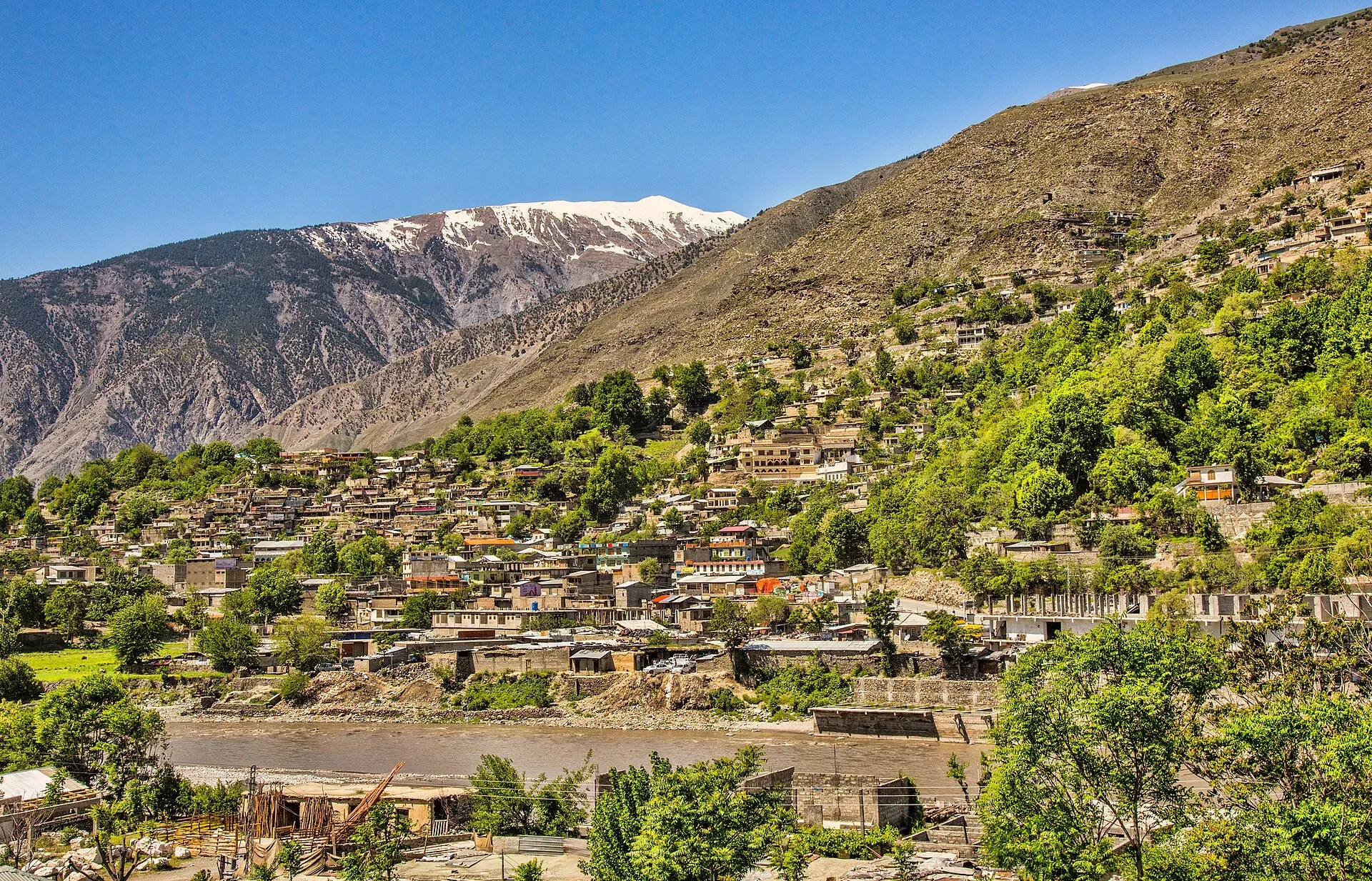
Photo: Shah Tahsin Anwar, with thanks · CC BY-SA 4.0 · via Wikimedia Commons · temporary stand-in photo

Chitral River (Kunar)
A river of about 480 km that rises in the Hindu Kush of Chitral, flows past Chitral town, becomes the Kunar in Afghanistan, and joins the Kabul River east of Jalalabad.
Overview
The Chitral River is also known as the Kunar River. Reference works give its length as about 480 km and its basin as about 26,000 sq km. It rises in the glaciers of the Hindu Kush in Chitral, and the Chiantar Glacier on the Gilgit-Baltistan border is named as a source. An estimated 60 to 70 per cent of the Kunar's yearly flow starts in Chitral. The mean annual flow near Chitral city is about 292 cubic metres a second.
Plan your visit
- Nearest town
- Chitral
- Getting there
Chitral town is reached by road over the Lowari Pass (the N-45 route) or by long mountain routes from Gilgit-Baltistan, and by flights from Islamabad when weather allows. More
Best months
May – Oct
Course and names
In Chitral the upper river is called the Mastuj River until it meets the Lotkoh River, after which it is the Chitral River. It runs south past Chitral town and leaves Pakistan, and in Afghanistan it is called the Kunar. Near Asadabad it meets the Pech, and it flows into the Kabul River east of Jalalabad. The combined river re-enters Pakistan and joins the Indus at Attock. Tributaries listed include the Lotkoh, Landai Sin and Pech on the right bank and the Shishi on the left. The Yarkhun River, which comes down from Broghil, is a main headstream.
The valley it drains
Chitral was an independent monarchy until 1895, when a British treaty made it a semi-autonomous princely state. It became part of Pakistan in August 1947. Wikipedia describes the old district as Khyber Pakhtunkhwa's northernmost and largest, at 14,850 km2, with elevations from about 1,094 m to 7,726 m. Mountains and glaciers cover about 76 per cent of the land, and Tirich Mir, the highest peak of the Hindu Kush, rises in the north. The river is fed by melting glaciers and snow from the Hindu Kush.
Upstream, Mastuj is the main settlement of Mastuj tehsil at about 2,359 m, with the ruins of an 18th-century fort. In 2018 the old district was split into Upper Chitral and Lower Chitral. Chitral town itself stands on the river at the foot of Tirich Mir.
What to see and do
- Chitral town. The river is on the doorstep of Chitral Fort, the Shahi Mosque and the museum. Evening walks along the bank are popular. See the Chitral, Chitral Fort and Chitral Museum pages.
- Mastuj and Yarkhun. Upstream, the road and trails follow the Mastuj and Yarkhun rivers towards Broghil and Shandur. See the Chitral Valley page.
- Treks. Several Chitral treks (Karambar An, Darkot An, Zani An) cross the river or its headstreams; see their trek pages.
- Fishing and rafting. No official source on either was found. Ask Khyber Pakhtunkhwa Fisheries or Tourism about licences and closed seasons.
Culture and people
Most people in Chitral are Kho and speak Khowar. The Kalash, who have their own language and customs, live in valleys south-west of Chitral town that drain towards the river; observe local customs and ask before taking photographs. A trekking guidebook of about 2002 traces the valley's history back more than three thousand years, through Persian, Buddhist and later Muslim periods.
When to visit
May to October is the main season. The river is highest in July and August. In winter it is low and clear; the main roads can close with snow, especially at the passes.
Good to know
- Glacial flood outbursts and heavy rain can cause floods in side valleys and wash out roads and bridges. Check local conditions before you set out.
- Never wade across the river in summer. See the river crossings guide.
- Ask the district administration or local police about current conditions before you go. Safety. For foreign visitors: the UK FCDO (updated 27 October 2026, checked 16 November 2026) advises against all travel on the N-45 from north of the Mardan ring road to the edge of Chitral city, including the Kalash valleys, and against all travel to Upper and Lower Dir. Read the live page before you decide on a route; it does not advise against Gilgit-Baltistan generally.
- Some stretches near the Afghan border are inside the FCDO 10-mile border zone. Do not plan travel there.
Highlights
- About 480 km from the Hindu Kush to the Kabul River
- Called the Mastuj, Chitral and then Kunar River
- About 60 to 70 per cent of the Kunar flow starts in Chitral
- Runs beside Chitral town and its fort
Getting there
Chitral town is reached by road over the Lowari Pass (the N-45 route) or by long mountain routes from Gilgit-Baltistan, and by flights from Islamabad when weather allows. Because the FCDO currently advises against the N-45 route, check the latest advice and conditions with your operator before travel. Wikipedia lists the Lowari Tunnel as open since July 2017; the old district was also reached from Gilgit over Shandur Top.
Tips
- Read the FCDO advice for Chitral and the N-45 first
- Never wade across the river in summer
- Check flood and road reports in July and August
- Ask before photographing people in Kalash villages
Photos we still need: the river upstream at Mastuj or on the Yarkhun; a river crossing or bridge in Chitral. Send us yours
Sources and last checked
Last checked Confidence medium7 sources4 still to check
- Last checked
- Method
- Desk research from published sources
- Confidence
- medium
- Checked by
- trek.pk research team
Researched from published sources; not yet checked on the ground by our team. Spot something out of date? Report a mistake.
Sources
- Kunar River (Wikipedia) · Wikipedia · checked
- Kabul River (Wikipedia) · Wikipedia · checked
- Trekking in the Karakoram and Hindukush (facts only) · Lonely Planet (owner-provided) · checked
- Pakistan travel advice (updated 27 October 2026) · UK Foreign, Commonwealth & Development Office · checked
- Lowari Tunnel (Wikipedia) · Wikipedia · checked
- Chitral District · Wikipedia · checked
- Mastuj · Wikipedia · checked
Still to be checked on the ground (4)
- Length within Pakistan not sourced (Wikipedia gives only the 480 km total)
- Which headstream is the longest (Wikipedia does not compare Yarkhun and Mastuj)
- Fishing and rafting rules (no official source found)
- Current N-45 status (Wikipedia lists the Lowari Tunnel as open since July 2017, all-weather, at least 10 hours a day by late 2018; current status not confirmed)
Nearby and related

Chitral
The main town of Lower Chitral District, at about 1,500 m on the Chitral River, with a historic fort, a royal mosque and views of Tirich Mir. The base for the Kalash valleys.

Chitral Valley
The long Chitral River valley at the foot of the Hindu Kush, with Chitral town's fort and Shahi Mosque, the Lowari Tunnel route, Tirich Mir views and side valleys leading to Kalash and Shandur.

Chitral Fort (Shahi Qila)
The fort and royal residence on the Chitral river, with a history reaching back to the 18th century and the 1895 siege. It is still the home of the ceremonial Mehtar, so access is limited.

Chitral Museum
A small museum in Chitral town, established in 2010, with galleries on Chitrali life, weapons, and Kalash and Gandhara Grave archaeology.

Kalash Valleys (Bumburet, Rumbur, Birir)
Three side valleys of the Chitral River, home to the Kalasha people, who keep their own religion, language and festivals. Visit with respect and check security advice first.

Indus River
Pakistan's greatest river, rising in Tibet and running about 3,180 km to the Arabian Sea. It crosses Gilgit-Baltistan, meets the Gilgit near Jaglot and the Kabul at Attock, and feeds the plains from Tarbela to the delta.

Kabul River
A river of about 700 km that rises in Afghanistan, enters Khyber Pakhtunkhwa near Peshawar, passes Charsadda and Nowshera, and joins the Indus near Attock. Not a visitor destination at present; see travel advice.
Chiantar Glacier (upper Chitral)
A glacier on the Gilgit-Baltistan and Chitral border, named as a source of the Chitral (Kunar) River. It is remote and has no visitor route in our sources.

Chitral and Kalash
A 6-7 day road trip from Islamabad to Chitral through Dir and the Lowari Tunnel, with the Kalash valleys of Bumburet, Rumbur and Birir, Chitral Fort and Tirich Mir views.