

Photo: Haris akhon, with thanks · CC BY-SA 4.0 · via Wikimedia Commons · temporary stand-in photo

Panjkora Valley
The river valley of the Panjkora in Upper Dir, Lower Dir and Bajaur, from Kumrat down to its meeting with the Swat River. FCDO advises against all travel in Upper and Lower Dir.
Overview
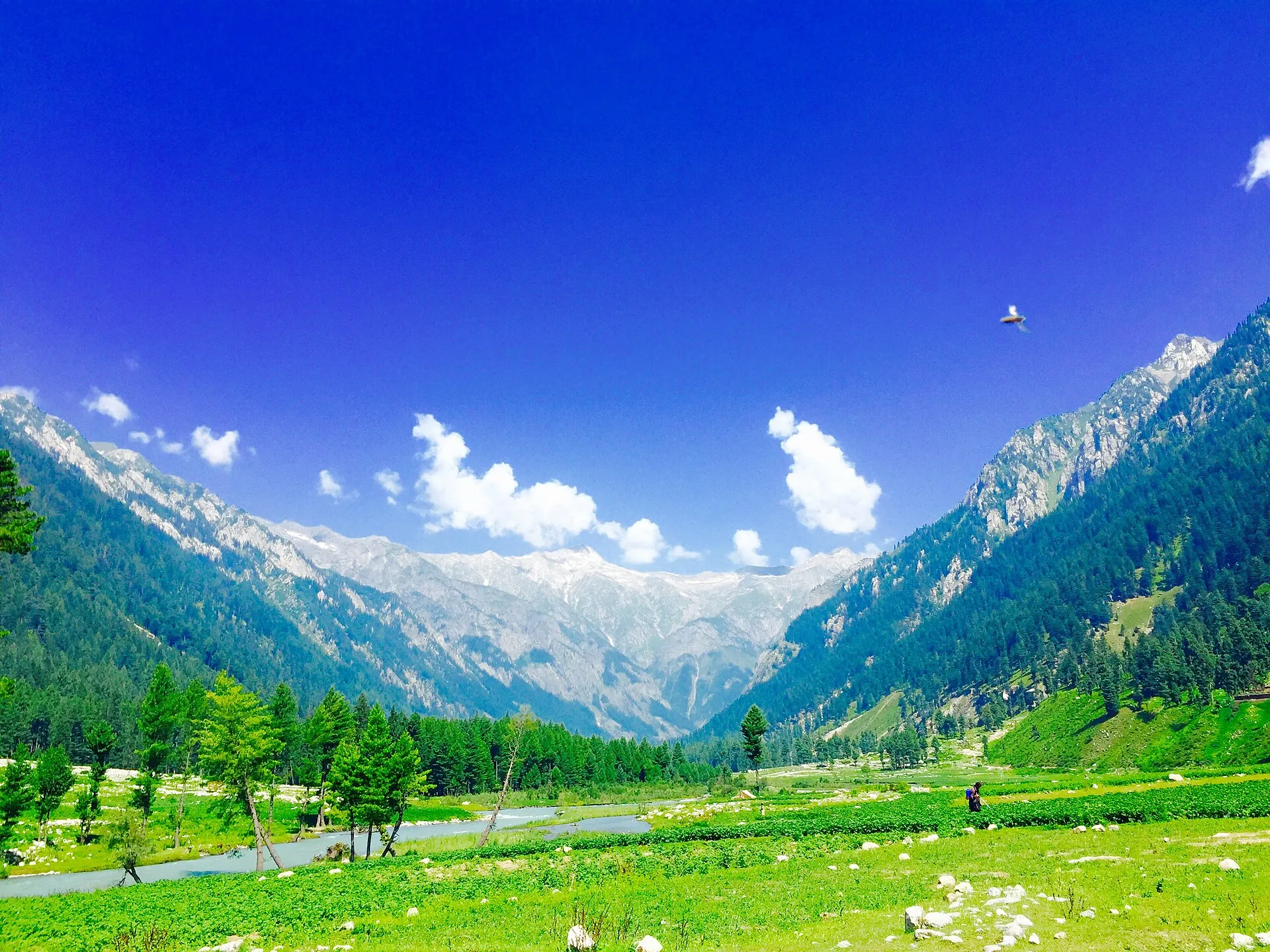
The Panjkora Valley follows the Panjkora River through Khyber Pakhtunkhwa. The upper valley is also called Panjkora Kohistan or Dir Kohistan, and the lower valley is called Dir Valley. Wikipedia places the boundary at a narrow gorge near Sheringal. The valley is divided among Upper Dir, Lower Dir and Bajaur districts. The upper valley is highly mountainous, with peaks above 6,000 m, and the valley floor drops to about 500 m towards the south.
Plan your visit
- Nearest town
- Dir
- Getting there
The valley road runs through Timergara, Dir and Sheringal. Lowari Pass leads to Chitral and Badgoi Pass to Swat. Distances are not confirmed. More
- Panjkora Valley
- Related places nearby: Dir, Kumrat Valley, Timergara, Chitral
The river
The Panjkora is about 220 km long. Its headwaters are in Hindu Kush glaciers at about 3,600 m, and the valley article places the source near the Shandur Pass. The river flows south through Upper Dir and Lower Dir, passing Thal, Dir and Timergara, and joins the Swat River near Totakan, close to Chakdara, below the village of Kalangai. The Swat flows on into the Kabul River and the Indus basin.
The river runs all year but swells in the monsoon, from June to September. The 2010 floods were the best-known event. About 15 per cent of the basin is classed as highly flood-prone, and many of those areas are inhabited. A 2022 academic study assessed flood risk in the valley. Keep away from riverbanks in heavy rain.
Kumrat and the upper valley
Kumrat Valley forms most of the upper valley and covers about 346 km². Wikipedia says it can be reached only by four-wheel-drive vehicles because the road is unmetalled, and that around Eid al-Fitr about 2,000 vehicles enter in a day. Pine forest grows in the upper section and oak in the lower. Tall deodar (Himalayan cedar) stands on level ground beside the river; see Kumrat deodar forests. Wikipedia notes that the stands are shrinking because locals burn the wood for winter heating and cooking. The valley has several waterfalls and a spring called Kala Chashma (Black Spring), and makeshift camping spots line the river channels. See Kumrat waterfall.
Floods and a collapsed bridge have cut road access in recent years; the Kumrat page records the current position.
Towns on the river
- Dir. The old capital of the princely state of Dir, at the foot of the Lowari Pass.
- Timergara. District headquarters of Lower Dir, on the east bank at about 823 m. Across the river, an excavated site at Balambat has been occupied since about 1500 BC. Wikipedia reports houses from about 500 BC and fire altars there, and describes graves of about 1500 to 600 BC.
- Chakdara. Near where the Panjkora meets the Swat, it has a museum holding Buddhist remains from the area.
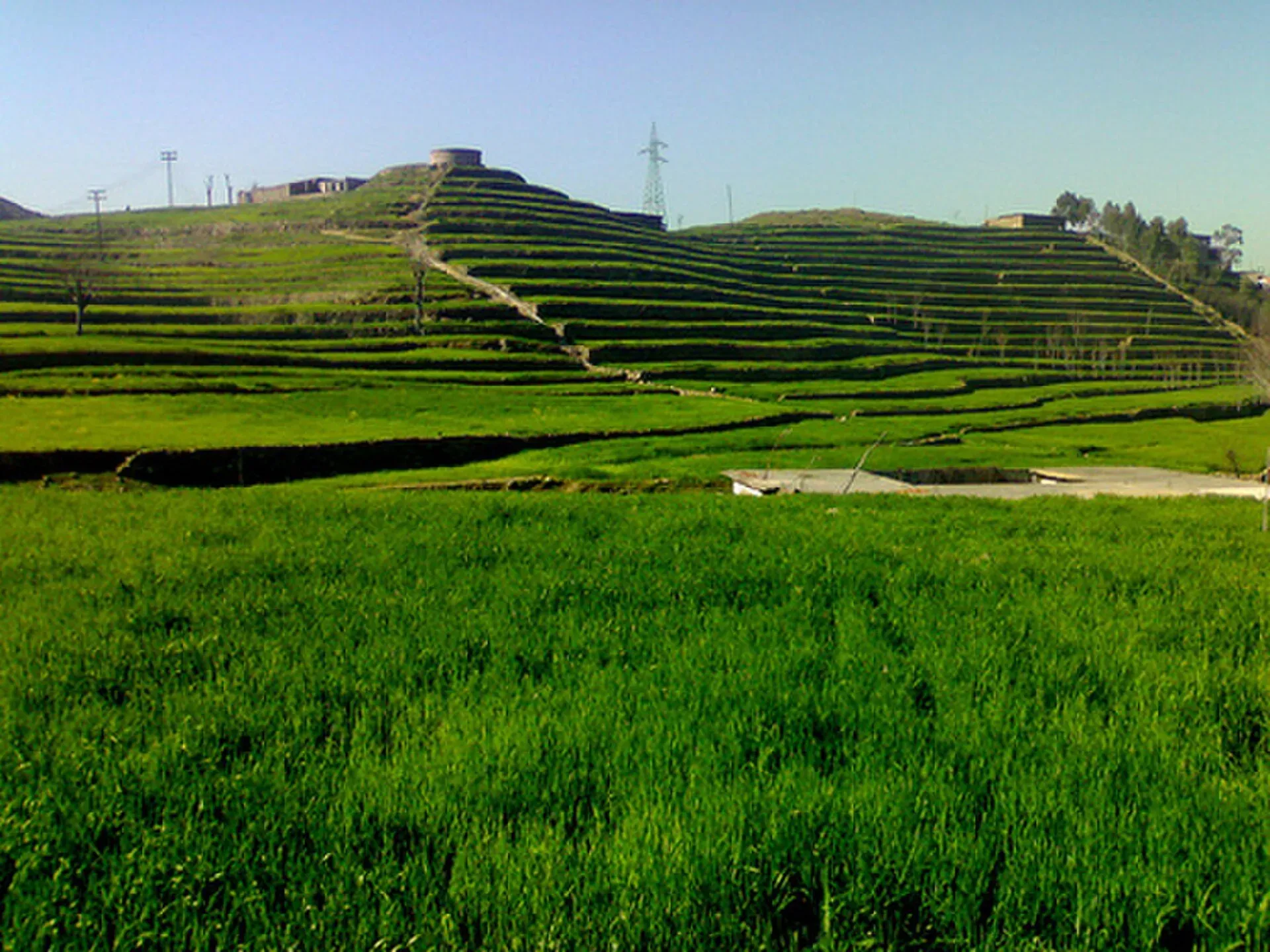
Photo: Kalival, with thanks · CC BY-SA 3.0 · via Wikimedia Commons · temporary stand-in photo

People and languages
Gawri people live in the upper valley, and Yousafzai Pashtuns, mainly of the Malizai tribe, in the lower valley. Gawri is spoken in the north. Pashto dominates the lower valley and serves as a regional common language, and Gujari speakers also live in the valley.
History
The Gauraioi, thought to be ancestors of the Gawri, resisted Alexander the Great in 327 BCE, according to Wikipedia. The area later became part of the Gandharan Buddhist world; stupa remains are displayed at Chakdara Museum. Islam arrived after Mahmud of Ghazni's invasion in the early 11th century, and Yousafzai Pashtuns settled the lower valley in the early 16th century. Akhund Ilyas and his descendants founded the Dir state. Dir stayed a princely state until 1960, when it became part of Pakistan's tribal administration. It was merged into the North-West Frontier Province in 1969 and split into Lower and Upper Dir districts after a 1996 decision.
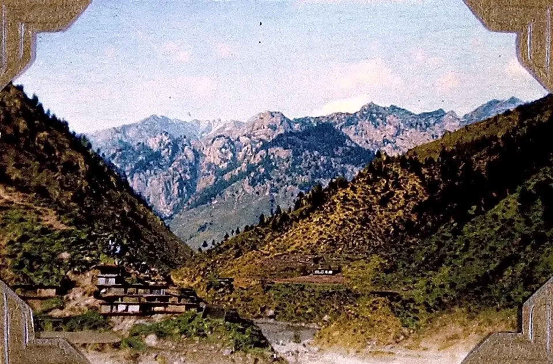
Photo: Lt Col Cyril Nisbet Steel (photo album, 1904–1921), with thanks · Public domain (CC0) · via Wikimedia Commons · temporary stand-in photo

Getting there
The Lowari Pass links the valley to Chitral, and the Badgoi Pass links it to Swat. The Lowari Tunnel carries the road between Dir and Chitral. Towns on the valley road include Timergara, Dir and Sheringal. Distances and journey times for the whole valley are not confirmed here; see the Dir, Timergara and Kumrat pages for figures on individual stretches.
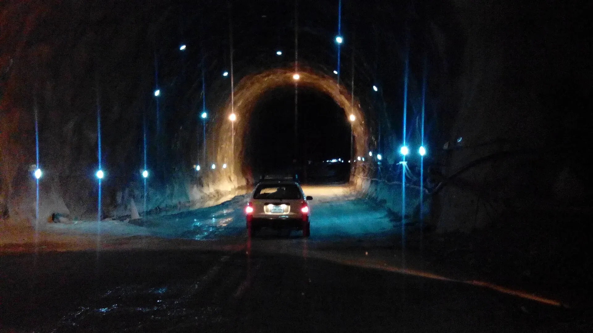
Photo: Ihsan Farid, with thanks · CC BY-SA 4.0 · via Wikimedia Commons · temporary stand-in photo

Safety and practical points
- Security advice. The UK Foreign Office advises against all travel to Upper Dir and Lower Dir, and to Bajaur (checked 17 November 2026). The whole Panjkora Valley lies in those districts.
- Floods. Avoid riverbanks in heavy rain, and check road and bridge status before travel.
Highlights
- River valley from Kumrat to Kalangai
- Gawri-speaking upper valley
- Passes to Chitral (Lowari) and Swat (Badgoi)
Tips
- Read the FCDO advice for Upper and Lower Dir first.
- Check river and weather conditions before travelling.
Photos we still need: Sheringal gorge; Chakdara and the confluence with the Swat River. Send us yours
Sources and last checked
Last checked Confidence medium5 sources4 still to check
- Last checked
- Method
- Desk research from published sources
- Confidence
- medium
- Checked by
- trek.pk research team
Researched from published sources; not yet checked on the ground by our team. Spot something out of date? Report a mistake.
Sources
- Panjkora Valley (Wikipedia) · Wikipedia · checked
- Pakistan travel advice (last updated 27 October 2026) · UK FCDO · checked
- Panjkora River · Wikipedia · checked
- Kumrat Valley · Wikipedia · checked
- Timergara · Wikipedia · checked
Still to be checked on the ground (4)
- Coordinates are those of Dir town; the valley has no single point
- Road distances and journey times for the whole valley
- Which parts are open to visitors
- Wikipedia gives the river source as glaciers at about 3,600 m and also near the Shandur Pass
Nearby and related

Dir
The old capital of the princely state of Dir, on the Dir River at the foot of the Lowari Pass, with a palace on the hill above. A stop on the road between Peshawar and Chitral.

Kumrat Valley
The upper Panjkora valley in Upper Dir, known for deodar forest, the Jahaz Banda meadow and Katora Lake. Access has been cut by floods and a collapsed bridge in 2025 and 2026.

Timergara
District capital of Lower Dir on the Panjkora River, at about 823 m. For foreign visitors: the UK FCDO advises against all travel to Lower Dir, so this is for information only.

Chitral
The main town of Lower Chitral District, at about 1,500 m on the Chitral River, with a historic fort, a royal mosque and views of Tirich Mir. The base for the Kalash valleys.

Khyber Pakhtunkhwa
Mountains, Buddhist ruins and old bazaars in north-west Pakistan: Swat, Kaghan, Chitral, the Kalash valleys, the Khyber Pass and Peshawar.