

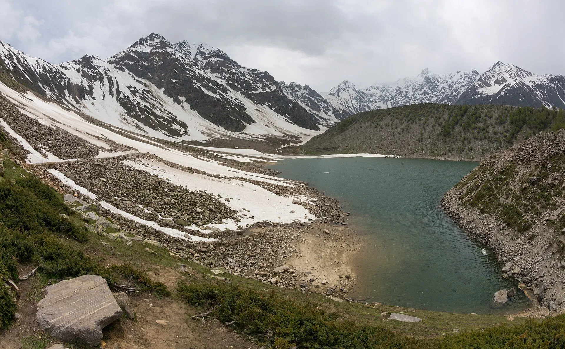
Photo: Ahmed Sajjad Zaidi, with thanks · CC BY-SA 3.0 · via Wikimedia Commons · temporary stand-in photo

Nanga Parbat National Park
A large high-mountain park in Diamer and Astore districts around Nanga Parbat (8,126 m), taking in Fairy Meadows, the Rupal side and Rama Lake. Notified in 2020 to 2021.
Overview
Nanga Parbat National Park protects the high country around Nanga Parbat, the ninth-highest mountain in the world, in Diamer and Astore districts of Gilgit-Baltistan. Wikipedia, citing the Gilgit-Baltistan Forest, Wildlife and Environment Department, gives its area as about 1,786 square kilometres. It was launched in December 2020 as one of two new high-altitude national parks in Gilgit-Baltistan, and Wikipedia gives 2021 as the year of establishment. Together with the neighbouring Himalaya National Park it covers about 5% of Gilgit-Baltistan.
The terrain runs from dry conifer forest to alpine meadow and bare high mountain. Trees and shrubs include spruce, birch, blue pine, juniper, fir, willow and sea buckthorn. Landmarks named in the park are Nanga Parbat, Rupal Peak, the Mazeno Ridge, Fairy Meadows, Laila Peak, Shaigiri Peak and Rama Lake.
Plan your visit
- Nearest town
- Chilas
- Getting there
The park covers the Diamer and Astore sides of Nanga Parbat. For the north side, follow the Fairy Meadows page for the jeep road and walk from the Karakoram Highway. More
Best months
May – Sep
- Nanga Parbat National Park
- Related places nearby: Nanga Parbat, Nanga Parbat View Point (Raikot), Fairy Meadows, Rupal Valley, Rama Lake, Raikot and Tatto (Fairy Meadows access), Chilas, Astore Valley (with Rama), Himalaya National Park
The mountain
Nanga Parbat rises to 8,126 m, with 4,608 m of prominence. Wikipedia describes its Rupal Face on the south as rising about 4,600 m above its base and often called the highest mountain face in the world. The Rakhiot flank on the north is gentler: it climbs about 7,000 m from the Indus valley to the summit in only 25 km. The name comes from Sanskrit words for "naked mountain", a reference to the usually snow-free south face. Locally it is known by its Shina name, Diamer.
The mountain has a hard history. Albert Mummery reached about 6,100 m on the Diamer side in 1895 and later that year died with two Gurkha companions while reconnoitring the Rakhiot face. In 1934 a storm killed Willy Merkl, Willo Welzenbach, Ulrich Wieland and six Sherpas. Hermann Buhl made the first ascent on 3 July 1953, alone for the last 1,300 m and without oxygen. The peak is nicknamed Killer Mountain for its number of deaths.
The Fairy Meadows side
On the north side, a gravel jeep track of about 15 km runs from Raikot Bridge on the Karakoram Highway to the village of Tattu (Tato). Wikipedia says the track is open only to local drivers, who carry visitors. From Tato it is about 5 km on foot, taking three to four hours, to Fairy Meadows at about 3,300 m. Wikipedia gives a six-month season, April to the end of September. Locals have run camp sites here since 1992.
The peak that looks like the summit from the meadows is the North Peak (7,816 m). The true summit is hidden behind it and the Silver Saddle. Fairy Meadows is also the launch point for climbers on the Rakhiot face, and many visitors walk on to the base camp at about 4,100 m. See Fairy Meadows and Raikot and Tatto.
The Rupal side
The Astore valley branches off the Karakoram Highway at Jaglot, about 60 km south of Gilgit, and the Rupal Valley lies at its end. From the village of Tarishing the Rupal Face rises beyond the fields and glaciers. The Rupal base camp is named for Karl Herrligkoffer. See Rupal Valley. Rama Lake lies in forest above Astore, at about 3,300 m; see Rama Lake.
What to see and do
- Nanga Parbat from Fairy Meadows. The classic view of the north side.
- Rupal side. The south face, one of the highest mountain walls in the world, is reached from the Astore side.
- Rama Lake and meadow. A lake in forest above Astore.
- Wildlife. Himalayan brown bear, Kashmir musk deer, markhor, Ladakh urial, Himalayan ibex, Himalayan wolf and Himalayan marmot are listed. Birds include monal pheasant and Himalayan griffon vulture. Most animals are shy and rarely seen.
- Trekking. The Fairy Meadows to base camp trek and the Rupal trek both go through the park.
When to visit
Most visitors come from about May or June to September, when the high tracks are open. Wikipedia's Fairy Meadows article gives April to the end of September for that side. Snow closes the high ground in winter.
Where to stay and eat
There is no accommodation run by the park. Visitors use the guest houses and camps at Fairy Meadows, Rama and Tarashing, and hotels in Chilas, Astore and Gilgit. Bring food and cold-weather gear for treks.
Good to know
- A fee may apply. Current fees will be added soon; check with the park office or the wildlife department before you go.
- Fairy Meadows is reached by a rough jeep road and then a walk. Local drivers and guides are the normal way to do it.
- Follow the standard park rules: take your litter out with you, do not light fires outside marked sites, do not pick plants or disturb animals, and do not hunt. Hunting and trapping inside a national park are offences. Ask the park office before flying a drone; many parks need written permission and drones are banned near borders and sensitive sites.
Travel advice
Ask the district administration or local police about current conditions before you go. For foreign visitors: the UK FCDO's current advice (updated 27 October 2026, checked 17 November 2026) does not list Gilgit-Baltistan as a region of its own, but it does advise against all travel on the Karakoram Highway between Mansehra and Chilas, and against all travel within 10 miles of the Line of Control. Read the live advice before you plan.
Highlights
- Nanga Parbat, the ninth-highest mountain in the world
- Both the Fairy Meadows and Rupal approaches lie inside the park
- Conifer forest, alpine meadow and high glaciers
Getting there
The park covers the Diamer and Astore sides of Nanga Parbat. For the north side, follow the Fairy Meadows page for the jeep road and walk from the Karakoram Highway. For the south side, go to Astore town and then up the Rupal valley. Chilas and Astore are the usual bases; see their pages. The KKH between Mansehra and Chilas is covered by FCDO's advice against all travel.
Tips
- Go between about June and September
- Hire a local driver and guide for Fairy Meadows and Rupal
- Check security and road conditions before you set out
Wildlife
Facilities
- Guest houses and camps at Fairy Meadows, Rama and Tarashing (privately run)
- Jeep tracks and trekking paths
Photos we still need: wildlife in the park (markhor, ibex or brown bear) with a verifiable location; wildlife in the park (markhor, ibex or brown bear) with a verifiable location. Send us yours
Sources and last checked
Last checked Confidence low6 sources5 still to check
- Last checked
- Method
- Desk research from published sources
- Confidence
- low
- Checked by
- trek.pk research team
Researched from published sources; not yet checked on the ground by our team. Spot something out of date? Report a mistake.
Sources
- Nanga Parbat National Park (Wikipedia) · Wikipedia · checked
- List of national parks of Pakistan (Wikipedia) · Wikipedia · checked
- Pakistan travel advice: warnings and insurance · UK FCDO · checked
- Nanga Parbat (Wikipedia) · Wikipedia · checked
- Fairy Meadows National Park (Wikipedia) · Wikipedia · checked
- Rupal Valley (Wikipedia) · Wikipedia · checked
Still to be checked on the ground (5)
- Year of establishment: Wikipedia's article says 2021; its list page says 1995 (10,000 ha); launched December 2020 per Gulf News. Confirm with the GB Forest, Wildlife and Environment Department
- Area: article says 178,561 ha; the list says 10,000 ha
- Park boundary and whether a fee or permit applies
- Park coordinates are the article's; no official source opened
- Best months for access (no source)
Nearby and related

Fairy Meadows and Nanga Parbat Base Camp

Rupal Valley and Nanga Parbat Rupal Face
Mazeno La

Nanga Parbat
Nanga Parbat (8,126 m), the ninth-highest mountain on Earth, rises above the Indus in Diamer and Astore. Fairy Meadows and the Rupal Valley give the best treks to its north and south faces.

Nanga Parbat View Point (Raikot)
Nanga Parbat (8,126 m) can be seen from the Karakoram Highway near Raikot Bridge, the start of the jeep track to Fairy Meadows. A roadside view; no official viewpoint is marked.

Fairy Meadows
A grassy terrace at about 3,300 m below the north face of Nanga Parbat, reached by a rough jeep track from Raikot Bridge and then a walk of a few hours.
Rupal Valley
The valley below the south face of Nanga Parbat, reached from Astore by a rough road to Tarishing. The Rupal Face rises about 4,600 m; an easy trek leads to the German base camp and Shaigiri.

Rama Lake
A high lake in the Rama Valley near Astore, at about 3,300 m. Snow covers the valley for seven to eight months of the year, and it is also a route towards the eastern side of Nanga Parbat.

Raikot and Tatto (Fairy Meadows access)
Raikot Bridge on the Karakoram Highway is the start of the jeep track to Tatto, the road-end village below Fairy Meadows and the north face of Nanga Parbat.

Chilas
Headquarters of Diamer on the Karakoram Highway and the Indus, with thousands of ancient rock carvings, views towards Nanga Parbat, and the road junctions for Fairy Meadows and Babusar Pass.
Astore Valley (with Rama)
A forested valley south-east of Gilgit on the eastern side of Nanga Parbat, with Rama Meadows and Rama Lake, the Rupal and Rattu valleys and the seasonal road over the Deosai plateau.
Himalaya National Park
A high-mountain park of about 2,263 sq km in Astore district, announced in December 2020, covering the upper Astore valley near Minimarg and Rama and running towards Deosai.

Fairy Meadows and Nanga Parbat View
A 5-day trip from Islamabad on the Karakoram Highway to Raikot Bridge, a jeep and short hike to Fairy Meadows, and the north face of Nanga Parbat (8,126 m).