

Photo: Drsaeed90, with thanks · CC BY-SA 4.0 · via Wikimedia Commons · temporary stand-in photo

M-1 Peshawar-Islamabad Motorway
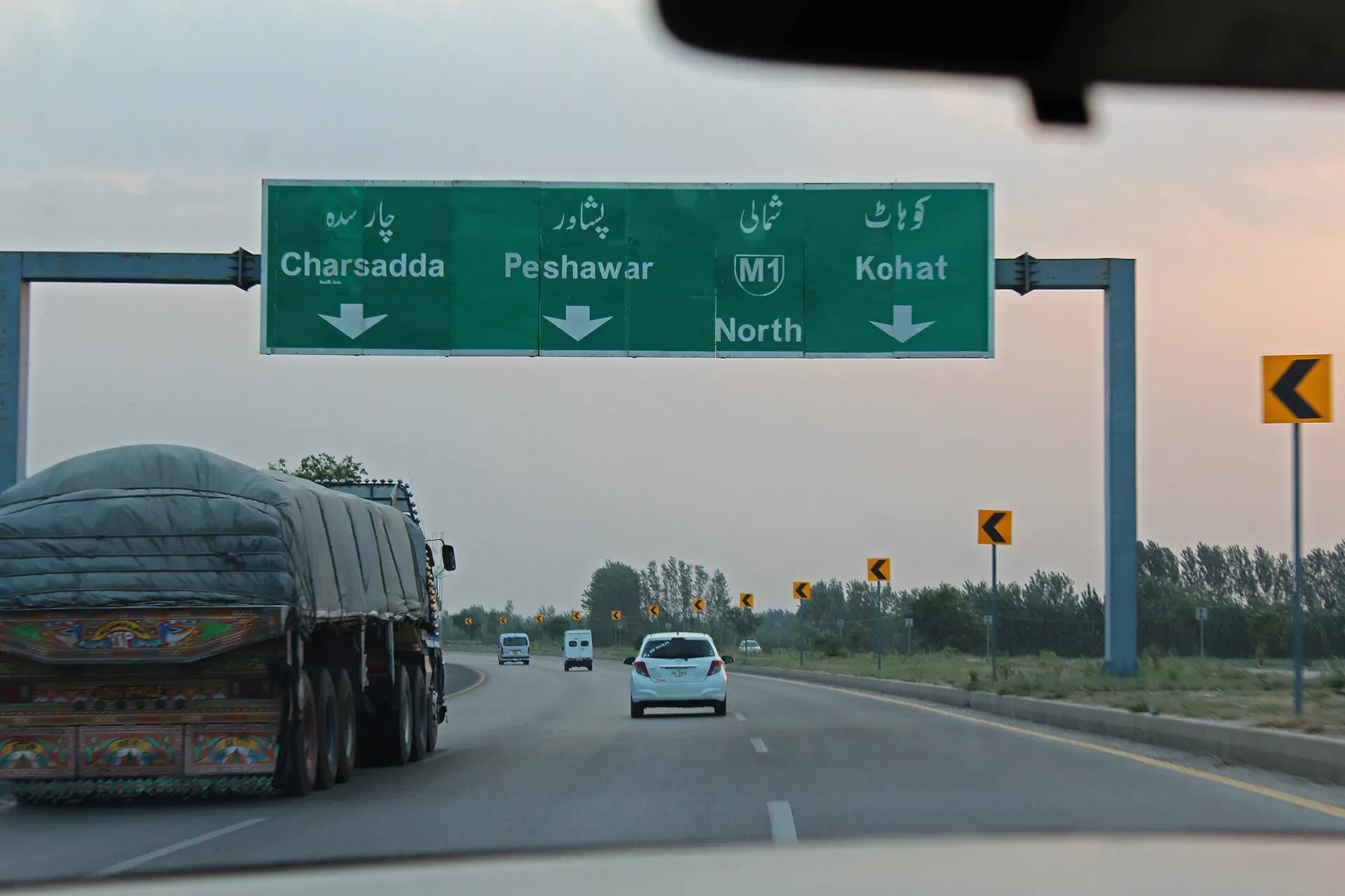
The 155 km M-1 links Peshawar and Islamabad. Interchanges serve Mardan, Swabi and Hasan Abdal; the M-15 and M-14 branch off. It was closed 23-27 September 2026 for rehabilitation work.
The journey
Last verified: 17 November 2026.
Overview
The M-1 is a six-lane motorway of about 155 km between Peshawar and Islamabad. Wikipedia gives 88 km in Khyber Pakhtunkhwa and 67 km in Punjab, and an opening date of 30 October 2007. At the Islamabad end it continues as the M-2 towards Lahore. It is the usual way into Islamabad from the north-west, and the M-15 (Hazara) and M-14 (Hakla to Dera Ismail Khan) both start from it.
Status in 2026
The M-1 is open. The federal government closed it between Islamabad Toll Plaza and Chach interchange from 23 September 2026 for rehabilitation of the M-14, the loop road to the Hazara Motorway and some interchanges. NHMP reported it fully reopened on 27 to 28 September 2026. ARY News (28 September 2026) said rehabilitation of the M-14 between Hakla and Kundal and of the loop road to the Hazara Motorway was still under way, with work also continuing at some M-1 interchanges, and that traffic from Islamabad to Abbottabad was being diverted via Burhan, the GT Road and Jhary Kas. There is no known later report, so expect lane closures.
Interchanges and service areas
Wikipedia lists these, from Peshawar towards Islamabad: Peshawar Ring Road and Northern Bypass, Nowshera, Mardan and Rashakai (N-95 link), Risalpur (N-45 link), Wali, M-16 (Swat Motorway), Swabi, Chach, Ghazi, M-15 (Hazara), Hasan Abdal and Burhan (N-5), Brahma Bahtar, Sangjani and Peswal, M-14 (Hakla) and Fateh Jang, then Islamabad. The article gives no kilometre markers, and its junction table is untidy. Service areas are reported as ten, five on each side, without positions. Check the signs.
Rules, tolls and M-Tag
Motorway Police (NHMP) patrol the road; for emergencies call 130. DrivePK (22 June 2026) reported that NHMP restored the motorway limits to 120 km/h for cars and light vehicles and 110 km/h for buses and heavy vehicles, after a temporary cut in March 2026. Limits can change and some stretches carry their own, so follow the signs. Keep left, overtake on the right, and do not stop on the carriageway.
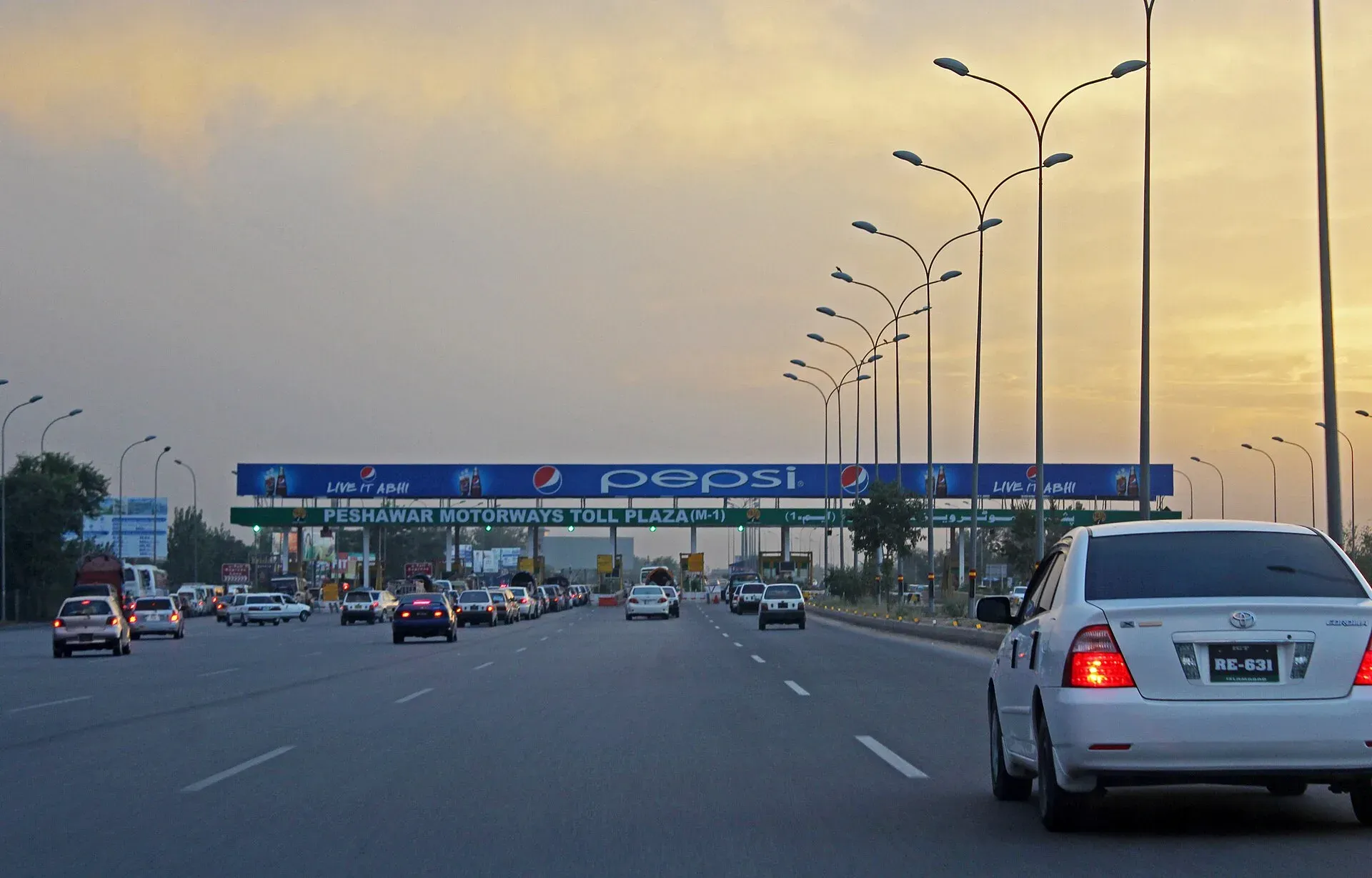
Photo: Drsaeed90, with thanks · CC BY-SA 4.0 · via Wikimedia Commons · temporary stand-in photo

Tolls are charged at interchanges and the NHA publishes the rates; news reports say rates were revised in 2026. Current fees will be added soon, so check the NHA toll chart before you go. Most NHA motorways use the electronic M-Tag; ask your rental company whether the car has one.
History and engineering
Work began in 1997. A Turkish firm, Bayindir, won the first contract, but progress stopped after the government was dismissed in 1999 and was slow until 2003, when a Pakistani consortium took over with the Frontier Works Organization running the site. The road cost Rs13 billion and President Pervez Musharraf opened it on 30 October 2007. It has six lanes for its whole length. Three major bridges cross the Haro, Indus and Kabul rivers, and the road also has 18 flyovers, 27 small bridges, 137 underpasses and 571 culverts. It crosses the Ghazi Barotha canal, which feeds the Ghazi-Barotha hydropower project.
Along the route
Travelling from Peshawar towards Islamabad:
- Peshawar and the Ring Road. The motorway starts north-east of the city at the Ring Road junction.
- Nowshera, Mardan and Rashakai. The first interchanges serve the Nowshera and Mardan side. The Rashakai junction links to the N-95.
- Swabi. The M-16 Swat Motorway branches off before the Swabi interchange.
- The river crossings. Bridges carry the road over the Kabul, the Indus and the Haro.
- Burhan and Hasan Abdal. Burhan is the exit for the N-5 and the Hazara Motorway (M-15).
- Hakla and Fateh Jang. The M-14 branches off towards Dera Ismail Khan.
- Islamabad. The road ends at the Islamabad Toll Plaza and continues as the M-2.
What to see near the exits
Hasan Abdal, about 40 km north-west of Islamabad, is the nearest town to the Burhan exit. Gurdwara Panja Sahib marks the place where, according to Wikipedia, Guru Nanak stayed in 1521. A rock there is believed to carry his handprint, and Sikh pilgrims visit twice a year. Wah Gardens was laid out in Akbar's reign by Raja Man Singh as terraced gardens in four parts, and Shah Jahan rested there on four journeys to Kabul. The Tomb of the Hakims dates to 1589. Loquat orchards and freshwater springs surround the town.
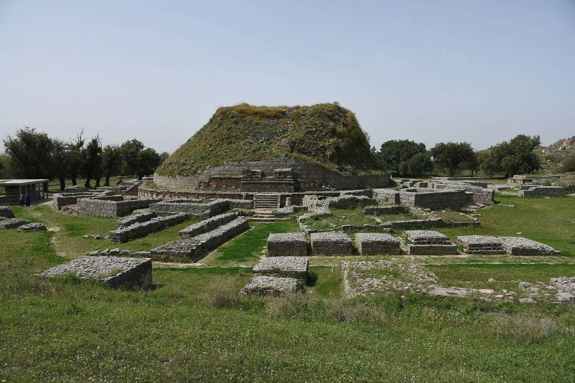
Photo: Mhtoori, with thanks · CC BY-SA 4.0 · via Wikimedia Commons · temporary stand-in photo

Taxila is close to the Burhan and Hasan Abdal exits. UNESCO listed it in 1980 as a serial site of 18 monuments and places. The three main settlements are Bhir Mound (6th century BCE), Sirkap (2nd century BCE, built by Greco-Bactrian kings) and Sirsukh, built by the Kushans. The Buddhist monasteries and stupas include Dharmarajika, Jaulian and Mohra Moradu. John Marshall began excavating in 1913 and worked there for about twenty years. The Taxila Museum holds Gandharan Buddhist sculpture from the valley. Wikipedia reports that UNESCO warned Pakistan in 2026 about unauthorised reconstruction at Mohra Moradu and Sirkap, so what stands now may differ from older photographs. The Gandhara trail page covers the sites in order.
Safety
Ask the district administration or local police about current conditions before you go. For foreign visitors: the UK FCDO (updated 27 October 2026, checked 16 November 2026) advises against all travel to Peshawar, including the city, and against all travel to Buner and Charsadda. It advises against all but essential travel to Mardan, Nowshera, Swabi and Malakand. It also notes emergency measures and Governor's Rule in Khyber Pakhtunkhwa since 11 October 2026. Read the full page before you plan a journey on the northern half of this road. Fog and closures can happen in winter. Stay on the motorway and use main service areas.
Highlights
- 155 km between Peshawar and Islamabad
- Branches to M-15, M-14 and M-16
- Closed 23-27 September 2026 for rehabilitation
- Motorway Police: 130
Stops
- Peshawar (Ring Road and Northern Bypass)Western end
- Rashakai (Mardan and Nowshera, N-95)Interchange
- SwabiM-16 branches off before Swabi
- Burhan (Hasan Abdal, N-5)Hazara Motorway (M-15) link; exit for Taxila
- Hakla (M-14)Branch to Dera Ismail Khan
- IslamabadContinues as the M-2
km: distance from the start along the route.
Numbers follow the stops in order. The map shows the 5 stops that have a trek.pk page, not the road itself.
Road conditions
Six lanes, surface rehabilitation work continued after the September 2026 closure. Check NHMP before you leave.
Fuel and services
Service areas with fuel, food and prayer rooms on both carriageways (about five each side, per Wikipedia). Fill up before the Peshawar end.
Where to stay, eat and fuel up
Places to stay
- Serena HotelCall Serena HotelMap of Serena Hotel in Google Maps
- Islamabad Marriott HotelCall Islamabad Marriott HotelMap of Islamabad Marriott Hotel in Google Maps
- Mabali IslandCall Mabali IslandMap of Mabali Island in Google Maps
- Ramada by Wyndham IslamabadCall Ramada by Wyndham IslamabadMap of Ramada by Wyndham Islamabad in Google Maps
- Avari Xpress Residences Islamabad HotelCall Avari Xpress Residences Islamabad HotelMap of Avari Xpress Residences Islamabad Hotel in Google Maps
- Movenpick Hotel CentaurusCall Movenpick Hotel CentaurusMap of Movenpick Hotel Centaurus in Google Maps
Places to eat
- The Monal IslamabadCall The Monal IslamabadMap of The Monal Islamabad in Google Maps
- Tehzeeb Bakers Blue AreaCall Tehzeeb Bakers Blue AreaMap of Tehzeeb Bakers Blue Area in Google Maps
- TKR 3Call TKR 3Map of TKR 3 in Google Maps
- Savour FoodsCall Savour FoodsMap of Savour Foods in Google Maps
- Cheezious Commercial MarketCall Cheezious Commercial MarketMap of Cheezious Commercial Market in Google Maps
- Savour FoodsCall Savour FoodsMap of Savour Foods in Google Maps
Essential services fuel stations, mechanics, pharmacies and hospitals and clinics
Fuel
- Attock Petrol PumpMap of Attock Petrol Pump in Google Maps
- PSO Petrol PumpMap of PSO Petrol Pump in Google Maps
- PSO Petrol Pump (Zoom Filling)Call PSO Petrol Pump (Zoom Filling)Map of PSO Petrol Pump (Zoom Filling) in Google Maps
- Attock Petrol PumpCall Attock Petrol PumpMap of Attock Petrol Pump in Google Maps
- Byco Petrol Pump (Range Road)Map of Byco Petrol Pump (Range Road) in Google Maps
- PSO Petrol PumpCall PSO Petrol PumpMap of PSO Petrol Pump in Google Maps
Mechanics and tyre shops
- Mohammed Bilal tyre centreMap of Mohammed Bilal tyre centre in Google Maps
- Toyota GT MotorsCall Toyota GT MotorsMap of Toyota GT Motors in Google Maps
- JAPAN TYRES Blue AreaCall JAPAN TYRES Blue AreaMap of JAPAN TYRES Blue Area in Google Maps
- Polygon CastCall Polygon CastMap of Polygon Cast in Google Maps
- Hybrid SpecialistCall Hybrid SpecialistMap of Hybrid Specialist in Google Maps
- Honda CapitalCall Honda CapitalMap of Honda Capital in Google Maps
Pharmacies
- Imtiaz Mega - Ramzan Mall - islamabadCall Imtiaz Mega - Ramzan Mall - islamabadMap of Imtiaz Mega - Ramzan Mall - islamabad in Google Maps
- D.WATSON CHEMIST BLUE AREACall D.WATSON CHEMIST BLUE AREAMap of D.WATSON CHEMIST BLUE AREA in Google Maps
- D.WATSON CHEMIST F-11 MARKAZCall D.WATSON CHEMIST F-11 MARKAZMap of D.WATSON CHEMIST F-11 MARKAZ in Google Maps
- Shaheen Chemist I-8 MarkazCall Shaheen Chemist I-8 MarkazMap of Shaheen Chemist I-8 Markaz in Google Maps
- Shaheen ChemistCall Shaheen ChemistMap of Shaheen Chemist in Google Maps
- D. Watson Chemist F-10 MarkazCall D. Watson Chemist F-10 MarkazMap of D. Watson Chemist F-10 Markaz in Google Maps
Hospitals and clinics
- Shifa International Hospitals LimitedCall Shifa International Hospitals LimitedMap of Shifa International Hospitals Limited in Google Maps
- Amanat Eye Hospital RawalpindiCall Amanat Eye Hospital RawalpindiMap of Amanat Eye Hospital Rawalpindi in Google Maps
- Maryam Memorial Hospital (MMH)Call Maryam Memorial Hospital (MMH)Map of Maryam Memorial Hospital (MMH) in Google Maps
- Combined Military Hospital Rawalpindi (CMH)Call Combined Military Hospital Rawalpindi (CMH)Map of Combined Military Hospital Rawalpindi (CMH) in Google Maps
- Advanced International Hospital IslamabadCall Advanced International Hospital IslamabadMap of Advanced International Hospital Islamabad in Google Maps
- Brain Surgery HospitalCall Brain Surgery HospitalMap of Brain Surgery Hospital in Google Maps
Listings come from Google Maps data and are unverified: phone numbers, opening months and prices may have changed. Report a problem · Own one of these? Claim it
More safety notes
See the FCDO advice in the body. Call 130 for the Motorway Police.
Tips
- Check NHMP for closures before you set out
- Read the FCDO advice for Khyber Pakhtunkhwa
- Fuel up at a service area, not at the exits
Photos we still need: Gurdwara Panja Sahib at Hasan Abdal (exterior). Send us yours
Sources and last checked
Last checked Confidence medium8 sources5 still to check
- Last checked
- Method
- Desk research from published sources
- Confidence
- medium
- Checked by
- trek.pk research team
Researched from published sources; not yet checked on the ground by our team. Spot something out of date? Report a mistake.
Sources
- M-1 motorway (Pakistan) · Wikipedia · checked
- National Highway Authority (official site; toll chart page could not be opened from our connection) · Government of Pakistan · checked
- National Highways and Motorway Police (helpline 130) · Government of Pakistan · checked
- Pakistan restores motorway speed limits to 120 km/h · DrivePK · checked
- Motorway Police begin fines for new speed limits on M2 · Dunya News · checked
- M-1 Motorway reopens to all traffic after five-day closure · ARY News · checked
- Hasan Abdal · Wikipedia · checked
- Taxila · Wikipedia · checked
Still to be checked on the ground (5)
- Interchange km markers (none found; a 2007 Dawn report named km 4 and km 106 for mini service areas)
- Service area locations (ten service areas, five each side; positions not found)
- Toll rates (NHA): news reports of a July 2026 revision exist but no dated official notice was opened
- Status of the rehabilitation work on the M-14 loop road after 28 September 2026
- Extent of any reconstruction at Taxila sites after the 2026 UNESCO warning (Wikipedia only)
Nearby and related

Islamabad
Pakistan's green, planned capital at the foot of the Margalla Hills: Faisal Mosque, hillside trails, cafes and the gateway to the north.

Peshawar
Khyber Pakhtunkhwa's capital and one of South Asia's oldest living cities: the Gandhara museum, Qissa Khwani Bazaar, mosques and a strong food culture.

Taxila
The ruins of several ancient cities and Buddhist monasteries near Islamabad, inscribed by UNESCO in 1980. Taxila was a crossroads of Gandhara, Greek, Persian and Kushan culture, with a fine museum.

Attock
District capital on the Grand Trunk Road near the Indus, about 86 km from Islamabad. A practical stop with the Mughal-era Attock Fort nearby.

Hasan Abdal
Historic town on the Grand Trunk Road in Attock District. Known for Gurdwara Panja Sahib, a major Sikh pilgrimage site, and Mughal-era tombs.

Gurdwara Panja Sahib (Hasan Abdal)
A Sikh shrine in Hasan Abdal where a handprint on a boulder is believed to be Guru Nanak's, beside a spring that never dries. About 64 km from Islamabad. Check access rules before you go.
Wah Gardens (Mughal Garden), Wah
A Mughal garden of the 16th to 17th centuries beside the Grand Trunk Road at Wah, near Hasan Abdal, with spring-fed pools and twelve-door pavilions. Visited by Jahangir, Shah Jahan and Aurangzeb.

Taxila Museum
A site museum near Taxila with one of Pakistan's finest collections of Gandharan Buddhist sculpture, coins and everyday objects from the ancient cities and stupas of the valley.

Dharmarajika Stupa
The largest stupa in the Taxila region, linked by tradition to Emperor Ashoka and later rebuilt under the Kushans. Part of the Taxila World Heritage Site, inscribed in 1980.

Swabi
District capital near the Indus, about 100 km from Islamabad and Peshawar, and close to the Tarbela Dam area. For foreign visitors: the UK FCDO advises against all but essential travel to Swabi.

Mardan
The second-largest city in Khyber Pakhtunkhwa, set in the Peshawar valley, and the gateway to Gandhara's Takht-i-Bahi monastery (UNESCO), Shahbaz Garhi's Ashoka edicts and the Guides Memorial.

Gandhara Buddhist Trail
A themed journey through the Buddhist stupas and monasteries of Gandhara: Taxila, Bhamala and Mankiala are open day trips from Islamabad; the great Khyber Pakhtunkhwa sites are currently advised against.