

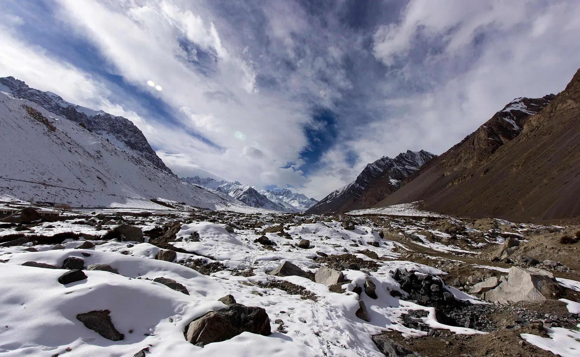
Photo: Zeeo Zia, with thanks · CC BY-SA 4.0 · via Wikimedia Commons · temporary stand-in photo

Chapursan Valley
A high Wakhi valley running west from Sost to the Afghan border, with villages above 3,000 m, the Baba Ghundi shrine, glaciers and remote passes. Reached by a rough jeep road.
Overview
Chapursan (also spelt Chipursan or Chipurson) is a long, high valley that runs west from the Karakoram Highway near Sost, ending close to the border with Afghanistan's Wakhan corridor. About eight scattered villages sit above 3,000 m, with roughly 500 households and about 3,000 people. Most are Wakhi, with one Burushaski-speaking village (Raminj), and most follow the Ismaili tradition. Beyond the last villages are summer pastures, a major shrine, glaciers and several passes.
It is a quiet valley for people who want an unhurried look at mountain life, long drives on a rough road, and access to some serious high routes.
Plan your visit
- Nearest town
- Sost
- Getting there
The Chapursan road leaves the Karakoram Highway near Sost. Sost to Zood Khun is about 52 km (OSRM models about 1 h; reports say 3 to 6 hours on the unpaved road). From Gilgit to Zood Khun is about 236 km. More
Best months
Jun – Sep
- Chapursan Valley
- Related places nearby: Gojal and Shimshal, Hunza Valley, Khunjerab National Park, Irshad Pass
Getting there
The road to Chapursan leaves the KKH near Sost. Villages and pastures run from Yarzerech and Raminj through Kirmin, Khill, Rashet, Sheresubz, Ispenj and Shetmerg to Zood Khun, then on to the pastures of Yashkuk and the Baba Ghundi shrine. OSRM models Sost to Zood Khun at about 52 km and one hour, but the road is unpaved and travellers report roughly three to six hours depending on the season and how far you go. One operator page (undated) describes a daily cargo jeep from Baba Ghundi Hotel in Sost to Zood Khun, leaving around 2 pm and taking about three hours, with a return at 5.30 am. It warns that times vary, so confirm times in Sost or Passu. For comfort, hire a 4x4 with a driver in Sost, Passu or Gulmit.
Distance from Gilgit to Zood Khun is about 236 km by OSRM, modelled at 3 hours 20; plan a full day, and expect to stay at least one night in the valley.
Landscape
The valley floor is above 3,000 m, and Wikipedia gives about 3,700 m for the lower localities. Peaks in the surrounding ranges climb past 7,000 m. The valley is narrow, with steep slopes that lead up to ice fields and rock faces, and glaciers feed streams that water the fields below. It forms part of the Karakoram. All village and pasture names are in Wakhi.
Villages and sights
- Yarzerech and Raminj. The first villages, with terraced fields, apricot and poplar trees, and views up the valley.
- Zood Khun. The usual overnight stop, with homestays. Wikipedia lists it as the last village before the pastures.
- Yashkuk (Yishkuk). A high village and pasture area with views over the glaciers, on the way towards the start of the Chilinji An trek. Beyond Zood Khun the pastures run on through Yashkuk, Kukchaizem, Biban Joi, Kohrben and Korkot to Baba Ghundi, with more pastures and the Pamir beyond.
- Baba Ghundi Ziarat. A shrine to Baba Ghundi, the Pir of Ghund, celebrated in legend as the Sufi saint who brought Islam to the valley. Wikipedia notes that he is not actually buried here. The former Mir of Hunza grazed his sheep and goats around the shrine and visited it every year. It is visited throughout the year by people from across Hunza. Visit it respectfully: remove shoes, dress modestly and follow local guidance. There is a security checkpoint near the shrine because of the nearby Afghan border, and visitors should carry passports or ID.
- Passes and peaks. Irshad Pass leads to Afghanistan, and Lupgar Pir Pass links Yashkuk and Raminj. Peaks include Sakar Sar, Kuksar and Lupghar Sar.
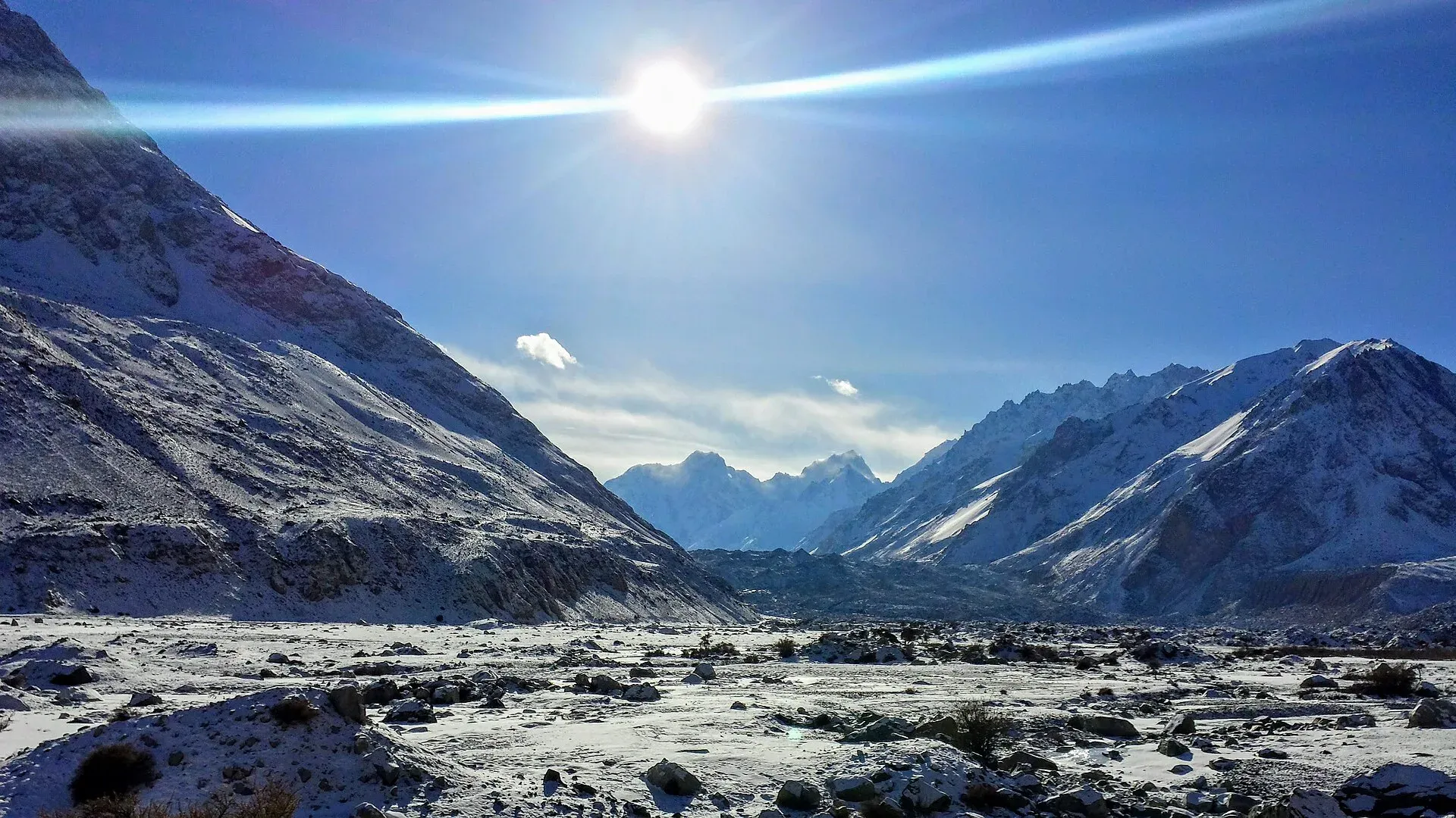
Photo: Azeez Saddiquee, with thanks · CC BY-SA 4.0 · via Wikimedia Commons · temporary stand-in photo

Treks and walks
- Chilinji An and Qalander Uween run from Baba Ghundi over glaciated passes to Karambar and Bort. They are technical and in restricted country.
- Lupgar Pir Pass is a hard but shorter route between Yashkuk and Raminj.
- More short walks are listed in Other treks in Gojal.
When to go
June to September is the main season. Spring and autumn can be pleasant at the lower villages, but the upper valley is cold, and the road may be snowed up from late autumn. Winters are severe.
Where to stay and eat
Zood Khun and some lower villages have family guest houses and homestays; the Zood Khun guesthouse and Pamir Serai are named by one operator page. Facilities are basic: simple rooms, bedding, bread, soups, dairy and dried fruit. Fuel and cash are best arranged in Sost before you leave; there are no banks.
Culture and languages
Wakhi is the main language. Burushaski is spoken in Raminj, and some people also speak Urdu or English. The valley's people are Ismaili Muslims, and a family may host you in the same room where they live and pray. Dress modestly, ask before photographing, and follow your host's lead.
Safety and practical points
- Permits are unclear. Guidance from operators conflicts: some say foreigners need a no-objection letter from the Deputy Commissioner in Gilgit for the upper valley and for treks, others say a passport check at the Baba Ghundi checkpoint is enough. Foreign visitors have not needed an NOC for Gilgit-Baltistan generally since March 2019, but the notification kept a 10-mile strip along the Afghan border restricted (Dawn, March 2019). The same operator page says to register at the police post. Check with your operator or GB Tourism (Gilgit, 05811-920173) before you go.
- The road has landslide, rockfall and stream-crossing risks. Avoid it during heavy rain.
- The area is near an international border. Stay on the roads and routes your operator has cleared.
- Altitude: the upper valley is above 3,000 m.
Highlights
- Wakhi villages above 3,000 m, with homestays
- Baba Ghundi Ziarat, a major pilgrimage place
- Glaciers and passes near the Afghan border
- Starting point for Chilinji An and Lupgar Pir Pass treks
- A quiet valley with few visitors
Tips
- Hire a 4x4 and driver in Sost, Passu or Gulmit, and set out early.
- Confirm permit and checkpoint rules with your operator before you go.
- Bring cash and fuel from Sost; there are no banks.
- Take warm clothes even in summer; nights are cold above 3,000 m.
Photos we still need: Baba Ghundi shrine; Zood Khun and village life in summer; the Sost to Zood Khun road; Lupghar Sar and other peaks seen from the valley. Send us yours
Sources and last checked
Last checked Confidence low6 sources4 still to check
- Last checked
- Method
- Desk research from published sources
- Confidence
- low
- Checked by
- trek.pk research team
Researched from published sources; not yet checked on the ground by our team. Spot something out of date? Report a mistake.
Sources
- Chapursan (Wikipedia) · Wikipedia · checked
- Gojal (Wikipedia) · Wikipedia · checked
- Chapursan Valley Travel Guide (jeep times, permits; supporting only) · Off The Atlas · checked
- Contact Chapursan Valley (shared jeep times; supporting only) · Pamir Trails · checked
- OSRM driving routes (distances and modelled times between towns) · OSRM / OpenStreetMap · checked
- NOC requirements for foreigners visiting Pakistan abolished (26 March 2019) · Dawn · checked
Still to be checked on the ground (4)
- Permit and NOC requirements for foreign visitors in the upper valley (2019 notification keeps a 10-mile Afghan-border strip restricted; Chapursan's position against it is not stated in any official source)
- Whether the daily Sost to Zood Khun jeep still runs (one undated operator page only)
- Baba Ghundi checkpoint arrangements
- Road condition and winter closure
Nearby and related

Chilinji An and Qalander Uween

Lupgar Pir Pass

Other treks in Gojal

Karambar An and Darkot An

Gojal and Shimshal
Upper Hunza: Gulmit, Ghulkin, Passu and Sost on the Karakoram Highway, with big glaciers and the Passu Cones, plus the remote Shimshal valley, its Wakhi village and its mountaineering community.

Hunza Valley
A long Karakoram valley on the Karakoram Highway, with Karimabad, Baltit and Altit forts, Ganish village and Attabad Lake, below Rakaposhi and Ultar Sar. About 100 km from Gilgit.

Khunjerab National Park
A high-altitude park on the Pakistan-China border, created in 1975 to protect Marco Polo sheep, snow leopard and Himalayan ibex. It surrounds the Khunjerab Pass on the Karakoram Highway.
Irshad Pass
A pass of about 4,979 m on the Pakistan–Afghanistan border at the head of the Chapursan valley, leading to the Wakhan. Not a visitor route: it is inside the FCDO's 10-mile border zone.

Hunza and Khunjerab (KKH)
A 7-8 day road trip from Islamabad up the Karakoram Highway to Hunza and on to Khunjerab Pass (4,693 m), with overnight stops at Besham, Chilas and Gilgit.