

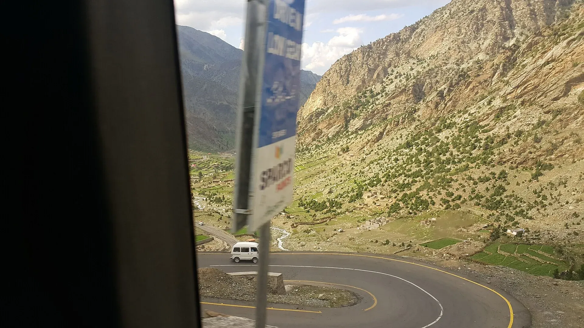
Photo: Kskhh, with thanks · CC BY-SA 4.0 · via Wikimedia Commons · temporary stand-in photo

N-15 Mansehra-Naran-Babusar-Chilas
The 240 km N-15 climbs the Kaghan Valley from Mansehra to Naran, crosses Babusar Top (4,173 m) and drops to Chilas on the Karakoram Highway. Open to Naran most of the year, over the pass only in summer.
Overview
The N-15 runs from Mansehra in Hazara to Chilas on the Karakoram Highway (KKH). The NHA list gives its length as 240 km, with the last 60 km in Gilgit-Baltistan; an NHA press report carried by APP (July 2025) gives 242 km for Mansehra to Jalkhand. The road follows the Kunhar River through Balakot and Kaghan to Naran, then climbs over Babusar Top and drops to the Indus valley. It is used by holiday traffic in summer and as a shorter, higher alternative to the KKH.
Measured by road routing from Mansehra, Balakot is about 40 km away, Kaghan 98 km, Naran 122 km, Babusar Top 186 km and Chilas 248 km.
When it is open
The pass is shut by snow for much of the year. At the time of checking (16 November 2026) you should assume it is closed beyond Naran and confirm locally.
- 2025: NHA cleared more than 21 glaciers between Naran and Babusar Top, and traffic was allowed through on 23 May 2025 after a seven-month closure (Dawn, 24 May 2025).
- 2026: On 21 April 2026 the Express Tribune reported that the Kaghan road had reopened to Naran after about five months, and that work to restore access to Babusar Top was still going on. ProPakistani (25 May 2026, citing ARY News) reported that the road over Babusar Top reopened in late May after seven months. It was then closed to all traffic until 6 June for more snow clearance (ProPakistani, 5 June 2026). Snowfall closed the Babusar Highway and the Babusar-Naran road again in mid-October 2026 (ProPakistani, 14 October 2026); no reopening date was given.
Opening and closing dates change every year with snow. Ask the district administration in Mansehra, NHA, or Diamer administration in Chilas before you drive.
Road condition
- Mansehra to Balakot: paved, congested at weekends.
- Balakot to Naran: paved, narrow in places, exposed to landslides and floods in monsoon.
- Naran to Babusar Top: steep, narrow and sharp bends. Fog and sudden weather are common.
- Babusar Top to Chilas: many hairpins; the Diamer officials quoted in Dawn in May 2025 cited accidents on this stretch every year.
A journey from Diamer to Mansehra takes about seven hours over Babusar, against about 14 by the KKH (Dawn, 24 May 2025).
What to see along it
Kilometres are OSRM road estimates from Mansehra.
- Balakot (km 40): the gateway to the valley and the transport hub. Wikivoyage says buses and vans to Kaghan and Naran leave from here.
- Kaghan (km 98): the village that gives the valley its name, with small hotels.
- Naran (km 122): the main base, with eating places near the market. Wikivoyage lists small cafes serving freshly caught fish and other Pakistani dishes. It also says brown trout and mahseer are stocked between Kaghan and Naran, and that fishing licences come from the Fisheries Department in Naran.
- Saiful Muluk Lake (side trip from Naran): about 14 km by road and roughly half an hour by jeep, according to Wikivoyage. If the road is closed, the walk takes 3 to 6 hours. It is inside Saiful Muluk National Park.
- Besal (km 137) and Lulusar Lake: the higher road starts at Besal. Wikivoyage describes Lulusar as a camping spot just before the final climb to Babusar Top.
- Dudipatsar Lake: remote and reached by a very difficult road or a long walk; Wikivoyage says there are no hotels or restaurants nearby.
- Babusar Top (km 186): views of Nanga Parbat on clear days, with a police checkpost in season.
- Chilas (km 248): the Chilas rock carvings are near the KKH at the northern end.
Stages and drive times
Chilas to Naran over Babusar takes about 4 hours (Wikivoyage), and Diamer to Mansehra about 7 hours against 14 by the KKH (Dawn, 24 May 2025). A practical plan is Islamabad to Naran in one day, Naran to Chilas over the pass on the second, then onward by the KKH. Cross the top before midday. Wikivoyage says movement on the road beyond Naran is restricted in the monsoon and that the road at Chilas Zero Point is closed daily at 17:00 to traffic from the north; confirm that locally.
Landslide and flood hazards
The Kunhar valley is steep and narrow. Heavy rain in monsoon (July and August) causes landslides and flash floods that can close the road for days. Winter snow and glaciers cover the upper road from about November. Dawn's 2025 report describes the glacier clearing that NHA does each spring.
Fuel and services
There is fuel at Mansehra, Balakot and Naran. Fuel supply north of Naran is limited, and none should be relied on at Babusar Top; fill up before you start the climb. Hotels and eateries cluster at Naran and Kaghan. Many close outside summer. Mobile signal is patchy above Naran.
Checkposts
Police check posts are set up at Babusar Top in season (Dawn, 24 May 2025). Carry copies of your passport and visa.
Safety and travel advice by section
For foreign visitors: the UK FCDO page (updated 27 October 2026, checked 16 November 2026) does not list the Kaghan Valley itself. It does advise against all travel on the KKH between Mansehra and Chilas, up to the N-15 junction. Both ends of the N-15 connect to that stretch, and the usual way to reach Mansehra from Islamabad is by the N-35, so read the N-35 page and the live FCDO text before you plan.
Do not cross Babusar Top late in the day, in rain or in fog. Use a low gear on descents and check your brakes at the top. Do not drive the pass at night.
Highlights
- Kaghan Valley and Naran
- Saiful Muluk and Lulusar lakes
- Babusar Top at 4,173 m
- Link between Hazara and the KKH at Chilas
Stops
- MansehraStart; N-35 junction
- BalakotGateway to the Kaghan Valley
- KaghanVillage and hotels
- NaranMain hub; open most of the year to here
- Saiful MulukSide trip from Naran by jeep
- BesalStart of the higher road
- Lulusar LakeLake before the final climb
- Babusar Top4,173 m; summer only
- ChilasJoins the KKH
km: distance from the start along the route.
Numbers follow the stops in order. The map shows the 7 stops that have a trek.pk page, not the road itself.
Where to stay, eat and fuel up
Places to stay
- Shangrila Chilas HotelCall Shangrila Chilas HotelMap of Shangrila Chilas Hotel in Google Maps
- HOTEL deMANCHICall HOTEL deMANCHIMap of HOTEL deMANCHI in Google Maps
- Pine View Hotel & RestaurantCall Pine View Hotel & RestaurantMap of Pine View Hotel & Restaurant in Google Maps
- Fairy Meadows HotelCall Fairy Meadows HotelMap of Fairy Meadows Hotel in Google Maps
- Mount Feast Hotel NaranCall Mount Feast Hotel NaranMap of Mount Feast Hotel Naran in Google Maps
- Indus lodges ChilasCall Indus lodges ChilasMap of Indus lodges Chilas in Google Maps
Places to eat
- Moon RestaurantCall Moon RestaurantMap of Moon Restaurant in Google Maps
- BaithakCall BaithakMap of Baithak in Google Maps
- Food HutCall Food HutMap of Food Hut in Google Maps
- SubwayCall SubwayMap of Subway in Google Maps
- Balochi Sajji House mansehraCall Balochi Sajji House mansehraMap of Balochi Sajji House mansehra in Google Maps
- Sunny Sweets & BakersCall Sunny Sweets & BakersMap of Sunny Sweets & Bakers in Google Maps
Essential services fuel stations, mechanics, ATMs, banks, pharmacies and hospitals and clinics
Fuel
- PSO Petrol Pump Sajjad Fill StationCall PSO Petrol Pump Sajjad Fill StationMap of PSO Petrol Pump Sajjad Fill Station in Google Maps
- Attock Petrol PumpMap of Attock Petrol Pump in Google Maps
- Total Parco Filling Station ChilasMap of Total Parco Filling Station Chilas in Google Maps
- Attock Petrol PumpCall Attock Petrol PumpMap of Attock Petrol Pump in Google Maps
- Nawaz Khan CNG StationMap of Nawaz Khan CNG Station in Google Maps
- PSO Petroleum ChilasMap of PSO Petroleum Chilas in Google Maps
Mechanics and tyre shops
- Balakot Auto EFI WorkshopCall Balakot Auto EFI WorkshopMap of Balakot Auto EFI Workshop in Google Maps
- Baig Suzuki center& Rental Bike NaranMap of Baig Suzuki center& Rental Bike Naran in Google Maps
- Tannan oil change, Wheel Alignment, balancing, Tunning & Battery shop 10 minute serviceCall Tannan oil change, Wheel Alignment, balancing, Tunning & Battery shop 10 minute serviceMap of Tannan oil change, Wheel Alignment, balancing, Tunning & Battery shop 10 minute service in Google Maps
- AZIZ AUTOSMap of AZIZ AUTOS in Google Maps
- M. Rafiqu AutosCall M. Rafiqu AutosMap of M. Rafiqu Autos in Google Maps
ATMs
- HBLMap of HBL in Google Maps
- Habib Bank LimitedCall Habib Bank LimitedMap of Habib Bank Limited in Google Maps
- NATIONAL BANK OF PAKISTANMap of NATIONAL BANK OF PAKISTAN in Google Maps
- Askari BankCall Askari BankMap of Askari Bank in Google Maps
- Summit BankCall Summit BankMap of Summit Bank in Google Maps
- Muslim Commercial BankCall Muslim Commercial BankMap of Muslim Commercial Bank in Google Maps
Banks and money exchange
- National Bank of Pakistan (NBP)Call National Bank of Pakistan (NBP)Map of National Bank of Pakistan (NBP) in Google Maps
- Pakistan Currency Exchange WESTERN UNION RIA MONEYGRAMCall Pakistan Currency Exchange WESTERN UNION RIA MONEYGRAMMap of Pakistan Currency Exchange WESTERN UNION RIA MONEYGRAM in Google Maps
- BankIslami - Mansehra BranchCall BankIslami - Mansehra BranchMap of BankIslami - Mansehra Branch in Google Maps
- Bank Al Habib LtdCall Bank Al Habib LtdMap of Bank Al Habib Ltd in Google Maps
- Dr Abdul Khaliq ClinicCall Dr Abdul Khaliq ClinicMap of Dr Abdul Khaliq Clinic in Google Maps
- Allied Bank LimitedMap of Allied Bank Limited in Google Maps
Pharmacies
- Bilal PlazaCall Bilal PlazaMap of Bilal Plaza in Google Maps
- Faisal Chemist 2Call Faisal Chemist 2Map of Faisal Chemist 2 in Google Maps
- Agha Jee MedicoseCall Agha Jee MedicoseMap of Agha Jee Medicose in Google Maps
- Mansehra Medical StoreCall Mansehra Medical StoreMap of Mansehra Medical Store in Google Maps
- Al madina medical store abbottabad road mansehraMap of Al madina medical store abbottabad road mansehra in Google Maps
- Al-Rehman MedicoseMap of Al-Rehman Medicose in Google Maps
Hospitals and clinics
- Irfan Neuro Psychiatry & General Hospital MansehraCall Irfan Neuro Psychiatry & General Hospital MansehraMap of Irfan Neuro Psychiatry & General Hospital Mansehra in Google Maps
- China Health CentreCall China Health CentreMap of China Health Centre in Google Maps
- Shifa Surgical CentreCall Shifa Surgical CentreMap of Shifa Surgical Centre in Google Maps
- Township MansehraCall Township MansehraMap of Township Mansehra in Google Maps
- Regional Headquarters Hospital ChilasMap of Regional Headquarters Hospital Chilas in Google Maps
- Tehsil Headquarter HospitalMap of Tehsil Headquarter Hospital in Google Maps
Listings come from Google Maps data and are unverified: phone numbers, opening months and prices may have changed. Report a problem · Own one of these? Claim it
More safety notes
- Mansehra to Balakot: Mansehra is the start of the KKH stretch the FCDO advises against; the Kaghan Valley itself is not listed.
- Naran to Babusar: weather, fog, snow, no night driving.
- Babusar to Chilas: the Chilas end is on the KKH section the FCDO advises against up to the N-15 junction (checked 16 November 2026).
Tips
- Check with district administrations before driving beyond Naran.
- Cross Babusar early in the day, never after dark.
- Use low gear on descents and check brakes at the top.
- Fill the tank at Naran before the climb.
Sources and last checked
Last checked Confidence medium11 sources5 still to check
- Last checked
- Method
- Desk research from published sources
- Confidence
- medium
- Checked by
- trek.pk research team
Researched from published sources; not yet checked on the ground by our team. Spot something out of date? Report a mistake.
Sources
- National highways of Pakistan · Wikipedia · checked
- N-15 National Highway · Wikipedia · checked
- Babusar road reopens to traffic after seven months · Dawn · checked
- Naran road reopens after months · The Express Tribune · checked
- Pakistan travel advice: warnings and insurance (updated 27 October 2026) · UK Foreign, Commonwealth & Development Office · checked
- OSRM routing (road distances measured from the start of each highway) · OpenStreetMap / Project OSRM · checked
- Babusar Top road closed again for all traffic (5 June 2026) · ProPakistani · checked
- Snowfall forces closure of Babusar Highway (14 October 2026) · ProPakistani · checked
- Babusar Top road reopens after seven months (25 May 2026) · ProPakistani · checked
- NHA confirms reopening northern routes after massive clearance operation (July, year not stated; likely 2025) · APP · checked
- Kaghan Valley (Wikivoyage) · Wikivoyage · checked
Still to be checked on the ground (5)
- Closing date this winter: snow closed the Babusar Highway on or before 14 October 2026; no reopening date found, confirm locally
- Fuel availability north of Naran (no current source found)
- Current road surface and landslide sites (a landslide on the Mansehra-Naran-Jalkhad road on 31 May 2026 was reported only in a search summary; no later report found)
- Official NHA length: 240 km (NHA list) and 242 km (APP) against 248 km measured by routing
- Daily closure time at Chilas Zero Point (Wikivoyage says 17:00 to traffic from the north; no official notice opened)
Nearby and related

Mansehra
The headquarters of Mansehra District in Hazara, famous for the Ashoka rock edicts near the city. A big market town and the usual stop before Balakot, Naran and the Karakoram Highway.

Balakot
The gateway to the Kaghan Valley, on the Kunhar River in Mansehra District. Balakot was destroyed in the 2005 earthquake and is the last big town before Naran, Shogran and Siri Paye.

Kaghan Valley (with Naran)
A 155 km Himalayan valley above Balakot along the Kunhar River, with Shogran, Naran, Saiful Muluk and Lulusar lakes, and the road to Babusar Pass. Open mainly from May to October.

Naran
The main base of the Kaghan Valley, at 2,409 m beside the Kunhar River. Naran is the starting point for Saiful Muluk, Lulusar and the road to Babusar Top.

Saiful Muluk
The best-known lake of the Kaghan Valley, at 3,224 m above Naran, with Malika Parbat behind it. It is about 9 km from Naran, reached by jeep, and is snowbound and frozen in winter.

Lulusar Lake
A large lake beside the Naran-Babusar road in upper Kaghan, at roughly 3,350–3,410 m. It is the main source of the Kunhar River and the gateway to Lulusar-Dudipatsar National Park.

Dudipatsar Lake
An alpine lake at about 3,800 m in Lulusar-Dudipatsar National Park, reached by a 5 to 8 hour walk from Besal on the Babusar road. Mid-June to late September.

Babusar Pass
A 4,173 m summer road pass on the N-15 linking the Kaghan valley with Chilas on the Karakoram Highway. Open only in summer and known for steep, sharp bends.

Chilas
Headquarters of Diamer on the Karakoram Highway and the Indus, with thousands of ancient rock carvings, views towards Nanga Parbat, and the road junctions for Fairy Meadows and Babusar Pass.
Chilas Rock Carvings
Thousands of rock carvings along the Indus near Chilas, from prehistoric hunting scenes to Buddhist stupas and inscriptions left by Silk Road travellers.

Naran, Kaghan and Babusar
A 4-day summer road trip from Islamabad up the Kaghan valley to Naran, Saiful Muluk and Lulusar Lake, over Babusar Pass (4,173 m) to Chilas on the KKH.

N-35 Karakoram Highway: Hasan Abdal-Khunjerab
The Karakoram Highway runs from Hasan Abdal through Hazara, Kohistan, Gilgit and Hunza to Khunjerab Pass (4,714 m) and China. Landslides are frequent and the UK advises against travel between Mansehra and Chilas.