

A road that follows older roads
The Karakoram Highway (KKH) is a modern road, finished in 1979 and opened to the public in 1986. But it did not invent its route. Traders, monks, pilgrims and soldiers crossed these gorges for centuries on foot and by pack animal, linking the Indus plains, Gandhara and Central Asia. The highway follows one of the many paths that make up what is called the Silk Road, and beside it the older travellers left their marks in stone.
This story follows those marks from the Indus gorge to the pass on the Chinese border. It covers what you can see, what the carvings tell us, and how to treat them with care.
Building the modern road
Work on the highway began in 1962 and finished in 1979, built jointly by Pakistan and China. It opened to the public in 1986. The full highway is about 1,300 km long, from Hasan Abdal to Kashgar in China. The Pakistani section, up to the Khunjerab Pass at 4,693 m, is given as about 806 km in one part of Wikipedia's article and 887 km in another, so treat the lengths as approximate. Our route page records that about 810 Pakistanis and about 200 Chinese workers died building it, mostly in landslides and falls, and that more than 140 Chinese workers are buried in the Chinese cemetery in Gilgit.
Carvings along the Indus
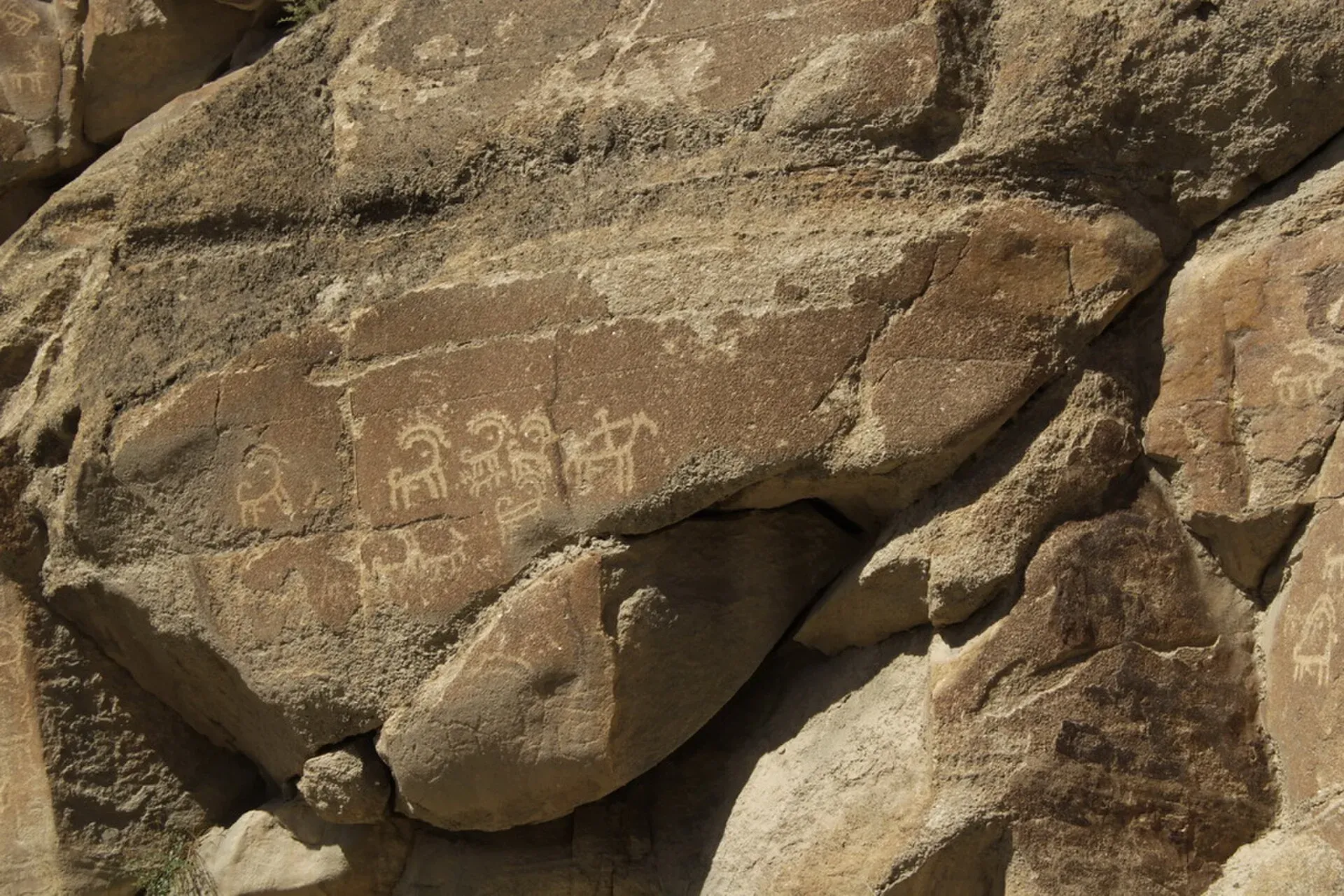
Between Hunza and Shatial there are more than 50,000 carvings and inscriptions at about ten major sites. The oldest are thought to date from about 5000 to 1000 BCE and show single animals, triangular human figures and hunting scenes, pecked into the rock with stone tools. Later carvings are mostly Buddhist.
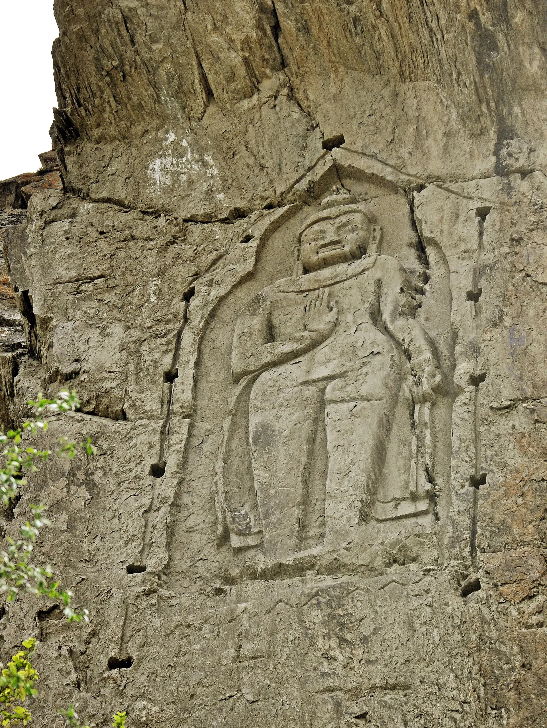
Photo: Furqanlw, with thanks · CC BY-SA 4.0 · via Wikimedia Commons · temporary stand-in photo
Chilas. Around Chilas the carvings lie on boulders and rock faces beside the Indus. Recorded examples include a Balarama and Krishna scene with a Kharoshthi inscription, dated to about the 1st century CE, a stupa dated to about 300 to 350 CE, and a donor in Central Asian dress at Thalpan-Ziyarat, dated to about the 7th century CE. Karl Jettmar and German-Pakistani teams recorded the carvings between 1979 and 1984. A report by Dialogue Earth says the planned Diamer-Bhasha dam would drown some of them, so the record on the rock may not last.
Shatial. Further down the river, more than 1,000 inscriptions at Shatial include over 550 in the Sogdian language, dated from the 3rd to the 7th centuries. Sogdians were traders from Central Asia who carried goods and ideas along the routes. Their names, scratched on the rock, are one of the clearest records of who was travelling here.
Chilas and Shatial lie on or near the stretch of the KKH that the UK government advises against travelling (see below).
A Buddha in a cliff
The Kargah Buddha, about 9.7 km west of Gilgit, is a standing figure about 15 m high cut into a cliff face in Kargah Nala. Most sources date it to the 7th century, though some suggest the 4th or 5th. It was recorded in 1938 to 1939. Holes around it once held a wooden cover that sheltered it from the weather. Reports in Dawn have described the site as neglected, so ask locally about its current state. It is one of the clearest signs of Gilgit's Buddhist past.
The Sacred Rock of Hunza
Beside the highway between Ganish village and Attabad Lake stands the Sacred Rock, known locally as Haldeikish, "the place of many male ibex". It is a hill of engraved boulders about 180 m long and up to 9 m high. The Department of Archaeology and Museums lists it as proto-historic, with a relative date in the first millennium BCE for the oldest carvings. Later inscriptions are in Sogdian, Kharosthi, Brahmi, Tibetan, Chinese and other scripts, and some name the Kushan emperors Kanishka and Huvishka. One Sanskrit inscription in Gupta script, dated to about 419 CE, reads "Chandra Sri Vikramaditya conquers", and whether it names a Gupta emperor is uncertain. Plan 30 to 45 minutes and visit when the light falls from the side.
Forts above the road
Baltit Fort above Karimabad and Altit Fort in the old village below are the best-known forts of Hunza. Altit is described as one of the oldest monuments in Gilgit-Baltistan, with an 11th-century construction date given by Wikipedia. The Aga Khan Trust for Culture restored both. Baltit re-opened in 1996 and is now run as a museum. Altit has been open to the public since 2007 and won the UNESCO Asia-Pacific Award of Distinction in 2011.
Khunjerab and the border
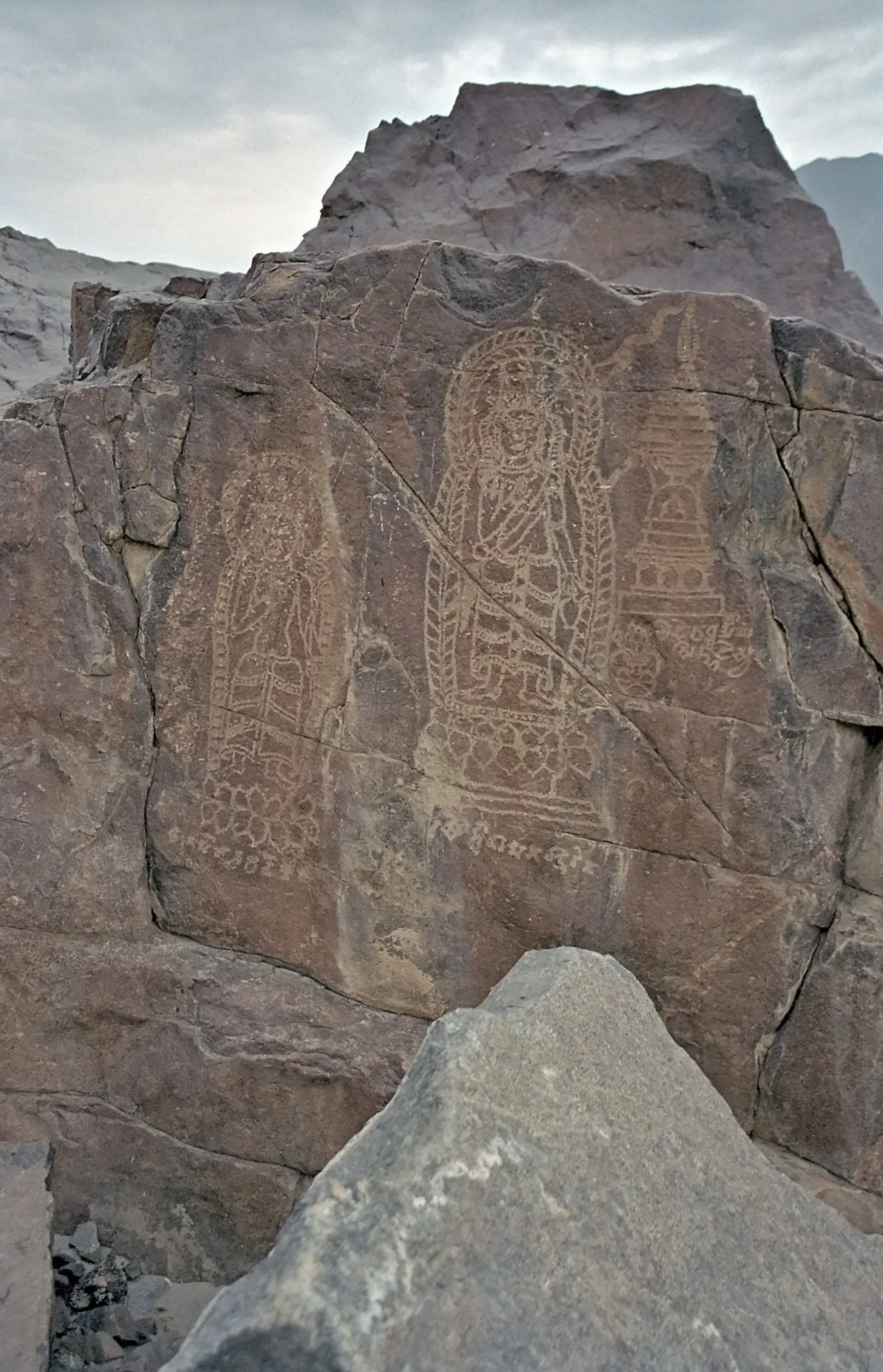
Photo: Kogo, with thanks · CC BY-SA 3.0 · via Wikimedia Commons · temporary stand-in photo
The road climbs from Sost, where Pakistan's customs and immigration post stands, to the Khunjerab Pass at 4,693 m. It is the only road crossing between Pakistan and China and is often described as the highest paved border crossing in the world. Dawn reported that Pakistan and China agreed in December 2024 to keep the pass open all year, with a virtual inauguration on 22 April 2025, although snow and slides can still close it for days. A bus service from Gilgit to Kashgar began on 1 June 2006, but we have not confirmed that it runs now. There is no confirmed rule allowing ordinary tourists to cross overland this year, so do not plan a crossing without checking with the Chinese embassy and the Sost customs post.
What the UK advises
Ask the district administration or local police about current conditions before you go. For foreign visitors: the UK FCDO page for Pakistan (updated 27 October 2026, checked 16 November 2026) advises against all travel on the Karakoram Highway between Mansehra and Chilas, and against all travel to Balochistan, Peshawar, Swat, Upper and Lower Dir and other listed parts of Khyber Pakhtunkhwa, the N-45 up to the edge of Chitral city (including the Kalash valleys) and within 10 miles of the Line of Control. It advises against all but essential travel to Malakand, Mardan, Nowshera, Shangla, Swabi, Azad Jammu and Kashmir, Sindh north of and including Nawabshah, and Dera Ghazi Khan. It does not advise against Gilgit-Baltistan generally. It also notes emergency measures and Governor's Rule in Khyber Pakhtunkhwa since 11 October 2026. Read the live page before you book.
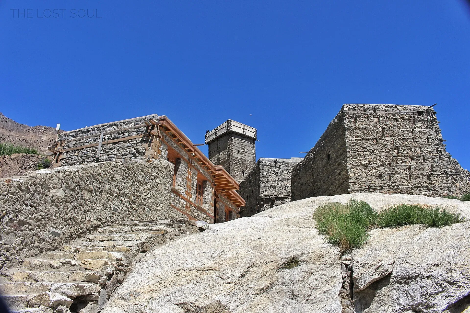
Photo: Fassifarooq, with thanks · CC BY-SA 4.0 · via Wikimedia Commons · temporary stand-in photo
Read the live page to see how it affects a plan that includes the Chilas and Shatial carvings, and for the parts further north, which are not on the list.
Treating the carvings with care
- Do not touch, trace, chalk or climb on the carvings. They are shallow and fragile.
- Visit in the morning or late afternoon, when side light shows the engravings.
- Ask local people which sites are accessible and whether a guide is available.
- Do not photograph checkposts or military sites.
- Take litter home.
A simple reading list of places
- Chilas and Shatial carvings (Indus gorge).
- Kargah Buddha (near Gilgit).
- Sacred Rock of Hunza (between Ganish and Attabad Lake).
- Baltit Fort and Altit Fort (Karimabad and Altit).
- Khunjerab Pass (Sost).
When to go
May to October is the practical season for Hunza and the pass. Landslides can close the road at any time. See our guide to Islamabad to Hunza by road for stages and checkposts.


