

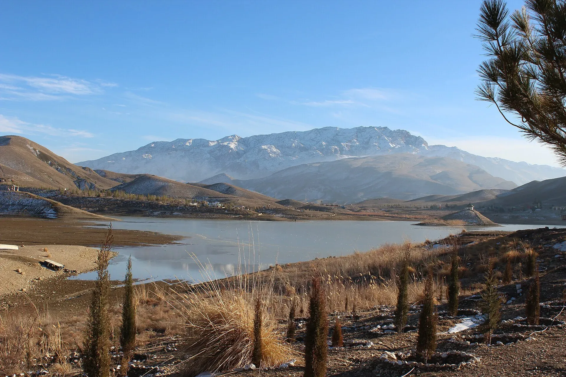
Photo: Aysafaran, with thanks · CC BY-SA 4.0 · via Wikimedia Commons · temporary stand-in photo

Balochistan Plateau
The dry upland plateau that fills most of Balochistan, in the south-east of the Iranian plateau, with ranges, cold winters and the cool hill areas around Quetta and Ziarat.
Overview
Balochistan is Pakistan's largest province, about 347,190 km² or 44% of the country, but the least populated: 14.9 million people at the 2023 census. It lies on the south-eastern edge of the Iranian plateau. The landscape is a rough upland split into basins by high ranges. Quetta sits in the Sulaiman Mountains, near the Bolan Pass, a long-used route between the coast and Central Asia. Only about 5% of the province is arable. This page is an orientation to the landscape; the province has its own page, Balochistan.
Plan your visit
- Nearest town
- Quetta
- Getting there
Quetta is the main gateway, by air or road and rail. Many routes in the province are covered by the FCDO advice against all travel; check it first. Quetta to Ziarat is about 126 km (modelled 1.8 h, OSRM). More
Best months
Apr – Jun, Sep – Oct
The main areas
- Quetta and the northern highlands. Quetta, Ziarat and Kalat are the cool places, at about 1,680 m for Quetta. See Quetta, Ziarat (Pakistan's largest juniper forest, Ziarat Juniper Forest), Kalat, Hanna Lake and Hazarganji Chiltan National Park.
- Bolan, Kachhi and Sibi. The Bolan Pass links the highlands to the plain of Kachhi, where the Neolithic site of Mehrgarh lies near Dhadar. Sibi is one of the hottest places in the country.
- The Makran coast. Gwadar, Pasni, Ormara and Jiwani lie on the Arabian Sea. See Gwadar, Hingol National Park, Kund Malir and Astola Island.
- Khuzdar, Turbat and the arid west. Khuzdar and Turbat (Kech) are the main towns in the centre and south-west. Chagai (19,338 km²) and Kharan (14,958 km²) are very dry districts.
People and languages
Balochi is the first language of 39.9% of people, Pashto of 34.0% and Brahui of 17.2% (2023 census). Pashtuns live mainly in the north and are the majority in Quetta; Baloch are concentrated in the west and south. Nearly all residents are Muslim, with small Christian and Hindu minorities.
History in brief
Mehrgarh is among the earliest known farming settlements in South Asia. The region later formed part of the Achaemenid, Sasanian and early Islamic worlds, and then the Khanate of Kalat. The British took control in the late 19th century and the province joined Pakistan in 1947 and 1948.
Land and livelihoods
Agriculture and livestock account for about 47% of provincial GDP. Natural gas, coal and other minerals matter too, and Balochistan is the country's second-largest gas supplier. Farming depends on irrigation, which is why only a small share of the land is arable. Gwadar port is being developed on the Arabian Sea, near the mouth of the Strait of Hormuz.
When to visit
The climate is extremely dry, with large differences by altitude. In the upper highlands winters are very cold and summers hot; northern highland places such as Ziarat, Quetta and Kalat can fall to about -20 °C in winter. The plains have mild winters and summers up to 50 °C; Sibi recorded 53 °C on 26 May 2010. Spring and early autumn are the easiest seasons in the highlands.
Where to stay and eat
Quetta has the main range of hotels. Smaller towns have basic stays. Roads can be long and remote, and the security situation changes, so ask the provincial authorities about the route before you travel.
Good to know
- Ask the district administration or local police about current conditions before you go. Travel advice: For foreign visitors: the UK FCDO (updated 27 October 2026) advises against all travel to Balochistan, including Quetta and Ziarat. Read the live page before any planning.
- Strong windstorms occur in desert parts.
- If you cannot travel there, the nearest comparable highland scenery is in the Margalla Hills or Murree, which are covered on their own pages.
- Quetta averages about 300 mm of rain a year (1991-2020 normals). Rainfall and wildlife for the plateau as a whole are not covered here.
- Quetta is about 126 km from Ziarat by road (modelled 1.8 h, OSRM).
Highlights
- Southeast part of the Iranian plateau
- About 347,190 km², 44% of Pakistan
- Ranges split into basins
- Cold highland winters, very hot plains
Getting there
Quetta is the main gateway, by air or road and rail. Many routes in the province are covered by the FCDO advice against all travel; check it first. Quetta to Ziarat is about 126 km (modelled 1.8 h, OSRM).
Tips
- Read the FCDO advice before planning
- Carry warm clothes for highland winters
- Expect strong wind in desert areas
Photos we still need: Quetta highlands in winter or a dry Balochistan basin; the Bolan Pass; the Makran coast. Send us yours
Sources and last checked
Last checked Confidence low4 sources3 still to check
- Last checked
- Method
- Desk research from published sources
- Confidence
- low
- Checked by
- trek.pk research team
Researched from published sources; not yet checked on the ground by our team. Spot something out of date? Report a mistake.
Sources
- Balochistan, Pakistan (Wikipedia) · Wikipedia · checked
- Pakistan travel advice (updated 27 October 2026) · UK Foreign, Commonwealth & Development Office · checked
- OSRM driving routes (modelled distance and time) · OSRM project · checked
- Quetta · Wikipedia · checked
Still to be checked on the ground (3)
- Plateau altitude range (only Quetta, 1,680 m, confirmed)
- Plateau-wide rainfall (only Quetta's 300 mm confirmed)
- Vegetation and wildlife (not covered)
Nearby and related

Balochistan
Pakistan's largest and least populated province: Quetta's high valleys, Ziarat's juniper forest, the Makran coast, Hingol and Gwadar. Security and permission rules need checking first.

Bolan Pass
An 89 km gorge route from Sibi to Quetta, with a highway and a railway. A key route since early times, but the FCDO advises against all travel in Balochistan.

Dhadar
Small headquarters town of Kachhi District on the Kachhi plain, close to Mehrgarh and the mouth of the Bolan Pass.

Gwadar
Arabian Sea port town and Gwadar District headquarters, a fishing settlement that Pakistan bought from Oman in 1958 and now a CPEC port.

Hanna Lake
A reservoir built in 1894 about 17 km east of Quetta at the start of the Urak Valley. Popular for boating, but water levels have been low or dry in several recent years.

Kalat
Historic capital of the Khanate of Kalat in the Central Brahui Range, now headquarters of Kalat District and Division.

Mehrgarh
One of the oldest farming villages in South Asia, on the Kachhi Plain near the Bolan Pass in Balochistan. People lived here from about 7000 BCE, and the site is on Pakistan's UNESCO tentative list (2004).

Quetta
Balochistan's high-valley capital, the Fruit Garden of Pakistan: bazaars, sajji, orchard valleys and the base for Hanna Lake and Ziarat.

Ziarat Valley
A cool mountain valley and hill station at about 2,400 m in northern Balochistan, known for ancient juniper forest, orchards and the Quaid-e-Azam Residency. Check security advice before travel.