

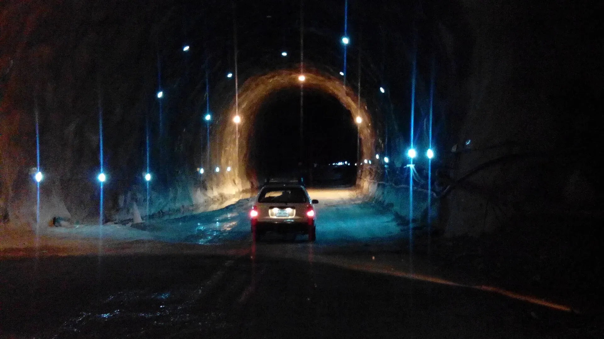
Photo: Ihsan Farid, with thanks · CC BY-SA 4.0 · via Wikimedia Commons · temporary stand-in photo

N-45 Nowshera-Chitral
The 309 km N-45 runs from Nowshera over the Malakand pass area through Lower and Upper Dir, then through the 10.4 km Lowari Tunnel to Chitral. The UK advises against travel on it from north of Mardan to Chitral.
Overview
The N-45 (Nowshera-Chitral Highway) is a two-lane road of 309 km according to the NHA list. It runs north from Nowshera to Mardan, across the hills at Malakand and Dargai, through Chakdara and Timergara, and up to Dir. From there it climbs to the Lowari Tunnel and drops to Ayun and Chitral. Measured by road routing from Nowshera, Dir is about 213 km away, the south portal of the tunnel about 245 km, and Chitral about 344 km. That is longer than the official length of 309 km (Wikipedia, citing the NHA list). We do not know why the two differ, so use the measured figures only as a guide.
The Lowari Tunnel
The tunnel is the main reason people use this road. It is made of two tunnels, 8.5 km and 1.9 km, 10.4 km together, and was opened in July 2017 at a cost of about Rs 26.9 billion (Wikipedia). Before it opened, Chitral was often cut off when snow closed Lowari Pass. The tunnel cut the 14-hour drive from Chitral to Peshawar by around seven hours.
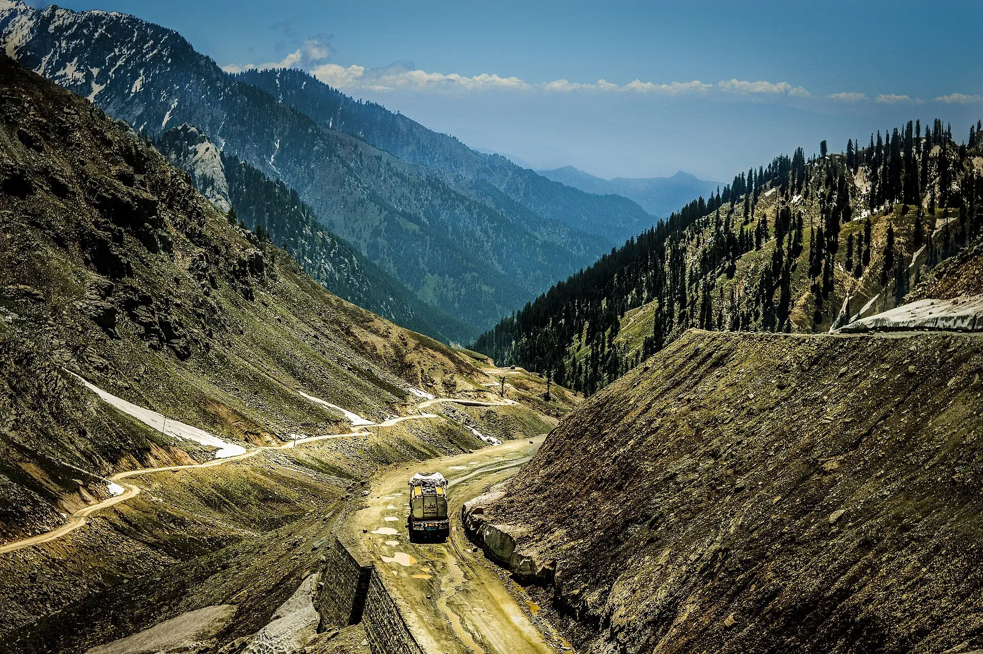
Photo: Msanamsaeed, with thanks · CC BY-SA 3.0 · via Wikimedia Commons · temporary stand-in photo

Winter snowfall can still close the approach roads and the tunnel. An APP report of 24 January 2017, before the tunnel formally opened, said it was closed for a day by snow and was then open only on Fridays and Tuesdays; that rule is out of date. An NHA advisory in January 2019 closed it from 8 pm to 6 am, with set daytime windows (Chitral Today, 12 January 2019). Dawn (3 August 2026) reported that the tunnel was open round the clock, but that the NHA had notified a plan to close it for 12 hours a day (three hours closed, three open), which Chitral residents rejected. There is no known toll. Check with NHA or the Chitral administration before you travel.
Stops and stages
OSRM road distances from Nowshera (estimates): Mardan 23 km, Dargai 67 km, Chakdara 101 km, Timergara 141 km, Dir 213 km, Lowari Tunnel south portal 245 km, Ayun 286 km and Chitral 344 km. A realistic plan splits the journey at Dir, with the tunnel and the drive down to Chitral the next morning. Chitral to Peshawar took about 14 hours before the tunnel opened and about seven hours less after it (Wikipedia).
Road condition
The road is paved but narrow in many places. In the lower section expect heavy local traffic through Mardan, Dargai and Chakdara. North of Dir the road is mountainous with sharp bends and drops to the Chitral River. The surface and shoulders are generally poorer in winter and after rain.
What to see along it
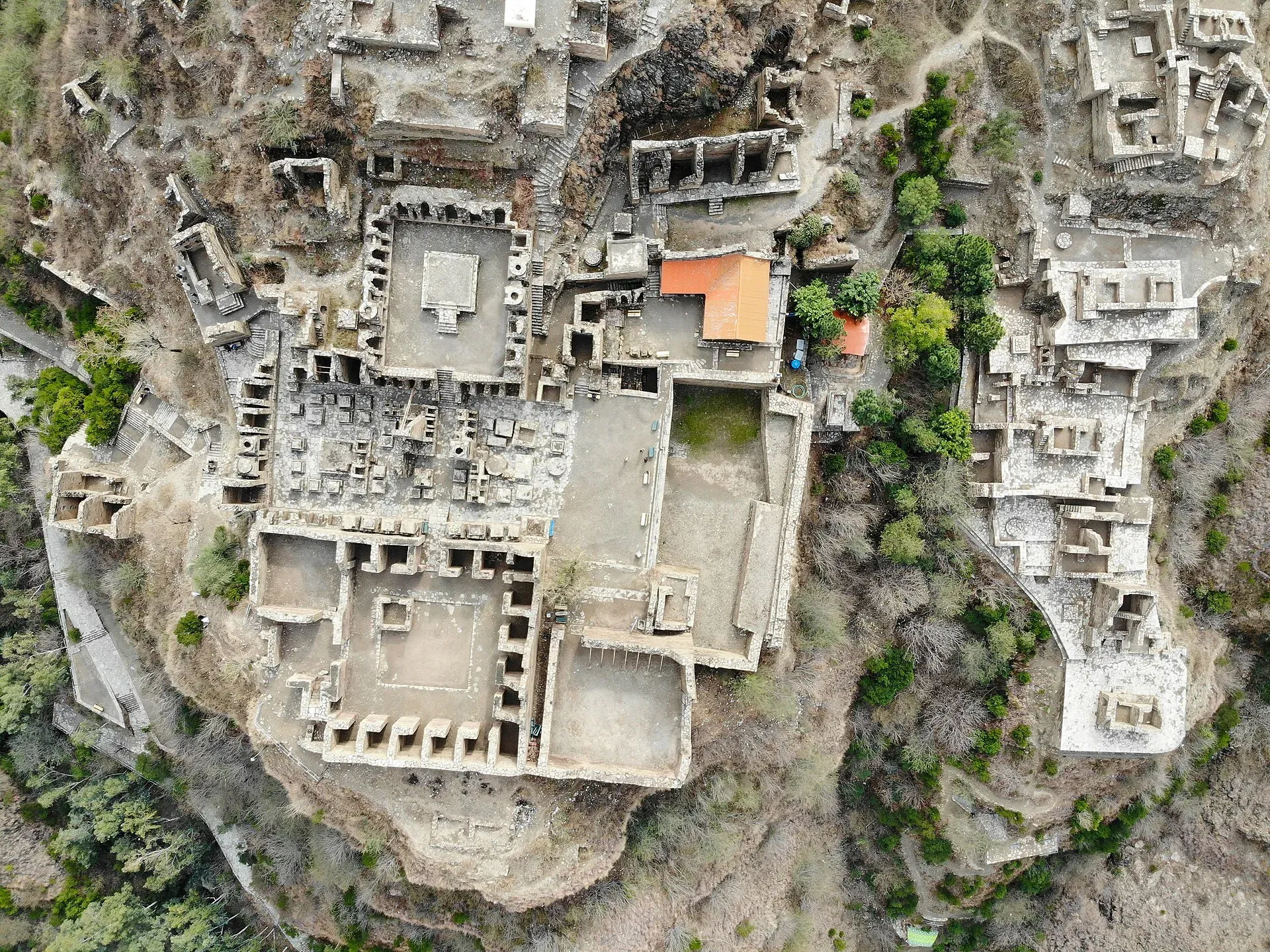
Photo: Muzamil Hassain Toori, with thanks · CC BY-SA 4.0 · via Wikimedia Commons · temporary stand-in photo

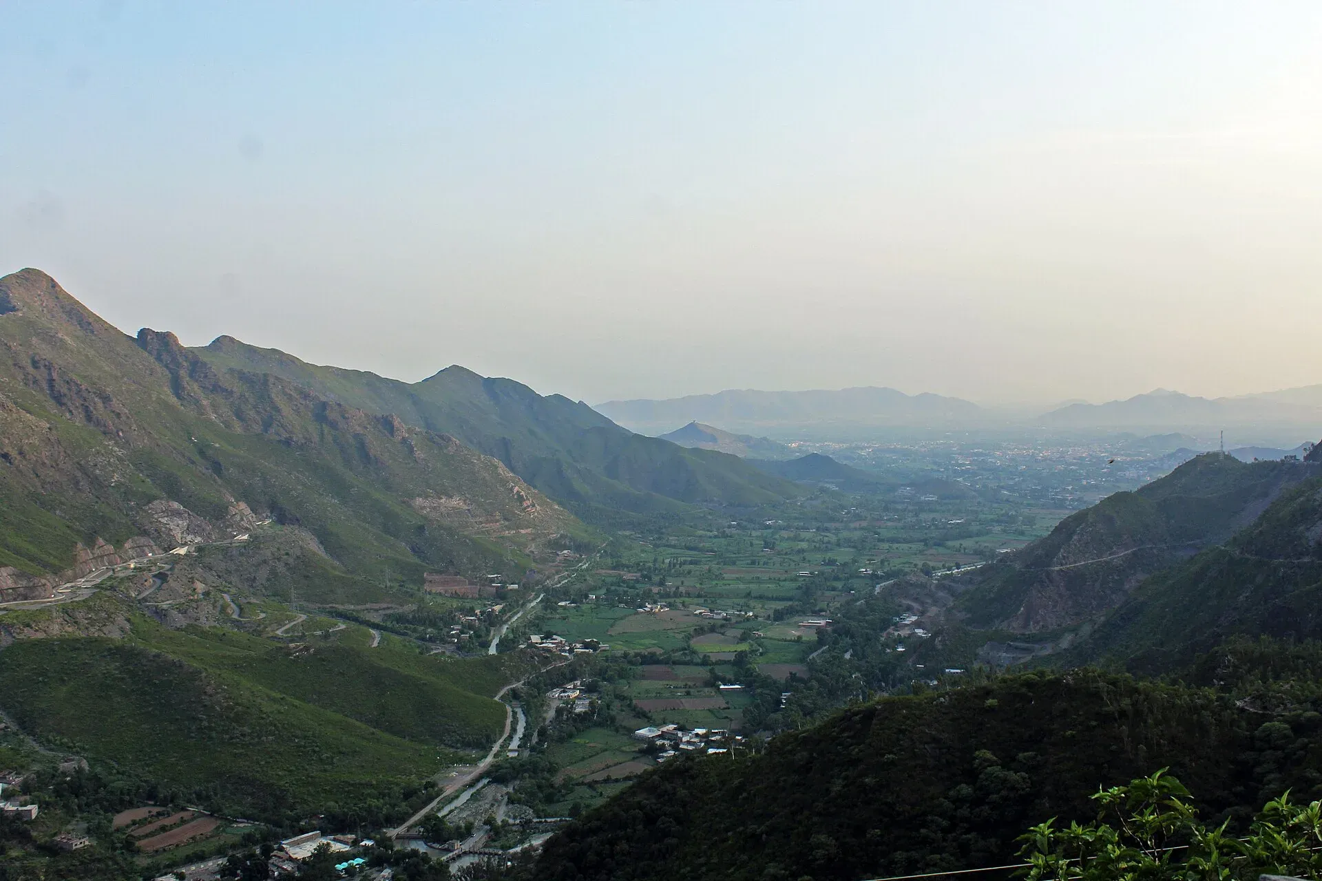
Photo: Malakand District, with thanks · CC BY-SA 4.0 · via Wikimedia Commons · temporary stand-in photo

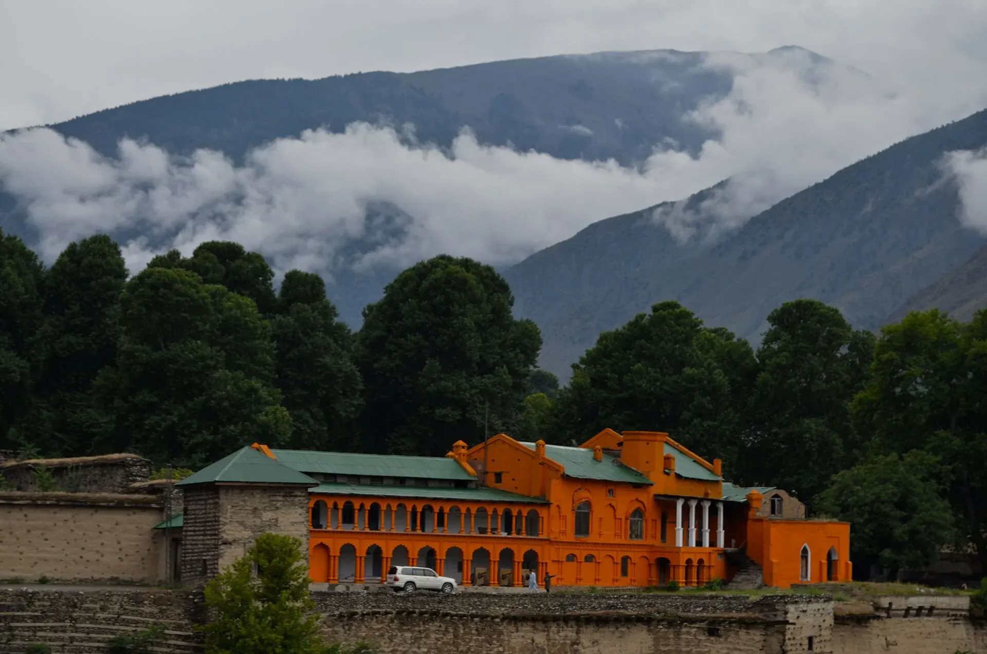
Photo: Kamran Adil, with thanks · CC BY-SA 4.0 · via Wikimedia Commons · temporary stand-in photo

In order from the south:
- Takht-i-Bahi, near Mardan. A Buddhist monastery on a hill about 150 m high, some 15 km from Mardan. Wikipedia says it was likely founded in the early 1st century CE, used until the 7th century and damaged by the Huns in the mid-5th century. The complex has a stupa court, monastic chambers, a later temple area and a group of small, dark cells. It was inscribed by UNESCO in 1980 together with the nearby city remains at Sahr-i-Bahlol.
- Malakand Pass. The old route into Swat, crossed on the way to Dargai and Chakdara.
- Chakdara. The junction for the N-95 to Swat.
- Dir and the valleys that lead to Kumrat. Dir is the last large town before the tunnel.
- Lowari Pass and Tunnel. The old pass road still exists above the tunnel; before the tunnel, snow on it cut Chitral off in winter.
- Chitral town. Chitral Fort stands on the bank of the Chitral River; the museum and polo ground are close by.
- The Kalash valleys, reached by a side road south of Chitral. See the FCDO wording below before planning this side trip.
Landslide and flood hazards
Heavy rain and snowmelt cause rockfall and landslides on the road and its approaches, especially around Dir and Ayun. Avalanche risk on the tunnel approaches in winter. There is no known dated landslide event for 2026 specific to the N-45.
Fuel and services
Fuel at Mardan, Dargai, Chakdara, Timergara, Dir and Chitral. North of the tunnel the number of stations falls. Fill up at Dir before the tunnel. Food stops are frequent in lower sections and fewer on the climb.
Tolls and checkposts
Tolls may apply on NHA roads; current rates will be added soon. Expect police and army checkposts at district borders and on the approaches to the tunnel. Carry passport and visa copies.
Safety and travel advice by section
Ask the district administration or local police about current conditions before you go. For foreign visitors: the UK FCDO page (updated 27 October 2026, checked 16 November 2026) advises against all travel on the N-45 from north of the Mardan ring road to the edge of Chitral city, including the Kalash valleys. Nowshera and Mardan are on the all but essential travel list, and Malakand too. Lower Dir and Upper Dir are on the advise-against-all-travel list. Chitral city itself is not named in the list of areas to avoid, but you must pass through the advised-against section to reach it by road. KP emergency measures and Governor's Rule since 11 October 2026 also apply. Check the live text.
Highlights
- Lowari Tunnel, the longest road tunnel in Pakistan at 10.4 km
- Year-round link to Chitral
- Passes Malakand, Dir and the Kumrat turn-off
- Access to Chitral and the Kalash valleys
Stops
- MardanRing road; FCDO boundary
- DargaiMalakand area
- ChakdaraJunction for Swat (N-95)
- TimergaraLower Dir
- DirLast big town before the tunnel
- Lowari Tunnel (south portal)10.4 km of tunnel
- AyunChitral side
- ChitralTown and fort
km: distance from the start along the route.
Numbers follow the stops in order. The map shows the 7 stops that have a trek.pk page, not the road itself.
Where to stay, eat and fuel up
Places to stay
- Apple Hotel & RestaurantCall Apple Hotel & RestaurantMap of Apple Hotel & Restaurant in Google Maps
- Shelton Hotel and RestaurantCall Shelton Hotel and RestaurantMap of Shelton Hotel and Restaurant in Google Maps
- Tirch Mir View Hotel ChitralCall Tirch Mir View Hotel ChitralMap of Tirch Mir View Hotel Chitral in Google Maps
- Hayat Hotel & RestaurantCall Hayat Hotel & RestaurantMap of Hayat Hotel & Restaurant in Google Maps
- Tower Hotel ChitralCall Tower Hotel ChitralMap of Tower Hotel Chitral in Google Maps
- Legendary Hotel ChitralCall Legendary Hotel ChitralMap of Legendary Hotel Chitral in Google Maps
Places to eat
- River View RestaurantCall River View RestaurantMap of River View Restaurant in Google Maps
- HFCCall HFCMap of HFC in Google Maps
- Khurak MahalCall Khurak MahalMap of Khurak Mahal in Google Maps
- Royal Dir Restaurant (best family Restaurant)Call Royal Dir Restaurant (best family Restaurant)Map of Royal Dir Restaurant (best family Restaurant) in Google Maps
- River Swat RestaurantCall River Swat RestaurantMap of River Swat Restaurant in Google Maps
- Diwan Hotel & RestaurantCall Diwan Hotel & RestaurantMap of Diwan Hotel & Restaurant in Google Maps
Essential services fuel stations, mechanics, ATMs, banks, pharmacies and hospitals and clinics
Fuel
- Haji Nawab Filling Station - Attock PetroleumMap of Haji Nawab Filling Station - Attock Petroleum in Google Maps
- Swat Motorway PSO Filling StationCall Swat Motorway PSO Filling StationMap of Swat Motorway PSO Filling Station in Google Maps
- Total ParcoCall Total ParcoMap of Total Parco in Google Maps
- BycoMap of Byco in Google Maps
- ABC Petroleum StationCall ABC Petroleum StationMap of ABC Petroleum Station in Google Maps
- Saad CNGMap of Saad CNG in Google Maps
Mechanics and tyre shops
- Sharjah TyresCall Sharjah TyresMap of Sharjah Tyres in Google Maps
- Noor Autos BatkhelaCall Noor Autos BatkhelaMap of Noor Autos Batkhela in Google Maps
- Car Repairing Near Al Khidmat FoundationMap of Car Repairing Near Al Khidmat Foundation in Google Maps
ATMs
- Bank AlfalahMap of Bank Alfalah in Google Maps
- Allied BankCall Allied BankMap of Allied Bank in Google Maps
- NBP AitemaadCall NBP AitemaadMap of NBP Aitemaad in Google Maps
Banks and money exchange
- Bank Of PanjabCall Bank Of PanjabMap of Bank Of Panjab in Google Maps
- National Bank of Pakistan (NBP)Map of National Bank of Pakistan (NBP) in Google Maps
- Bank AlfalahMap of Bank Alfalah in Google Maps
- BankIslami - Chitral BranchCall BankIslami - Chitral BranchMap of BankIslami - Chitral Branch in Google Maps
- Bank of KhyberMap of Bank of Khyber in Google Maps
- BankIslami - Timargarha BranchCall BankIslami - Timargarha BranchMap of BankIslami - Timargarha Branch in Google Maps
Pharmacies
- Star PharmacyCall Star PharmacyMap of Star Pharmacy in Google Maps
- IDREES MEDICOSCall IDREES MEDICOSMap of IDREES MEDICOS in Google Maps
Hospitals and clinics
- Doctor Aneeqa Waqar ClinicMap of Doctor Aneeqa Waqar Clinic in Google Maps
- Zakir eye centerCall Zakir eye centerMap of Zakir eye center in Google Maps
- Gulrang International HospitalCall Gulrang International HospitalMap of Gulrang International Hospital in Google Maps
- Nowshera Medical CollegeCall Nowshera Medical CollegeMap of Nowshera Medical College in Google Maps
- Muhammad Islam Surgical Hospital Urologist & Laparoscopic SurgeonCall Muhammad Islam Surgical Hospital Urologist & Laparoscopic SurgeonMap of Muhammad Islam Surgical Hospital Urologist & Laparoscopic Surgeon in Google Maps
- MANAL MEDICAL& DENTAL CLINICMap of MANAL MEDICAL& DENTAL CLINIC in Google Maps
Listings come from Google Maps data and are unverified: phone numbers, opening months and prices may have changed. Report a problem · Own one of these? Claim it
More safety notes
- Nowshera: the UK FCDO advises against all but essential travel.
- North of the Mardan ring road to the edge of Chitral city: the FCDO advises against all travel on the N-45, including the Kalash valleys (checked 16 November 2026).
- Lowari Tunnel: snow and avalanche risk in winter; check opening schedule.
- Do not drive at night.
Tips
- Check Lowari Tunnel opening hours and snow reports before travelling in winter.
- Fill up in Dir before the tunnel.
- Read the live FCDO text for this road.
- Leave early; the road is slow.
More photos
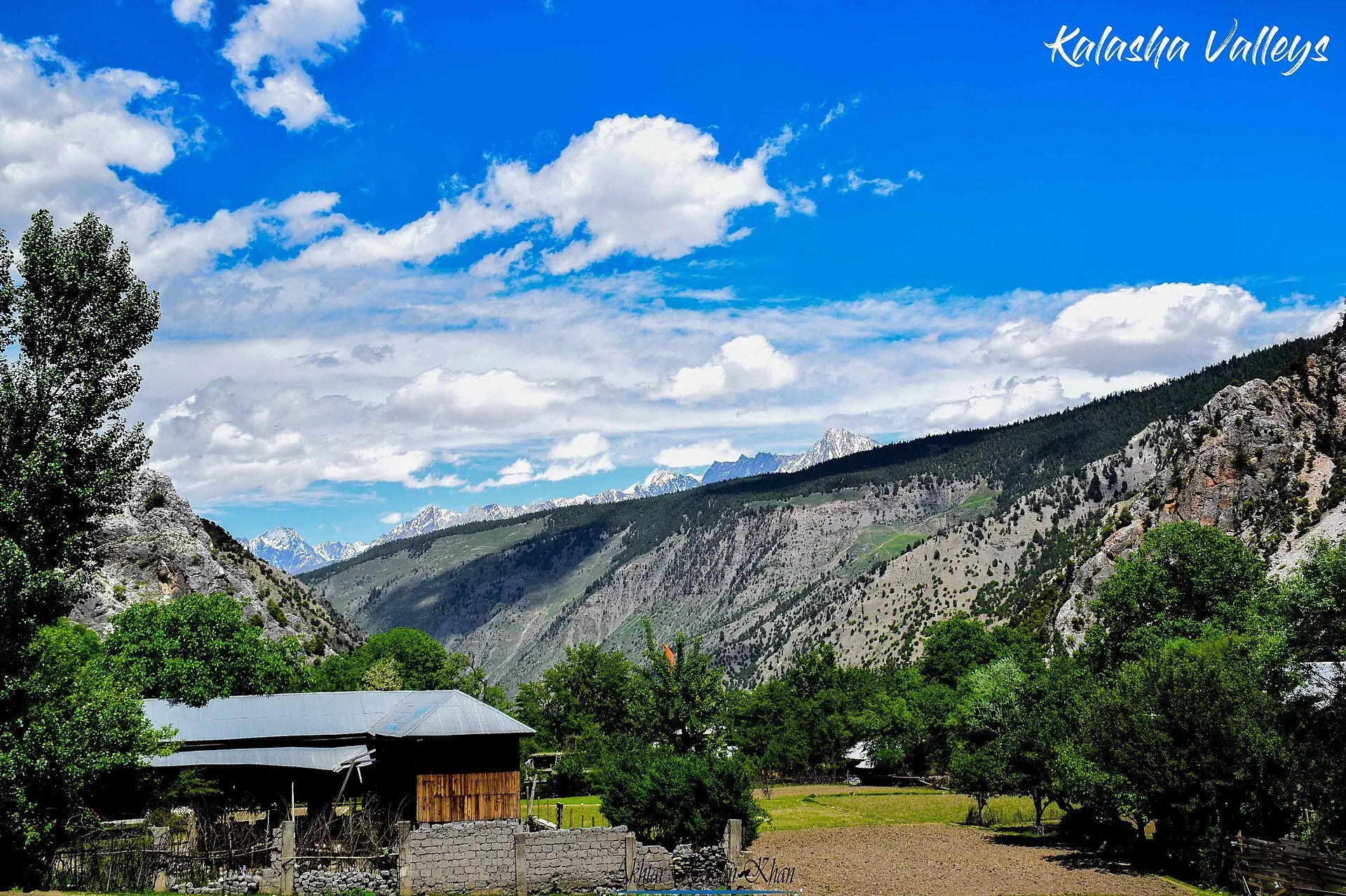
Photo: Akhtar Hassan, with thanks · CC BY-SA 4.0 · via Wikimedia Commons · temporary stand-in photo

Sources and last checked
Last checked Confidence medium9 sources3 still to check
- Last checked
- Method
- Desk research from published sources
- Confidence
- medium
- Checked by
- trek.pk research team
Researched from published sources; not yet checked on the ground by our team. Spot something out of date? Report a mistake.
Sources
- National highways of Pakistan · Wikipedia · checked
- N-45 National Highway · Wikipedia · checked
- Lowari Tunnel · Wikipedia · checked
- Lowari Tunnel to remain closed due to heavy snowfall: NHA · APP · checked
- Pakistan travel advice: warnings and insurance (updated 27 October 2026) · UK Foreign, Commonwealth & Development Office · checked
- OSRM routing (road distances measured from the start of each highway) · OpenStreetMap / Project OSRM · checked
- NHA announces nighttime closure of Lowari tunnel (12 Jan 2019) · Chitral Today · checked
- 12-hour daily closure plan for Lowari tunnel draws criticism (3 Aug 2026) · Dawn · checked
- Takht-i-Bahi · Wikipedia · checked
Still to be checked on the ground (3)
- Whether the NHA 12-hour closure plan for the Lowari Tunnel has taken effect since 3 August 2026, and whether any toll applies (none found)
- Road surface between Dir and Chitral (no recent dated report found)
- Why our measured 344 km differs from the official 309 km (no source explains it)
Nearby and related

Nowshera
A Grand Trunk Road and railway town on the Kabul River, about 43 km east of Peshawar, with a large cantonment. Mostly a stop on the way between Peshawar and Islamabad.

Mardan
The second-largest city in Khyber Pakhtunkhwa, set in the Peshawar valley, and the gateway to Gandhara's Takht-i-Bahi monastery (UNESCO), Shahbaz Garhi's Ashoka edicts and the Guides Memorial.

Malakand Pass
The road gateway from the plains to Swat and Dir, climbing from Dargai to Batkhela. Known for the 1895 and 1897 frontier fighting and the Swat Canal. For foreign visitors: the UK FCDO advises against all but essential travel to Malakand.

Timergara
District capital of Lower Dir on the Panjkora River, at about 823 m. For foreign visitors: the UK FCDO advises against all travel to Lower Dir, so this is for information only.

Dir
The old capital of the princely state of Dir, on the Dir River at the foot of the Lowari Pass, with a palace on the hill above. A stop on the road between Peshawar and Chitral.

Lowari Pass
A 3,118 m road pass on the Hindu Raj between Upper Dir and Chitral. Snow shuts the old road for months each winter; the Lowari Tunnel, opened in July 2017, now carries the traffic.

Chitral
The main town of Lower Chitral District, at about 1,500 m on the Chitral River, with a historic fort, a royal mosque and views of Tirich Mir. The base for the Kalash valleys.

Kalash Valleys (Bumburet, Rumbur, Birir)
Three side valleys of the Chitral River, home to the Kalasha people, who keep their own religion, language and festivals. Visit with respect and check security advice first.

Chitral Fort (Shahi Qila)
The fort and royal residence on the Chitral river, with a history reaching back to the 18th century and the 1895 siege. It is still the home of the ceremonial Mehtar, so access is limited.

Kumrat Valley
The upper Panjkora valley in Upper Dir, known for deodar forest, the Jahaz Banda meadow and Katora Lake. Access has been cut by floods and a collapsed bridge in 2025 and 2026.

Chitral and Kalash
A 6-7 day road trip from Islamabad to Chitral through Dir and the Lowari Tunnel, with the Kalash valleys of Bumburet, Rumbur and Birir, Chitral Fort and Tirich Mir views.

Kumrat Valley
A 4-day road trip from Islamabad to Kumrat in Upper Dir: deodar forest, the Panjkora river and waterfalls, via Chakdara, Dir and Thal, with a final jeep leg.