

Photo: Khalid Mahmood, with thanks · CC BY-SA 3.0 · via Wikimedia Commons · temporary stand-in photo

N-5 National Highway (GT Road): Karachi-Torkham
Pakistan's longest national highway, the old Grand Trunk Road: 1,819 km from Karachi through Hyderabad, Multan, Lahore, Rawalpindi and Peshawar to the Afghan border at Torkham.
Overview
The N-5 is the longest national highway in Pakistan. The NHA list puts it at 1,819 km from Karachi in Sindh to Torkham on the Afghan border. It runs mostly along the line of the historic Grand Trunk Road, one of the oldest long-distance roads in South Asia. It is part of the Asian Highway network (AH1, AH2 and AH4).
For most visitors the N-5 is a way to reach towns and sights, not a scenic drive. It is busy and mixed: trucks, buses, rickshaws, tractors and donkey carts share the lanes. Where a motorway runs alongside (M-9, M-2, M-1), most through traffic uses that instead.
Route and main stops
The road leaves Karachi, crosses the Indus plain through Hyderabad and the Sindh towns of Nawabshah and Sukkur, then enters Punjab. In Punjab it passes Rahim Yar Khan, Bahawalpur, Multan, Sahiwal and Lahore, then goes north-west through Gujranwala and Jhelum to Rawalpindi. West of Rawalpindi it passes Taxila and Attock, crosses the Indus into Khyber Pakhtunkhwa, and continues through Nowshera and Peshawar to the Khyber Pass, Landi Kotal and Torkham.
Distances in the stops list were measured by road routing from Karachi, using short hops between towns, and come to about 1,822 km at Torkham. That is close to the official length, but treat individual figures as approximate.
Road condition
Condition varies a lot. Some sections are dual carriageway in good order; others are narrow, patched or crowded with local traffic. In April 2025 the federal government announced that the GT Road would be widened to a uniform three-lane carriageway, built in two phases and limited by available funds (Dawn, 20 April 2025). ProPakistani (6 October 2026) lists the Islamabad Tee Chowk to Banth upgrade among GT Road projects nearing completion, and says rehabilitation of several GT Road and N-5 sections will soon be launched; it gives no dates. It also lists a Multan to Lodhran N-5 upgrade. There is no known source that says how much of the three-lane plan is finished, so do not assume it is.
Tolls apply on parts of the highway. Current rates will be added soon; check with the NHA.
History of the road
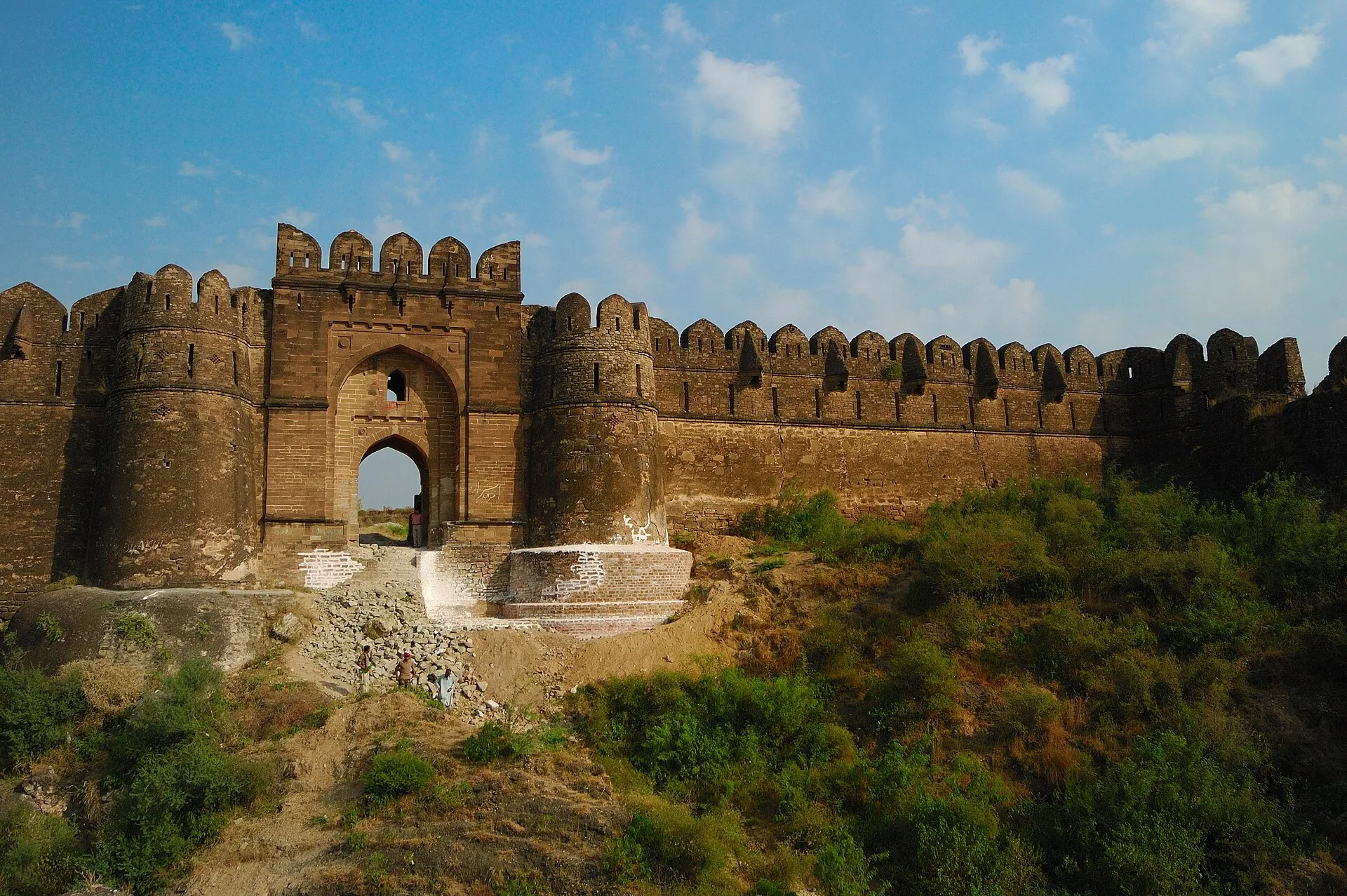
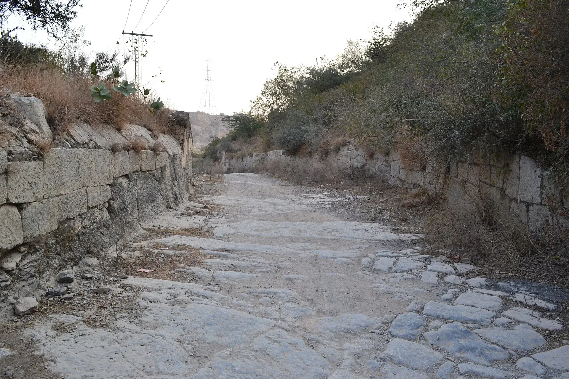
Photo: Usman.pg, with thanks · CC BY-SA 3.0 · via Wikimedia Commons · temporary stand-in photo

The N-5 follows the Grand Trunk Road, which Wikipedia traces to the ancient Uttarapatha and to Mauryan officials in the 3rd century BCE, linking Taxila and Peshawar with the Ganges plain. In the 16th century Sher Shah Suri repaired and widened it, rerouted it at Rohtas, and built caravanserais (roadside inns), kos minars (distance-marker towers) and wells. Jahangir later had brick and stone sarais built and shade trees planted between Lahore and Agra. The East India Company began metalling the road in the 1830s. After 1947 the stretch from Wagah to Peshawar passed to Pakistan. Kipling described it in the novel Kim as a river of life. The Pakistan-side line follows the Lahore, Gujranwala, Gujrat, Jhelum, Rawalpindi and Peshawar corridor.
Stages and journey times
The N-5 is long enough to need several days. The figures below are OSRM estimates for driving between city centres on the fastest road, which often means the motorways, not the N-5 itself, so real N-5 times will be longer. They are driving only, without stops.
- Karachi to Sukkur: about 478 km, 5 hours 50 minutes.
- Sukkur to Multan: about 425 km, 4 hours 35 minutes.
- Multan to Lahore: about 337 km, 3 hours 50 minutes.
- Lahore to Rawalpindi: about 286 km, 3 hours 55 minutes.
- Rawalpindi to Peshawar: about 184 km, 2 hours 10 minutes.
Wikipedia gives the length by province as 1,021 km in Punjab, 671 km in Sindh and 165 km in Khyber Pakhtunkhwa (these sum to more than the 1,819 km headline figure, so treat them as rough). Kilometre markers run from Karachi (km 0) to Ubauro (km 596) in Sindh, then about 90 markers across Punjab from Kot Sabzal (km 612) to Attock Khurd (km 1621), according to the same article.
Sindh: Karachi to Sukkur
The road leaves Karachi for Hyderabad, Sindh's second city, founded in 1768 and known for its glass bangles, Pacco Qillo fort and the Talpur tombs. The Makli necropolis near Thatta, a UNESCO World Heritage Site with royal tombs from the 14th to 18th centuries, is a detour from the Karachi end. Further north, Moenjodaro, the planned Indus Valley city of about 2500 BCE, lies about 30 km from Larkana. Sukkur has the 1932 Sukkur Barrage, the 1889 Lansdowne Bridge, Masum Shah's Minaret and the river islands of Rohri. Wikipedia names Hyderabad, Moro and Sukkur on the Sindh stretch, and lists the interchanges for the N-55 at Kotri and the N-305 at Sakrand.
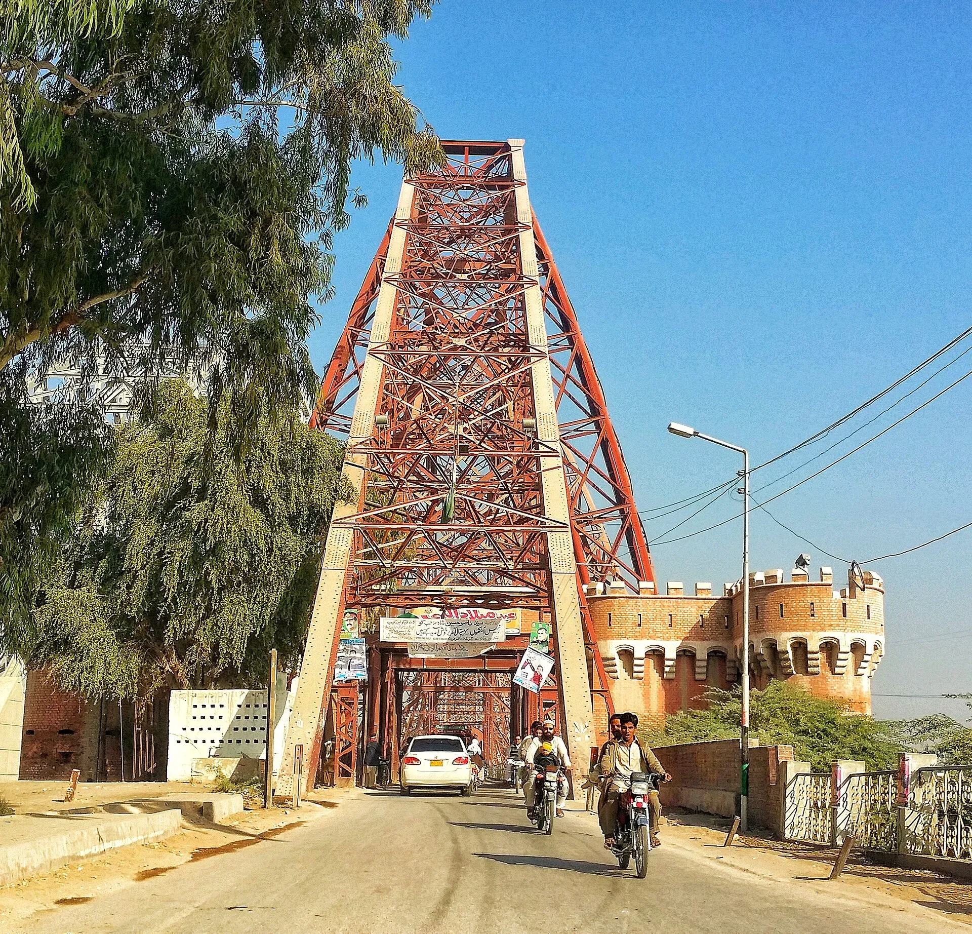
Photo: Fassifarooq, with thanks · CC BY-SA 4.0 · via Wikimedia Commons · temporary stand-in photo

South Punjab: Rahim Yar Khan to Multan
After Rahim Yar Khan the road reaches Bahawalpur, a former princely state on the edge of the Cholistan Desert, with Nawabi palaces such as Noor Mahal (1870s) and a museum. Uch Sharif, a cluster of tiled 13th to 15th century tombs on UNESCO's tentative list, is a short drive away. Multan, the City of Saints, has blue-tiled Sufi shrines, a crowded old city, blue pottery, sohan halwa and mangoes, according to our place page.
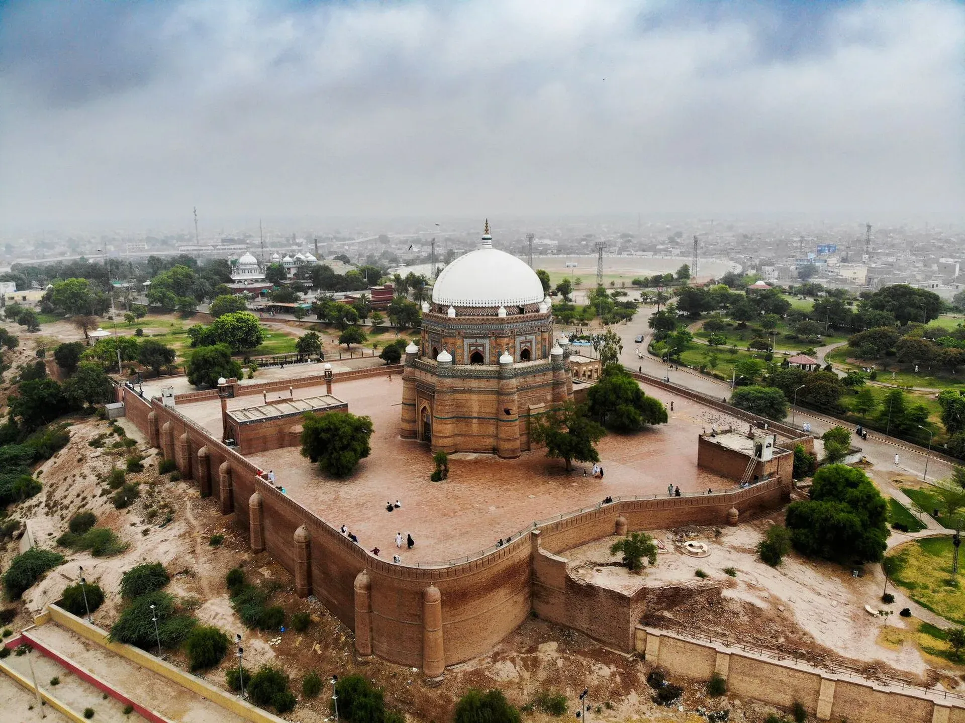
Photo: Yaarahmadd, with thanks · CC BY-SA 4.0 · via Wikimedia Commons · temporary stand-in photo

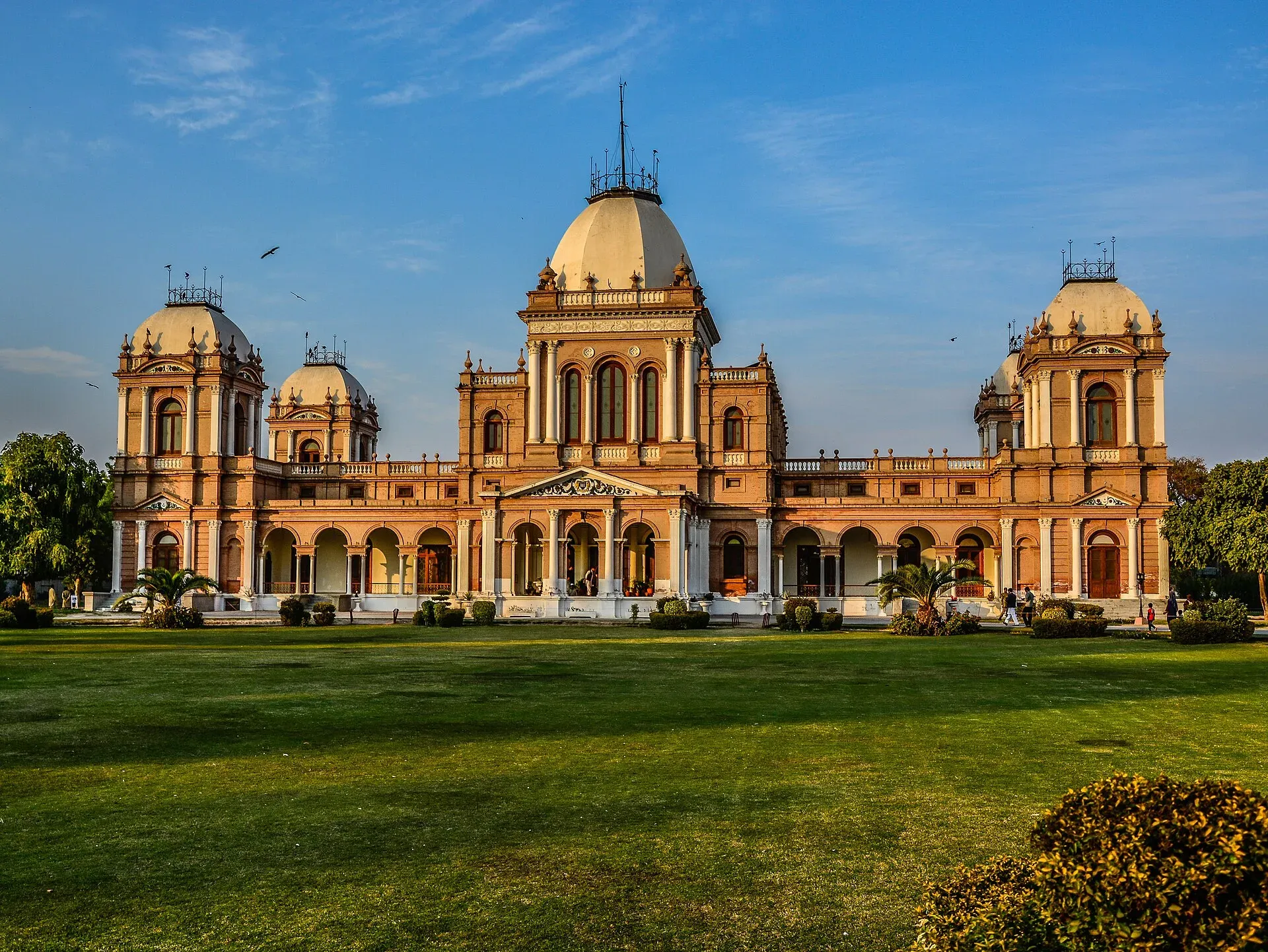
Photo: Muhammad Ashar, with thanks · CC BY-SA 3.0 · via Wikimedia Commons · temporary stand-in photo

Lahore, Gujranwala and Jhelum
Sahiwal and Lahore follow. Lahore has the Fort, the Badshahi Mosque and the old city; see the Lahore pages. Beyond Gujranwala the road runs through Gujrat, Lala Musa and Kharian to Jhelum. Rohtas Fort, a 16th-century fort of Sher Shah Suri about 23 km from Jhelum with four kilometres of walls, was inscribed by UNESCO in 1997. Sher Shah is the road's best-known patron, which makes Rohtas a fitting stop.
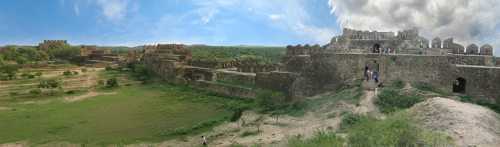
Photo: Skazimr (talk), with thanks · CC BY-SA 3.0 · via Wikimedia Commons · temporary stand-in photo

Rawalpindi, Taxila and the Indus
Rawalpindi is the junction for Islamabad and the north. West of it the N-5 passes Taxila, a group of ancient cities and Buddhist monasteries inscribed by UNESCO in 1980, with a fine museum, and then Attock. Attock Fort, built by Akbar in 1581-83 on the Indus, is run by the army and is not open to the public. Wikipedia says the road crosses the Indus near Attock Khurd and runs on through Nowshera and Peshawar.
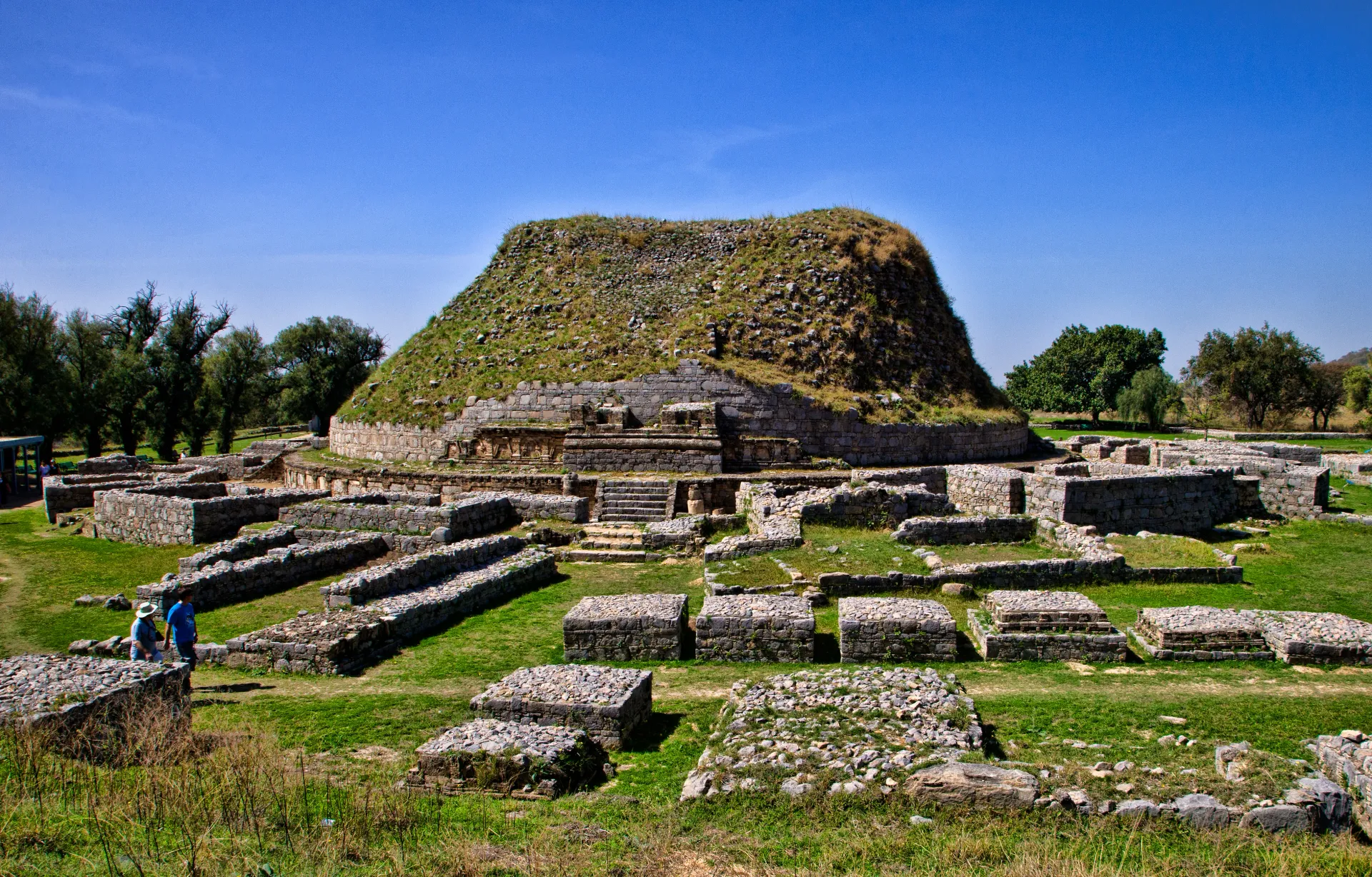
Photo: Sasha Isachenko, with thanks · CC BY-SA 3.0 · via Wikimedia Commons · temporary stand-in photo

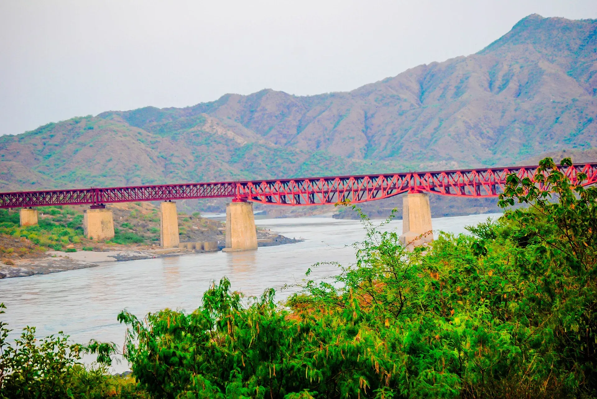
Photo: Prince Waqar Jalbai, with thanks · CC BY-SA 4.0 · via Wikimedia Commons · temporary stand-in photo

Peshawar and the Khyber
Peshawar's old city has Qissa Khwani Bazaar, Sethi houses and the Mahabat Khan Mosque, and the museum holds a Gandhara collection. From Peshawar the road passes Jamrud, where Bab-e-Khyber stands, and climbs the 40 km Khyber Pass to Landi Kotal (1,072 m) and Torkham. For foreign visitors this section is under an FCDO all-travel warning (see below), so the sights are listed for context only.
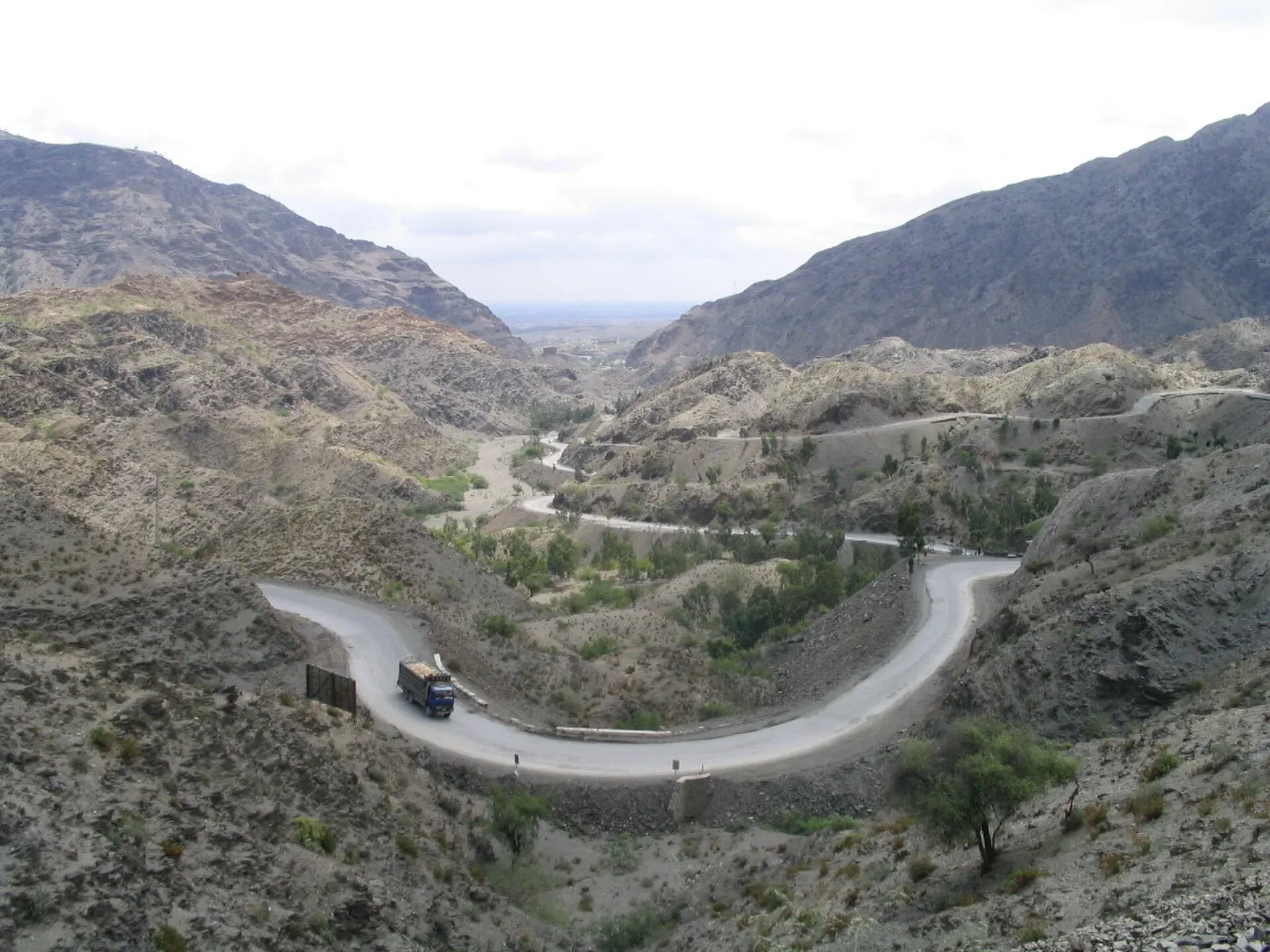
Photo: James Mollison, with thanks · CC BY-SA 2.5 · via Wikimedia Commons · temporary stand-in photo

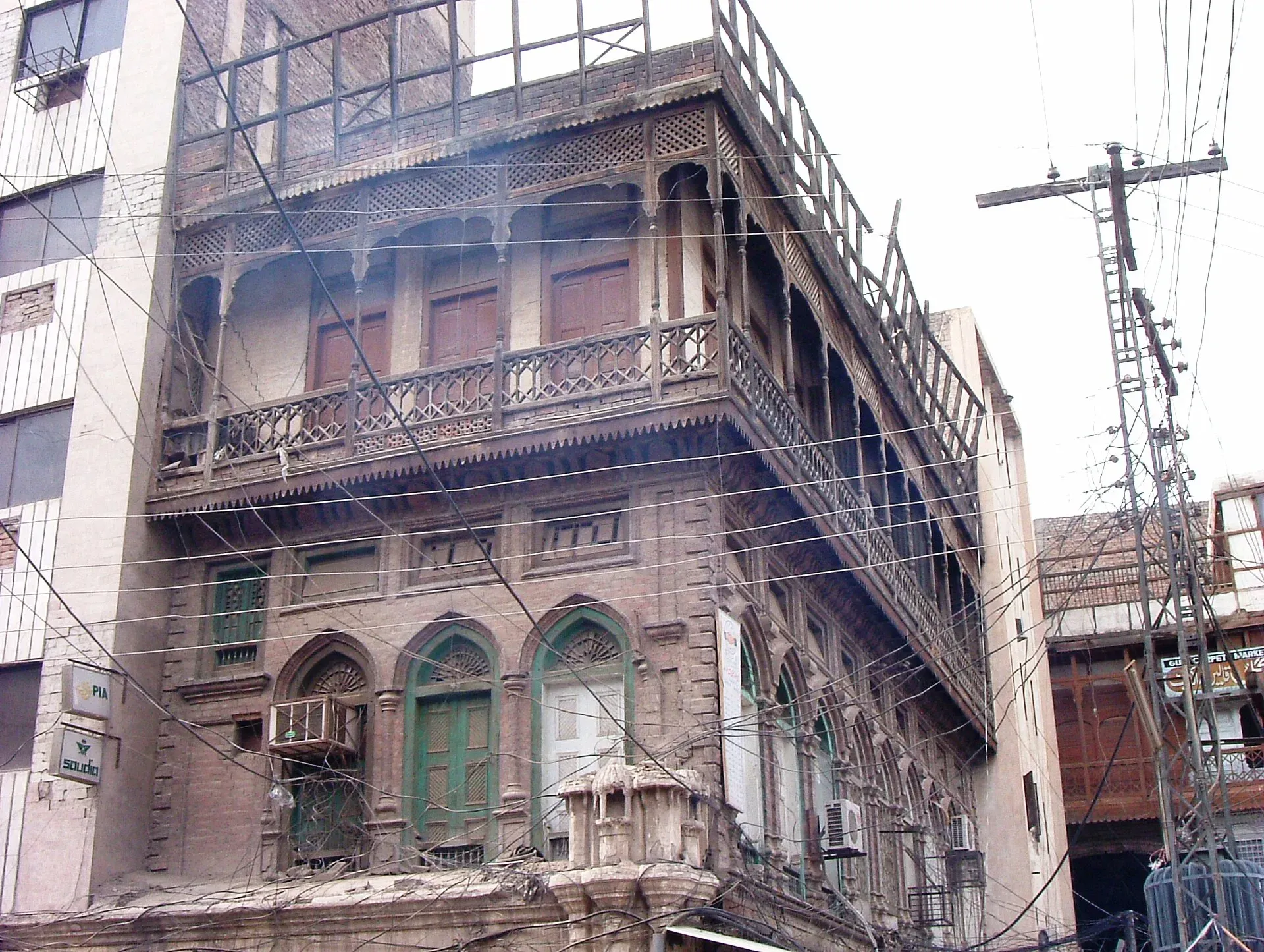
Photo: franek2, with thanks · CC BY-SA 3.0 · via Wikimedia Commons · temporary stand-in photo

Hazards and seasons
- Floods: Sindh and south Punjab stretches can be cut by monsoon and river floods (July to September). Check local news before a long drive.
- Fog: Dense winter fog (December and January) on the Punjab plain causes pile-ups and long closures. Avoid driving at night or before mid-morning.
- Traffic: Accidents involving trucks and buses are common. Travel in daylight and use the motorways where they run parallel.
Fuel and services
Fuel stations, tea stops and workshops are frequent on most of the road. Towns have banks and ATMs. The less populated stretches, such as parts of upper Sindh and the Khyber approaches, have longer gaps, so fill up in town. Carry cash for small purchases.
Checkposts
Expect police and army checkposts on the Khyber Pakhtunkhwa section, and at some Sindh district borders. Have your passport and visa copies ready. Foreign visitors may be asked to take an escort in some districts.
Safety and travel advice by section
The UK government's travel advice (updated 27 October 2026, checked 16 November 2026) does not list Karachi to Hyderabad, or the Punjab section from Lahore to Attock, as areas to avoid. It does advise against all but essential travel to Sindh north of and including Nawabshah, and to Nowshera. It advises against all travel to Peshawar and to Khyber district, and within 10 miles of the Afghan border, which includes Torkham. Torkham has also been repeatedly closed to trade and travellers. KabulNow reported on 31 March 2026 that it had reopened only for returning Afghan refugees, with trade and general passenger travel suspended. There is no known later report, so ask before you go.
Highlights
- Longest national highway in Pakistan: 1,819 km
- Follows the line of the historic Grand Trunk Road
- Passes Hyderabad, Multan, Lahore, Rawalpindi and Peshawar
- Climbs to the Khyber Pass and the Torkham border
Stops
- HyderabadLarge Sindh city
- NawabshahSindh; FCDO area (see safety)
- SukkurIndus crossing
- Rahim Yar KhanSouth Punjab
- BahawalpurPalaces and museum
- MultanShrines and tilework
- SahiwalCentral Punjab
- LahoreMajor city, many sights
- GujranwalaGT Road city
- JhelumNear Rohtas Fort
- RawalpindiJunction for Islamabad and the north
- AttockIndus crossing and fort
- NowsheraKhyber Pakhtunkhwa
- PeshawarAdvised against by FCDO
- Landi KotalKhyber district
- TorkhamAfghan border
km: distance from the start along the route.
Numbers follow the stops in order. The map shows the 15 stops that have a trek.pk page, not the road itself.
Where to stay, eat and fuel up
Places to stay
- Avari Towers KarachiCall Avari Towers KarachiMap of Avari Towers Karachi in Google Maps
- Pearl Continental Hotel, LahoreCall Pearl Continental Hotel, LahoreMap of Pearl Continental Hotel, Lahore in Google Maps
- Avari Hotel LahoreCall Avari Hotel LahoreMap of Avari Hotel Lahore in Google Maps
- Serena HotelCall Serena HotelMap of Serena Hotel in Google Maps
- Islamabad Marriott HotelCall Islamabad Marriott HotelMap of Islamabad Marriott Hotel in Google Maps
- Mövenpick KarachiCall Mövenpick KarachiMap of Mövenpick Karachi in Google Maps
Places to eat
- The Monal IslamabadCall The Monal IslamabadMap of The Monal Islamabad in Google Maps
- Tehzeeb Bakers Blue AreaCall Tehzeeb Bakers Blue AreaMap of Tehzeeb Bakers Blue Area in Google Maps
- TKR 3Call TKR 3Map of TKR 3 in Google Maps
- Port Grand - KarachiCall Port Grand - KarachiMap of Port Grand - Karachi in Google Maps
- Kolachi RestaurantCall Kolachi RestaurantMap of Kolachi Restaurant in Google Maps
- Savour FoodsCall Savour FoodsMap of Savour Foods in Google Maps
Essential services fuel stations, mechanics, banks, pharmacies and hospitals and clinics
Fuel
- PSO Petrol Pump (Stadium Service Station)Call PSO Petrol Pump (Stadium Service Station)Map of PSO Petrol Pump (Stadium Service Station) in Google Maps
- Attock Petrol PumpMap of Attock Petrol Pump in Google Maps
- PSO Petrol PumpMap of PSO Petrol Pump in Google Maps
- PSO Petrol PumpMap of PSO Petrol Pump in Google Maps
- Total Parco LA TownCall Total Parco LA TownMap of Total Parco LA Town in Google Maps
- PSO-Al-Rafay Filling Station - Petrol Pump Thokar Niaz BaigCall PSO-Al-Rafay Filling Station - Petrol Pump Thokar Niaz BaigMap of PSO-Al-Rafay Filling Station - Petrol Pump Thokar Niaz Baig in Google Maps
Mechanics and tyre shops
- Mohammed Bilal tyre centreMap of Mohammed Bilal tyre centre in Google Maps
- Changan City SalesCall Changan City SalesMap of Changan City Sales in Google Maps
- Toyota Airport MotorsCall Toyota Airport MotorsMap of Toyota Airport Motors in Google Maps
- Honda GatewayCall Honda GatewayMap of Honda Gateway in Google Maps
- Saif Traders - Best Tyre Shop in LahoreCall Saif Traders - Best Tyre Shop in LahoreMap of Saif Traders - Best Tyre Shop in Lahore in Google Maps
- Mini MotorsCall Mini MotorsMap of Mini Motors in Google Maps
Banks and money exchange
- State Bank of PakistanCall State Bank of PakistanMap of State Bank of Pakistan in Google Maps
Pharmacies
- Al Jadeed Super MarketCall Al Jadeed Super MarketMap of Al Jadeed Super Market in Google Maps
- Imtiaz Mega - Ramzan Mall - islamabadCall Imtiaz Mega - Ramzan Mall - islamabadMap of Imtiaz Mega - Ramzan Mall - islamabad in Google Maps
- Imtiaz Supermarket - Awami Markaz - KHICall Imtiaz Supermarket - Awami Markaz - KHIMap of Imtiaz Supermarket - Awami Markaz - KHI in Google Maps
- Imtiaz Mega - Kings Mall - GujranwalaCall Imtiaz Mega - Kings Mall - GujranwalaMap of Imtiaz Mega - Kings Mall - Gujranwala in Google Maps
- Hydri Super MarketCall Hydri Super MarketMap of Hydri Super Market in Google Maps
- Raja Market Garden Town LahoreCall Raja Market Garden Town LahoreMap of Raja Market Garden Town Lahore in Google Maps
Hospitals and clinics
- Hashmanis Hospital NumaishCall Hashmanis Hospital NumaishMap of Hashmanis Hospital Numaish in Google Maps
- Holistic CareCall Holistic CareMap of Holistic Care in Google Maps
- Lahore Care HospitalCall Lahore Care HospitalMap of Lahore Care Hospital in Google Maps
- Shifa International Hospitals LimitedCall Shifa International Hospitals LimitedMap of Shifa International Hospitals Limited in Google Maps
- Amanat Eye Hospital RawalpindiCall Amanat Eye Hospital RawalpindiMap of Amanat Eye Hospital Rawalpindi in Google Maps
- Maryam Memorial Hospital (MMH)Call Maryam Memorial Hospital (MMH)Map of Maryam Memorial Hospital (MMH) in Google Maps
Listings come from Google Maps data and are unverified: phone numbers, opening months and prices may have changed. Report a problem · Own one of these? Claim it
More safety notes
- Section Karachi-Hyderabad: not listed by the UK FCDO as an area to avoid (checked 16 November 2026).
- Ask the district administration or local police about current conditions before you go. Sindh north of and including Nawabshah: For foreign visitors: the UK FCDO advises against all but essential travel.
- Punjab (Multan to Attock): not listed, apart from Dera Ghazi Khan, which is off the N-5.
- Nowshera: all but essential travel advised against; Peshawar and Khyber: all travel advised against; Torkham lies within 10 miles of the Afghan border.
- Avoid night driving; check fog and flood reports.
Tips
- Use the motorways where they run alongside; the N-5 is slower and busier.
- Avoid night driving and winter fog on the Punjab plain.
- Check the border status before heading for Torkham.
- Carry copies of your passport and visa for checkposts.
Photos we still need: a section of the N-5 in Sindh or south Punjab (the one hero photo shows the original GT Road near Taxila). Send us yours
Sources and last checked
Last checked Confidence medium12 sources5 still to check
- Last checked
- Method
- Desk research from published sources
- Confidence
- medium
- Checked by
- trek.pk research team
Researched from published sources; not yet checked on the ground by our team. Spot something out of date? Report a mistake.
Sources
- National highways of Pakistan · Wikipedia · checked
- N-5 National Highway · Wikipedia · checked
- Government greenlights upgradation of G.T. Road to three-lane carriageway · Dawn · checked
- Pakistan travel advice: warnings and insurance (updated 27 October 2026) · UK Foreign, Commonwealth & Development Office · checked
- OSRM routing (road distances measured from the start of each highway) · OpenStreetMap / Project OSRM · checked
- Torkham border partially reopens for Afghan refugees (31 March 2026) · KabulNow · checked
- 16 GT roads, highways and motorways set to open (6 October 2026) · ProPakistani · checked
- Govt launches two-phase overhaul of GT Road (20 April 2025) · The Express Tribune · checked
- NHA increases toll tax on key highways and motorways (10 July 2026) · ProPakistani · checked
- Grand Trunk Road · Wikipedia · checked
- N-5 National Highway (route, kilometre markers and tolls list re-read) · Wikipedia · checked
- OSRM driving route between city centres, measured 17 November 2026 (estimates; fastest road, often motorways) · OSRM / OpenStreetMap contributors · checked
Still to be checked on the ground (5)
- Progress of the three-lane GT Road upgrade (no percentage found; only 'nearing completion' for Tee Chowk to Banth and 'soon to be launched' for other sections, Oct 2026)
- Toll plazas and current rates (NHA toll chart not reachable; ProPakistani reports an NHA notification of 10 July 2026 with a general national-highway rate but does not say it covers N-5, and it is not an official page)
- Torkham border status after 31 March 2026
- Section-by-section road condition
- Real N-5 driving times by stage (OSRM figures use the motorways)
Nearby and related

Karachi
Pakistan's largest city and main port: colonial buildings, museums, beaches, busy bazaars and some of the country's best food.

Hyderabad
Sindh's second-largest city, founded in 1768 and famous for its glass bangles, Pacco Qillo fort and Talpur tombs, about 160 km from Karachi.

Multan
The City of Saints in southern Punjab: blue-tiled Sufi shrines, a crowded old city, blue pottery, sohan halwa and mangoes.

Lahore
Punjab's capital and Pakistan's cultural city: Mughal forts, mosques and gardens, a lively Walled City, and some of the best food in the country.

Rawalpindi
Islamabad's older twin city: a busy bazaar and cantonment, the north's main rail and bus hub, and an easy base for Taxila and Murree.

Taxila
The ruins of several ancient cities and Buddhist monasteries near Islamabad, inscribed by UNESCO in 1980. Taxila was a crossroads of Gandhara, Greek, Persian and Kushan culture, with a fine museum.

Attock
District capital on the Grand Trunk Road near the Indus, about 86 km from Islamabad. A practical stop with the Mughal-era Attock Fort nearby.

Peshawar
Khyber Pakhtunkhwa's capital and one of South Asia's oldest living cities: the Gandhara museum, Qissa Khwani Bazaar, mosques and a strong food culture.

Khyber Pass
The historic 40 km pass from Jamrud to Landi Kotal and the Afghan border, used by invaders and traders for thousands of years. Today the area is under an FCDO all-travel warning and Torkham is closed.

Landi Kotal
Hill town at the western end of the Khyber Pass, 1,072 m above sea level and about 5 km from the Afghan border. For foreign visitors: the UK FCDO advises against all travel to Khyber.

Nowshera
A Grand Trunk Road and railway town on the Kabul River, about 43 km east of Peshawar, with a large cantonment. Mostly a stop on the way between Peshawar and Islamabad.

Jhelum
Grand Trunk Road city on the Jhelum River, 23 km from Rohtas Fort (UNESCO), about 30 km from Mangla Dam and about 116 km from Islamabad.

Rohtas Fort
A huge 16th-century fort of Sher Shah Suri near Jhelum, with four kilometres of walls, monumental gates and a village still living inside. UNESCO inscribed it in 1997.

Mughal Lahore and the Grand Trunk Road
A four-day journey from Lahore's Mughal monuments up the Grand Trunk Road to Rohtas Fort. History from Akbar to Aurangzeb, OSRM-measured day plan and current safety notes.